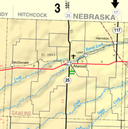
Geography
According to the United States Census Bureau, the city has a total area of 0.22 square miles (0.57 km2), all land. [6]
Climate
According to the Köppen Climate Classification system, McDonald has a semi-arid climate, abbreviated "BSk" on climate maps. [7]
According to weather data tallied between July 1, 1985 and June 30, 2015 for every location in the National Oceanic and Atmospheric Administration's official climate database, McDonald, Kansas, is the snowiest place in the state of Kansas with an average of 37.6 inches of snow per year. [8]
| Climate data for McDonald, Kansas (1991–2020) |
|---|
| Month | Jan | Feb | Mar | Apr | May | Jun | Jul | Aug | Sep | Oct | Nov | Dec | Year |
|---|
| Mean daily maximum °F (°C) | 42.2
(5.7) | 45.0
(7.2) | 55.8
(13.2) | 64.0
(17.8) | 73.8
(23.2) | 85.6
(29.8) | 90.9
(32.7) | 88.8
(31.6) | 81.5
(27.5) | 67.8
(19.9) | 53.7
(12.1) | 43.4
(6.3) | 66.0
(18.9) |
|---|
| Daily mean °F (°C) | 29.5
(−1.4) | 31.9
(−0.1) | 41.1
(5.1) | 49.2
(9.6) | 59.6
(15.3) | 71.0
(21.7) | 76.4
(24.7) | 74.4
(23.6) | 66.3
(19.1) | 52.9
(11.6) | 40.0
(4.4) | 30.8
(−0.7) | 51.9
(11.1) |
|---|
| Mean daily minimum °F (°C) | 16.8
(−8.4) | 18.9
(−7.3) | 26.4
(−3.1) | 34.4
(1.3) | 45.3
(7.4) | 56.4
(13.6) | 61.9
(16.6) | 60.0
(15.6) | 51.1
(10.6) | 38.0
(3.3) | 26.4
(−3.1) | 18.3
(−7.6) | 37.8
(3.2) |
|---|
| Average precipitation inches (mm) | 0.46
(12) | 0.56
(14) | 1.08
(27) | 2.22
(56) | 3.02
(77) | 2.95
(75) | 3.29
(84) | 3.03
(77) | 1.31
(33) | 1.59
(40) | 0.74
(19) | 0.55
(14) | 20.8
(528) |
|---|
| Average snowfall inches (cm) | 5.8
(15) | 5.6
(14) | 5.4
(14) | 4.1
(10) | 0.0
(0.0) | 0.0
(0.0) | 0.0
(0.0) | 0.0
(0.0) | 0.7
(1.8) | 2.1
(5.3) | 4.7
(12) | 5.2
(13) | 33.6
(85.1) |
|---|
| Source: NOAA [9] |
Demographics
2020 census
The 2020 United States census counted 113 people, 63 households, and 40 families in McDonald. [10] [11] The population density was 516.0 per square mile (199.2/km2). There were 91 housing units at an average density of 415.5 per square mile (160.4/km2). [11] [12] The racial makeup was 88.5% (100) white or European American (88.5% non-Hispanic white), 1.77% (2) black or African-American, 0.0% (0) Native American or Alaska Native, 0.0% (0) Asian, 0.0% (0) Pacific Islander or Native Hawaiian, 0.0% (0) from other races, and 9.73% (11) from two or more races. [13] Hispanic or Latino of any race was 2.65% (3) of the population. [14]
Of the 63 households, 15.9% had children under the age of 18; 47.6% were married couples living together; 30.2% had a female householder with no spouse or partner present. 31.7% of households consisted of individuals and 22.2% had someone living alone who was 65 years of age or older. [11] The average household size was 2.1 and the average family size was 2.1. [15] The percent of those with a bachelor’s degree or higher was estimated to be 6.2% of the population. [16]
18.6% of the population was under the age of 18, 1.8% from 18 to 24, 17.7% from 25 to 44, 28.3% from 45 to 64, and 33.6% who were 65 years of age or older. The median age was 59.8 years. For every 100 females, there were 98.2 males. [11] For every 100 females ages 18 and older, there were 109.1 males. [11]
The 2016-2020 5-year American Community Survey estimates show that the median household income was $40,417 (with a margin of error of +/- $16,401) and the median family income was $43,281 (+/- $15,330). [17] Males had a median income of $31,250 (+/- $8,281) versus $9,688 (+/- $3,095) for females. The median income for those above 16 years old was $19,375 (+/- $10,149). [18] Approximately, 14.9% of families and 33.3% of the population were below the poverty line, including 80.0% of those under the age of 18 and 17.9% of those ages 65 or over. [19] [20]
2010 census
As of the census [21] of 2010, there were 160 people, 77 households, and 48 families residing in the city. The population density was 727.3 inhabitants per square mile (280.8/km2). There were 98 housing units at an average density of 445.5 per square mile (172.0/km2). The racial makeup of the city was 97.5% White, 0.6% Native American, 0.6% from other races, and 1.3% from two or more races. Hispanic or Latino of any race were 11.3% of the population.
There were 77 households, of which 16.9% had children under the age of 18 living with them, 50.6% were married couples living together, 7.8% had a female householder with no husband present, 3.9% had a male householder with no wife present, and 37.7% were non-families. 32.5% of all households were made up of individuals, and 16.9% had someone living alone who was 65 years of age or older. The average household size was 2.08 and the average family size was 2.63.
The median age in the city was 53.5 years. 18.1% of residents were under the age of 18; 6.3% were between the ages of 18 and 24; 14.5% were from 25 to 44; 35.7% were from 45 to 64; and 25.6% were 65 years of age or older. The gender makeup of the city was 50.0% male and 50.0% female.
2000 census
As of the census [22] of 2000, there were 159 people, 80 households, and 46 families residing in the city. The population density was 864.9 inhabitants per square mile (333.9/km2). There were 109 housing units at an average density of 592.9 per square mile (228.9/km2). The racial makeup of the city was 99.37% White and 0.63% Native American.
There were 80 households, out of which 18.8% had children under the age of 18 living with them, 53.8% were married couples living together, 2.5% had a female householder with no husband present, and 42.5% were non-families. 40.0% of all households were made up of individuals, and 27.5% had someone living alone who was 65 years of age or older. The average household size was 1.99 and the average family size was 2.63.
In the city, the population was spread out, with 19.5% under the age of 18, 3.8% from 18 to 24, 18.9% from 25 to 44, 28.3% from 45 to 64, and 29.6% who were 65 years of age or older. The median age was 49 years. For every 100 females, there were 89.3 males. For every 100 females age 18 and over, there were 85.5 males.
The median income for a household in the city was $30,139, and the median income for a family was $32,083. Males had a median income of $23,125 versus $33,125 for females. The per capita income for the city was $15,790. About 13.3% of families and 11.8% of the population were below the poverty line, including 8.8% of those under the age of eighteen and 21.1% of those 65 or over.
This page is based on this
Wikipedia article Text is available under the
CC BY-SA 4.0 license; additional terms may apply.
Images, videos and audio are available under their respective licenses.