McKittrick, Missouri

Last updated

McKittrick, Missouri
McKittirck Farmers Mercantile3 NRHP 10000313 Montgomery County, MO.jpg
McKittrick in 2024
Montgomery County Missouri Incorporated and Unincorporated areas McKittrick Highlighted.svg
Location in Montgomery County and the state of Missouri
Coordinates: 38°44′19″N91°26′39″W / 38.73861°N 91.44417°W / 38.73861; -91.44417
Country United States
State Missouri
County Montgomery
Area
[1]
  Total0.49 sq mi (1.26 km2)
  Land0.49 sq mi (1.26 km2)
  Water0.00 sq mi (0.00 km2)
Elevation
[2]
558 ft (170 m)
Population
 (2020) [3]
  Total77
  Density157.79/sq mi (60.92/km2)
Time zone UTC-6 (Central (CST))
  Summer (DST) UTC-5 (CDT)
ZIP Code
65041
FIPS code 29-45200 [4]
GNIS feature ID2396745 [2]

McKittrick is a city in Montgomery County, Missouri, United States. The population was 77 at the 2020 census. [5]

Contents

History

McKittrick was laid out in 1895 when the railroad was extended to that point. [6] A post office called McKittrick was established in 1894, and remained in operation until 1967. [7]

The McKittrick Farmers Mercantile was listed on the National Register of Historic Places in 2010. [8]

Geography

McKittrick is in southeastern Montgomery County. Missouri Route 19 passes through the west side of the city limits, leading south 2 miles (3 km) across the Missouri River to the larger city of Hermann, with which it shares a ZIP Code. Route 19 also leads north 15 miles (24 km) to New Florence.

According to the U.S. Census Bureau, the city has a total area of 0.49 square miles (1.27 km2), all land. [1] The Loutre River, a tributary of the Missouri River, forms the western border of the city.

Demographics

Historical population
CensusPop.Note
1910 127
1920 111−12.6%
1930 15136.0%
1940 124−17.9%
1950 100−19.4%
1960 97−3.0%
1970 1014.1%
1980 87−13.9%
1990 66−24.1%
2000 729.1%
2010 61−15.3%
2020 7726.2%
U.S. Decennial Census [9]

2010 census

As of the census [10] of 2010, there were 61 people, 28 households, and 18 families living in the city. The population density was 677.8 inhabitants per square mile (261.7/km2). There were 36 housing units at an average density of 400.0 per square mile (154.4/km2). The racial makeup of the city was 100.0% White.

There were 28 households, of which 17.9% had children under the age of 18 living with them, 50.0% were married couples living together, 3.6% had a female householder with no husband present, 10.7% had a male householder with no wife present, and 35.7% were non-families. 32.1% of all households were made up of individuals, and 14.3% had someone living alone who was 65 years of age or older. The average household size was 2.18 and the average family size was 2.67.

The median age in the city was 44.5 years. 19.7% of residents were under the age of 18; 11.5% were between the ages of 18 and 24; 19.6% were from 25 to 44; 22.9% were from 45 to 64; and 26.2% were 65 years of age or older. The gender makeup of the city was 45.9% male and 54.1% female.

2000 census

At the 2000 census, [4] there were 72 people, 27 households and 20 families living in the town. The population density was 440.7 inhabitants per square mile (170.2/km2). There were 32 housing units at an average density of 195.8 per square mile (75.6/km2). The racial makeup of the town was 97.22% White and 2.78% Asian.

There were 27 households, of which 29.6% had children under the age of 18 living with them, 55.6% were married couples living together, 11.1% had a female householder with no husband present, and 25.9% were non-families. 22.2% of all households were made up of individuals, and 7.4% had someone living alone who was 65 years of age or older. The average household size was 2.67 and the average family size was 3.10.

Age distribution was 19.4% under the age of 18, 15.3% from 18 to 24, 26.4% from 25 to 44, 23.6% from 45 to 64, and 15.3% who were 65 years of age or older. The median age was 41 years. For every 100 females there were 89.5 males. For every 100 females age 18 and over, there were 100.0 males.

The median household income was $37,750, and the median family income was $38,750. Males had a median income of $18,750 versus $19,167 for females. The per capita income for the town was $17,105. None of the population and none of the families were below the poverty line.

Related Research Articles

<span class="mw-page-title-main">McKittrick, California</span> Place in California, United States

McKittrick is an unincorporated community in Kern County, California, United States. McKittrick is 14 miles (23 km) northwest of Taft, at an elevation of 1,056 feet (322 m). The population was 115 at the 2010 census, down from 160 at the 2000 census. For statistical purposes, the United States Census Bureau has defined McKittrick as a census-designated place (CDP).

<span class="mw-page-title-main">Bosworth, Missouri</span> City in Missouri, United States

Bosworth is a city in Carroll County, Missouri, United States. The population was 213 at the 2020 U.S. Census.

<span class="mw-page-title-main">McFall, Missouri</span> City in Missouri, United States

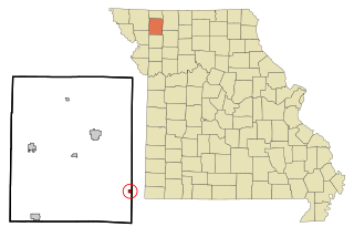
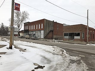
McFall is a rural village, incorporated and thus called a city in Missouri law, located in southeast Gentry County, Missouri, United States. It is also located within the Gentry County administrative subdivision of Miller Township. The population of McFall was 119 at the 2020 census. There is a post office at McFall, also a city hall and fire department, and a small apartment complex.

<span class="mw-page-title-main">Arcadia, Missouri</span> City in Missouri, United States

Arcadia is a city in Iron County, Missouri, United States. The population was 618 at the 2020 census.

<span class="mw-page-title-main">Goodman, Missouri</span> City in Missouri, United States

Goodman is a city in McDonald County, Missouri, United States. The population was 1,202 at the 2020 census.

<span class="mw-page-title-main">Bellflower, Missouri</span> City in Missouri, United States

Bellflower is a city in Montgomery County, Missouri, United States. The population was 325 at the 2020 census, down from 393 in 2010.

<span class="mw-page-title-main">High Hill, Missouri</span> City in Missouri, United States

High Hill is a city in Montgomery County, Missouri, United States. The population was 186 at the 2020 census.

<span class="mw-page-title-main">Jonesburg, Missouri</span> City in Missouri, US

Jonesburg is a city in Montgomery County, Missouri, United States. The population was 726 at the 2020 census.

<span class="mw-page-title-main">Middletown, Missouri</span> City in Missouri, United States

Middletown is a city in Montgomery County, Missouri, United States. The population was 171 at the 2020 census.

<span class="mw-page-title-main">New Florence, Missouri</span> City in Missouri, United States

New Florence is a city in Montgomery County, Missouri, United States. The population was 641 at the 2020 census.

<span class="mw-page-title-main">Wellsville, Missouri</span> City in Missouri, United States

Wellsville is a city in Montgomery County, Missouri, United States. The population was 998 at the 2020 census.

<span class="mw-page-title-main">Skidmore, Missouri</span> City in Missouri, United States

Skidmore is a city in western Nodaway County, Missouri, United States. The population was 245 at the 2020 Census. The small farming community is known for the unsolved extrajudicial killing of Ken Rex McElroy. Skidmore also has a yearly "Punkin' Show."

<span class="mw-page-title-main">Homestown, Missouri</span> City in Missouri, United States

Homestown is a city in Pemiscot County, Missouri, United States. The population was 73 at the 2020 census.

<span class="mw-page-title-main">Pleasant Hope, Missouri</span> City in Missouri, United States

Pleasant Hope is a city in Polk County, Missouri, United States. The population was 614 at the 2010 census. It is part of the Springfield, Missouri Metropolitan Statistical Area.

<span class="mw-page-title-main">Shelbyville, Missouri</span> City in Missouri, United States

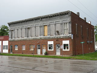
Shelbyville is a city in Shelby County, Missouri, United States. The population was 518 at the 2020 census. It is the county seat of Shelby County.

<span class="mw-page-title-main">Greendale, Missouri</span> City in Missouri, United States

Greendale is a city in St. Louis County, Missouri, United States. The population was 651 at the 2010 census.

<span class="mw-page-title-main">Northwoods, Missouri</span> City in Missouri, United States

Northwoods is a city in St. Louis County, Missouri, United States. The population was 4,227 at the 2010 census.

<span class="mw-page-title-main">Velda City, Missouri</span> City in Missouri, United States

Velda City is a city in St. Louis County, Missouri, United States. The population was 1,420 at the 2010 census.

<span class="mw-page-title-main">Montgomery City, Missouri</span> City in Missouri, United States

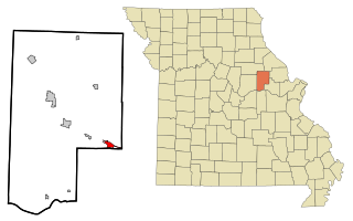
Montgomery City is a city in and the county seat of Montgomery County, Missouri, United States. The population was 2,811 at the 2020 census.

<span class="mw-page-title-main">Blackburn, Missouri</span> City in Missouri, United States

Blackburn is a city in Lafayette and Saline counties in the U.S. state of Missouri and is part of the Kansas City metropolitan area. The population was 224 at the 2020 census.

References

  1. 1 2 "2023 U.S. Gazetteer Files: Missouri". United States Census Bureau. Retrieved May 6, 2024.
  2. 1 2 U.S. Geological Survey Geographic Names Information System: McKittrick, Missouri
  3. "P1. Race – McKittrick city, Missouri: 2020 DEC Redistricting Data (PL 94-171)". U.S. Census Bureau. Retrieved May 6, 2024.
  4. 1 2 "U.S. Census website". United States Census Bureau . Retrieved January 31, 2008.
  5. "Explore Census Data". data.census.gov. Retrieved January 11, 2022.
  6. "Montgomery County Place Names, 1928–1945". The State Historical Society of Missouri. Archived from the original on June 24, 2016. Retrieved November 11, 2016.
  7. "Post Offices". Jim Forte Postal History. Retrieved November 11, 2016.
  8. "National Register Information System". National Register of Historic Places . National Park Service. July 9, 2010.
  9. "Census of Population and Housing". Census.gov. Retrieved June 4, 2015.
  10. "U.S. Census website". United States Census Bureau . Retrieved July 8, 2012.