Medina Dam | |
Nearest city | Castroville, Texas |
---|---|
Coordinates | 29°32′25″N98°56′2″W / 29.54028°N 98.93389°W |
Area | 4.1 acres (1.7 ha) |
Built | 1911 |
Built by | Fred Stark Pearson |
NRHP reference No. | 76002050 [1] |
TSAL No. | 468 |
Significant dates | |
Added to NRHP | March 15, 1976 |
Designated TSAL | May 28, 1981 |
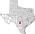
The Medina Dam is a hollow-masonry type dam built in 1911 and 1912 by the Medina Irrigation Company in what became Mico, Texas, USA. Medina Lake extends north of it in northeastern Medina County and southeastern Bandera County. The dam and irrigation project was designed and financed by Dr. Frederick Stark Pearson, an American engineer, with extensive British financial backing. The construction took over 1500 men two years to build while working 24 hours a day. They were mostly skilled Mexican workers with experience building other dams for Pearson. They received two dollars for a day's work, which were good wages for the time. [2] [3] Pearson's Medina Irrigation Company (MICO) built a camp to house the workers and their families; the company town was first called MICO after its acronym. The community is now known as Mico, Texas.
When the dam was completed in 1913, it was the largest hydraulic engineering project west of the Mississippi River and the fourth-largest dam in the US. [4] It is listed on the National Register of Historic Places for its significance as an infrastructure project and its contributions to economic development of the county. Author of Ripples from Medina Lake, Rev. Cyril M. Kuehne claims a total of 70 lives were taken during the dam's construction, however, he only managed to locate 27 death certificates. Dr. Oscar B. Taylor, dentist of near-by settlement Hondo, Texas, was quoted by Kuehne as saying "sixty-six [unmarked] graves" were counted at a cemetery 3 miles away. [5]
The dam contains over 292,000 cubic yards (223,000 m³) of concrete and measures 164 feet high by 128 feet (39 m) wide at the base by 1,580 feet (482 m) long. It is 25 feet (8 m) wide at the top, which is 1076.2 feet (328 m) above sea level, and the spillway is 1,064.2 feet (324 m) above sea level. [6] The dam provides irrigation to over 34,000 acres (138 km²) to Blackland Prairie farmlands below the Balcones Escarpment around Castroville, Texas, and also supplies water to the Medina River Ultrafiltration Water Treatment Plant owned and operated by the San Antonio Water System. [7]
The reservoir behind the dam is called Medina Lake and is a major recreation area. It discharges into the Medina River, which also contains a diversion dam four miles downstream.
The dam was featured in the 1919 serial The Masked Rider. [8]
Medina Dam was once a publicly accessible, one-lane roadway that connected to County Road 260. In 1980, vehicle traffic was closed and rerouted to a new road known as County Road 264; although temporary use of the dam as a road continued in 1990. [9]
Located on the dam are three state-placed historical markers. These markers are currently inaccessible to the public after foot traffic was disallowed following the September 11 attacks in response to terrorism concerns. [10]
The earliest of the three markers is a 1936 state marker that acknowledges the previous Mormon settlement, Mountain Valley that was built in 1854 and was destroyed in 1913 during construction of the dam. [11] The Mormon settlement Mountain Valley is now located underneath Medina Lake. [9]
"Established in 1854 by 16 families of Mormons under the leadership of Lyman Wight (1796-1858). They abandoned their homes and mills in 1858 as the result of Indian depredations. Their lands are now beneath the waters of Medina Lake. Erected by the State of Texas - 1936." [12]
The next is a marker placed in 1978 by the Texas Historical Commission that designated the dam as a state historical landmark. [13]
"Henri Castro, who colonized this area in the 1840s, envisioned irrigated farms along the Medina River. The project was delayed, however, until after the turn of the century, when Dr. Fred Stark Pearson, an internationally known engineer, persuaded British investors to finance construction of a dam at this site. Completed in 1912, Medina Dam was hailed as the largest in Texas and the fourth largest in the United States. Limestone boulders from a nearby quarry added bulk to the massive concrete structure. Four miles downstream, a small diversion dam conducted water into a system of irrigation canals. Gravitational force delivered the water to fields. The outbreak of World War I (1914) disrupted ties with British investors. Seeking new capital, Dr. Pearson and his wife left for England in 1915 on the "Lusitania" and were killed when a German submarine torpedoed the ship. The irrigation network created by Medina Dam brought new prosperity to this region. Vegetables raised in irrigated fields became a valuable crop. Water and electricity were made available to rural residents. In 1925 voters established the Bexar-Medine-Atascosa Counties Water Improvement District No. 1 to manage the project. 1978." [14]
Placed in 1991, a marker declared the dam a Texas Historic Civil Engineering Landmark. [9]
The Medina Lake Preservation Society is undertaking efforts to get the dam reopened to the public, or to at least have the historical markers moved so people can see them. [15]
Medina County is a county located in the U.S. state of Texas. As of the 2020 census, its population was 50,748. Its county seat is Hondo. The county is named for the Medina River. The extreme northern part of the county lies within the Edwards Plateau, which elevates into the Texas Hill Country. The Medina Dam, the fourth largest in the nation when completed in 1913, is listed on the National Register of Historic Places. The irrigation project, creating Medina Lake, was built by 1500 skilled workers who worked in shifts operating 24 hours a day to complete the dam in two years. Medina County is part of the San Antonio, TX Metropolitan Statistical Area.
The Brazos River, called the Río de los Brazos de Dios by early Spanish explorers, is the 14th-longest river in the United States at 1,280 miles (2,060 km) from its headwater source at the head of Blackwater Draw, Roosevelt County, New Mexico to its mouth at the Gulf of Mexico with a 45,000-square-mile (116,000 km2) drainage basin. Being one of Texas' largest rivers, it is sometimes used to mark the boundary between East Texas and West Texas.
The Gila River is a 649-mile-long (1,044 km) tributary of the Colorado River flowing through New Mexico and Arizona in the United States. The river drains an arid watershed of nearly 60,000 square miles (160,000 km2) that lies mainly within the U.S., but also extends into northern Sonora, Mexico.
Big Bear Lake is a reservoir in the western United States, located in the San Bernardino Mountains in San Bernardino County, California. It is a snow and rain-fed lake, having no other means of tributaries or mechanical replenishment.
The Espada Acequia, or Piedras Creek Aqueduct, was built by Franciscan friars in 1731 in what is now San Antonio, Texas, United States. It was built to supply irrigation water to the lands near Mission San Francisco de la Espada, today part of San Antonio Missions National Historical Park. The acequia is still in use today and is an National Historic Civil Engineering Landmark and a National Historic Landmark.
Mico is an unincorporated community in northeastern Medina County, Texas, United States. It is approximately 40 miles (64 km) west of Downtown San Antonio off Farm to Market Road 1283. The community is part of the San Antonio Metropolitan Statistical Area (MSA). Its zip code is 78056.
Medina Lake is a reservoir on the Medina River in the Texas Hill Country of the United States. It is operated by the Bexar/Medina/Atascosa County Agricultural District. Medina Dam was completed in 1913 in a privately financed project, creating the lake to supply irrigation water for local agricultural use. Lake Medina is in northeastern Medina County, and southeastern Bandera County, about 40 miles (64 km) northwest of San Antonio.
Medina Valley, also known as the Medina River Valley, is an area in south central Texas containing the Medina River, Lake Medina, and the Medina Dam. It serves to drain the Balcones Escarpment of the Texas Hill Country and irrigate the crop fields contained therein. It is approximately 120 miles long and is named for the Medina River.
The Medina River is located in south central Texas, United States, in the Medina Valley. It was also known as the Rio Mariano, Rio San Jose, or Rio de Bagres. Its source is in springs in the Edwards Plateau in northwest Bandera County, Texas and merges with the San Antonio River in southern Bexar County, Texas, for a course of 120 miles. It contains the Medina Dam in NE Medina County, Texas which restrains Lake Medina. Much of its course is owned and operated by the Bexar-Medina-Atascosa Water District to provide irrigation services to farmers and ranchers.
Pearson, named for Frederick Stark Pearson, is an unincorporated community in Medina County, Texas, United States. It is part of the San Antonio Metropolitan Statistical Area. Pearson was established in 1912 by the San Antonio Suburban Irrigation Company as a stop on the Southern Pacific Railroad. The community lies approximately seven miles west of LaCoste on FM 471 South and before the Noonan Switch and Natalia. It was formerly the site of a shop, a machinery and material yard, and a house for a caretaker.
Friant Dam is a concrete gravity dam on the San Joaquin River in central California in the United States, on the boundary of Fresno and Madera Counties. It was built between 1937 and 1942 as part of a U.S. Bureau of Reclamation (USBR) water project to provide irrigation water to the southern San Joaquin Valley. The dam impounds Millerton Lake, a 4,900-acre (2,000 ha) reservoir about 15 miles (24 km) north of Fresno.
The Stanislaus River is a tributary of the San Joaquin River in north-central California in the United States. The main stem of the river is 96 miles (154 km) long, and measured to its furthest headwaters it is about 150 miles (240 km) long. Originating as three forks in the high Sierra Nevada, the river flows generally southwest through the agricultural San Joaquin Valley to join the San Joaquin south of Manteca, draining parts of five California counties. The Stanislaus is known for its swift rapids and scenic canyons in the upper reaches, and is heavily used for irrigation, hydroelectricity and domestic water supply.
Millerton Lake is an artificial lake near the town of Friant, about 15 mi (24 km) north of downtown Fresno, California, United States. The reservoir was created by the construction of 319 ft high Friant Dam on the San Joaquin River which, with the lake, serves as much of the county line between Fresno County to the south and Madera County to the north.
Greater San Antonio, officially designated San Antonio–New Braunfels, is an eight-county metropolitan area in the U.S. state of Texas defined by the Office of Management and Budget (OMB). The metropolitan area straddles South Texas and Central Texas and is on the southwestern corner of the Texas Triangle. The official 2020 U.S. census showed the metropolitan area's population at 2,558,143—up from a reported 1,711,103 in 2000—making it the 24th largest metropolitan area in the United States. Austin–Round Rock lies about 80 mi (130 km) northeast of Greater San Antonio.
New Exchequer Dam is a concrete–faced, rock-fill dam on the Merced River in central California in the United States. It forms Lake McClure, which impounds the river for irrigation and hydroelectric power production and has a capacity of more than 1,000,000 acre-feet (1.2 km3). The Merced Irrigation District (MID) operates the dam and was also responsible for its construction.
Mormon Mill is a vanished Mormon colony established in 1851 on Hamilton Creek in Burnet County, in the U.S. state of Texas. The site is located on Mormon Mills Road 5 miles (8.0 km) north of Marble Falls and 10 miles (16 km) south of Burnet. Mormon Mill has also been known as Mormon Mills, Mormon Mill Colony and Mormon Mill Historical Site. Designated a Recorded Texas Historic Landmark in 1936, Marker number 9733. The population moved to another county in 1853, and no buildings remain of the colony.
Acequia Madre de Valero is an 18th-century agricultural irrigation canal built by the Spanish and located in the Bexar County city of San Antonio in the U.S. state of Texas. When Martín de Alarcón founded San Antonio for Spain by establishing San Antonio de Valero Mission in 1718, Franciscan priest Antonio de Olivares and the Payaya and Pastia peoples, dug Acequia Madre de Valero by hand. It was vital to the missions to be able to divert and control water from the San Antonio River, in order to grow crops and to supply water to the people in the area. This particular acequia was the beginning of a much wider irrigation system. Acequia Madre de Valero ran from the area currently known as Brackenridge Park southward to what is now Hemisfair and South Alamo Street. Part of it that is not viewable by the public runs beneath the Menger Hotel. The acequia was restored in 1968 and that same year was designated a Recorded Texas Historic Landmark.
Castroville Historic District is a United States historic district in Castroville, Texas. It includes the oldest parts of the city of Castroville and contains twelve designated contributing properties, including a Texas State Historic Site and numerous Recorded Texas Historic Landmarks. The district was listed on the National Register of Historic Places in 1970.
Comanche Springs was an aquifer of six artesian springs geographically located between the Edwards Plateau and the Trans-Pecos regions of West Texas. The military fortification Camp Stockton was built around the springs, eventually growing become the city of Fort Stockton.
The Blythe Intake is the thecplace of the first irrigation canal to feed water to the Palo Verde Valley in 1877. It is located just north of Blythe, California in Riverside County, California. The Blythe Intake was designated a California Historic Landmark (No.948) on March 1, 1982. The site of the Blythe Intake is currently at the Palo Verde Dam.