Mifflin, Pennsylvania

Last updated

Mifflin, Pennsylvania
Tuscarora from Railroad in Mifflin.jpg
Tuscarora Street
Juniata County Pennsylvania Incorporated and Unincorporated areas Mifflin Highlighted.svg
Location of Mifflin in Juniata County, Pennsylvania.
USA Pennsylvania location map.svg
Red pog.svg
Mifflin
Usa edcp location map.svg
Red pog.svg
Mifflin
Coordinates: 40°34′06″N77°24′13″W / 40.56833°N 77.40361°W / 40.56833; -77.40361
Country United States
State Pennsylvania
County Juniata
Settled1849
Incorporated1853
Area
[1]
  Total
0.17 sq mi (0.45 km2)
  Land0.17 sq mi (0.45 km2)
  Water0.00 sq mi (0.00 km2)
Elevation
[2] (church at center of borough)
456 ft (139 m)
Highest elevation
[2] (western borough boundary)
580 ft (180 m)
Lowest elevation
[2] (Juniata River)
418 ft (127 m)
Population
 (2020) [3]
  Total
530
  Density3,045.98/sq mi (1,174.45/km2)
Time zone UTC-5 (Eastern (EST))
  Summer (DST) UTC-4 (EDT)
Zip code
17058
Area code 717
FIPS code 42-49272

Mifflin is a borough in Juniata County, Pennsylvania, United States. The population was 534 at the 2020 census. [4]

Contents

History

1895 bird's-eye-view of Mifflin, then known as Patterson Mifflin (formerly Patterson) Pennsylvania, 1895.jpg
1895 bird's-eye-view of Mifflin, then known as Patterson

Mifflin was founded as the town of Patterson. At one time, Mifflin, as well as the small community of Denholm lying directly north of the town, was an important stop along the Pennsylvania Railroad. The railroad tracks still pass through the town, but they are now owned by the Norfolk Southern Railway.

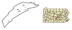
The Pennsylvania Railroad depot still stands in Mifflin, although it has long been abandoned. Mifflin is named after Thomas Mifflin, the first Governor of Pennsylvania.

Geography

Mifflin is located at 40°34′6″N77°24′13″W / 40.56833°N 77.40361°W / 40.56833; -77.40361 (40.568262, -77.403496). [5]

According to the United States Census Bureau, the borough has a total area of 0.2 square miles (0.52 km2), all land.

Demographics

Historical population
CensusPop.Note
1910 885
1920 9659.0%
1930 913−5.4%
1940 860−5.8%
1950 835−2.9%
1960 745−10.8%
1970 640−14.1%
1980 6481.3%
1990 6601.9%
2000 627−5.0%
2010 6422.4%
2020 534−16.8%
2021 (est.)527 [4] −1.3%
Sources: [6] [7] [8] [3]

As of the census [7] of 2000, there were 627 people, 234 households, and 165 families residing in the borough. The population density was 3,506.9 inhabitants per square mile (1,354.0/km2). There were 260 housing units at an average density of 1,454.2 per square mile (561.5/km2). The racial makeup of the borough was 92.82% White, 1.28% Native American, 0.32% Asian, 0.32% Pacific Islander, 3.83% from other races, and 1.44% from two or more races. Hispanic or Latino of any race were 6.38% of the population.

There were 234 households, out of which 38.5% had children under the age of 18 living with them, 49.1% were married couples living together, 13.2% had a female householder with no husband present, and 29.1% were non-families. 23.5% of all households were made up of individuals, and 10.3% had someone living alone who was 65 years of age or older. The average household size was 2.66 and the average family size was 3.07.

In the borough the population was spread out, with 28.9% under the age of 18, 10.4% from 18 to 24, 30.9% from 25 to 44, 20.9% from 45 to 64, and 8.9% who were 65 years of age or older. The median age was 32 years. For every 100 females there were 97.8 males. For every 100 females age 18 and over, there were 96.5 males.

The median income for a household in the borough was $26,438, and the median income for a family was $28,750. Males had a median income of $27,386 versus $19,044 for females. The per capita income for the borough was $12,843. About 14.9% of families and 17.5% of the population were below the poverty line, including 27.0% of those under age 18 and 4.8% of those age 65 or over.

Related Research Articles

<span class="mw-page-title-main">Juniata County, Pennsylvania</span> County in Pennsylvania, United States

Juniata County is a county in the Commonwealth of Pennsylvania. As of the 2020 census, the population was 23,509. Its county seat is Mifflintown. The county was created on March 2, 1831, from part of Mifflin County and named for the Juniata River. The county is part of the Central Pennsylvania region of the state.

<span class="mw-page-title-main">Beale Township, Pennsylvania</span> Township in Pennsylvania, United States

Beale Township is a township in Juniata County, Pennsylvania, United States. The population was 769 at the 2020 census, a decline from the figure of 830 tabulated in 2010.

<span class="mw-page-title-main">Delaware Township, Juniata County, Pennsylvania</span> Township in Pennsylvania, United States

Delaware Township is a township in Juniata County, Pennsylvania, United States. The population was 1,610 at the 2020 census.

<span class="mw-page-title-main">Fermanagh Township, Juniata County, Pennsylvania</span> Township in Pennsylvania, United States

Fermanagh Township is a township in Juniata County, Pennsylvania, United States. The population was 2,865 at the 2020 census, an increase over the figure of 2,811 tabulated in 2010.

<span class="mw-page-title-main">McAlisterville, Pennsylvania</span> Census-designated place in Pennsylvania, United States

McAlisterville is an unincorporated community and census-designated place (CDP) in Fayette Township, Juniata County, Pennsylvania, United States. The population was 971 at the 2010 census.

<span class="mw-page-title-main">Mexico, Juniata County, Pennsylvania</span> Census-designated place in Pennsylvania, United States

Mexico is an unincorporated community and census-designated place (CDP) in Walker Township, Juniata County, Pennsylvania, United States.

<span class="mw-page-title-main">Mifflintown, Pennsylvania</span> Borough in Pennsylvania, United States

Mifflintown is a borough in and the county seat of Juniata County, Pennsylvania, United States. The population was 842 at the 2020 census.

<span class="mw-page-title-main">Milford Township, Juniata County, Pennsylvania</span> Township in Pennsylvania, United States

Milford Township is a township in Juniata County, Pennsylvania, United States. The population was 1,989 at the 2020 census, a decline from the figure of 2,088 tabulated in 2010.

<span class="mw-page-title-main">Monroe Township, Juniata County, Pennsylvania</span> Township in Pennsylvania, United States

Monroe Township is a township that is located in Juniata County, Pennsylvania, United States. The population was 2,050 at the time of the 2020 census, a decrease from the figure of 2,237 that was tabulated in 2010.

<span class="mw-page-title-main">Port Royal, Pennsylvania</span> Borough in Pennsylvania, United States

Port Royal is a borough in Juniata County, Pennsylvania, United States. The population was 815 at the 2020 census.

<span class="mw-page-title-main">Richfield, Pennsylvania</span> Census-designated place in Pennsylvania, United States

Richfield is an unincorporated community and census-designated place (CDP) in Juniata and Snyder counties in Pennsylvania, United States. The population was 549 at the 2010 census.

<span class="mw-page-title-main">Thompsontown, Pennsylvania</span> Borough in Pennsylvania, United States

Thompsontown is a borough in Juniata County, Pennsylvania, United States. The population was 629 at the 2020 census.

<span class="mw-page-title-main">McVeytown, Pennsylvania</span> Borough in Pennsylvania, United States

McVeytown is a borough in Mifflin County, Pennsylvania, United States, on the west bank of the Juniata River. Formerly known as Waynesburg, it was settled in 1762, laid out in 1795, and incorporated in 1833. The population was 344 at the 2020 census. The "Father of Pennsylvania Forestry", Dr. Joseph Rothrock was born in McVeytown on April 9, 1839. He was largely responsible for the acquisition of the lands that became Pennsylvania state parks and forests, including Rothrock State Forest.

<span class="mw-page-title-main">Newton Hamilton, Pennsylvania</span> Borough in Pennsylvania, United States

Newton Hamilton is a borough in Mifflin County, Pennsylvania, United States. The population was 197 at the time of the 2020 census.

<span class="mw-page-title-main">Duncannon, Pennsylvania</span> Borough in Pennsylvania, United States

Duncannon is a borough in Perry County, Pennsylvania, United States. The population was 1,473 at the 2020 census. It is part of the Harrisburg–Carlisle Metropolitan Statistical Area. The center of population of Pennsylvania is located in Duncannon. Lightning Guider Sleds were manufactured in Duncannon from 1904 until 1988. The Appalachian Trail makes its way through the town, going on various streets, and runs mainly along North High Street. It comes off the mountain at 40.3813, -77.0292 lat/long, onto Inn Road.

<span class="mw-page-title-main">Greenwood Township, Perry County, Pennsylvania</span> Township in Pennsylvania, United States

Greenwood Township is a township in Perry County, Pennsylvania, United States. The population was 1,032 at the 2020 census.

<span class="mw-page-title-main">Landisburg, Pennsylvania</span> Borough in Pennsylvania, United States

Landisburg is a borough in Perry County, Pennsylvania, United States. The population was 220 at the 2010 census. It is part of the Harrisburg–Carlisle Metropolitan Statistical Area.

<span class="mw-page-title-main">Millerstown, Pennsylvania</span> Borough in Pennsylvania, United States

Millerstown is a borough in northern Perry County, Pennsylvania, United States, located 29 miles (47 km) northwest of Harrisburg and 29 miles (47 km) southwest of Selinsgrove. The population was 688 at the 2020 Census. The borough is part of the Harrisburg–Carlisle Metropolitan Statistical Area.

<span class="mw-page-title-main">Newport, Pennsylvania</span> Borough in Pennsylvania, United States

Newport is a borough in Perry County, Pennsylvania, United States. The population was 1,487 at the 2020 census. It is part of the Harrisburg–Carlisle Metropolitan Statistical Area.

<span class="mw-page-title-main">West Beaver Township, Pennsylvania</span> Township in Pennsylvania, United States

West Beaver Township is a township in Snyder County, Pennsylvania, United States. The population was 1,129 at the 2020 census.

References

  1. "ArcGIS REST Services Directory". United States Census Bureau. Retrieved October 12, 2022.
  2. 1 2 3 "Mifflintown Topo Map, Juniata County PA (Mifflintown Area)". TopoZone. Locality, LLC. Retrieved November 26, 2019.
  3. 1 2 "Census Population API". United States Census Bureau. Retrieved October 12, 2022.
  4. 1 2 "City and Town Population Totals: 2020-2021". Census.gov. US Census Bureau. Retrieved July 14, 2022.
  5. "US Gazetteer files: 2010, 2000, and 1990". United States Census Bureau. February 12, 2011. Retrieved April 23, 2011.
  6. "Census of Population and Housing". U.S. Census Bureau. Retrieved December 11, 2013.
  7. 1 2 "U.S. Census website". United States Census Bureau . Retrieved January 31, 2008.
  8. "Incorporated Places and Minor Civil Divisions Datasets: Subcounty Resident Population Estimates: April 1, 2010 to July 1, 2012". Population Estimates. U.S. Census Bureau. Retrieved December 11, 2013.