Fermanagh Township, Juniata County, Pennsylvania

Last updated

Fermanagh Township,
Pennsylvania
Fermanagh Township cut.jpg
A road cut along U.S. Route 322 with visible anticline rock strata
Map of Juniata County, Pennsylvania Highlighting Fermanagh Township.PNG
Map of Juniata County, Pennsylvania highlighting Fermanagh Township
Map of Pennsylvania highlighting Juniata County.svg
Map of Juniata County, Pennsylvania
Country United States
State Pennsylvania
County Juniata
Settled1754
Incorporated1755
Area
[1]
  Total32.49 sq mi (84.15 km2)
  Land32.05 sq mi (83.00 km2)
  Water0.44 sq mi (1.15 km2)
Population
 (2020) [2]
  Total2,865 Increase2.svg
  Estimate 
(2022) [2]
2,854
  Density89.00/sq mi (34.36/km2)
Time zone UTC-5 (EST)
  Summer (DST) UTC-4 (EDT)
ZIP code
17059 [3]
Area code 717
FIPS code 42-067-25648

Fermanagh Township is a township in Juniata County, Pennsylvania, United States. The population was 2,865 at the 2020 census, [2] an increase over the figure of 2,811 tabulated in 2010. [4]

Contents

The township was named after County Fermanagh in Ireland. [5]

Geography

According to the United States Census Bureau, the township has a total area of 32.5 square miles (84.1 km2), of which 32.0 square miles (83.0 km2) are land and 0.46 square miles (1.2 km2), or 1.37%, are water. [4]

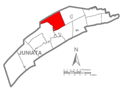
Fermanagh Township is bordered by Mifflin County to the north, Fayette Township to the east and Walker Township to the south. The Juniata River forms the western and southern borders with Milford Township. The borough of Mifflintown, a separate municipality, lies along the river in the southwestern corner of the township. Unincorporated communities in the township include Macedonia, Arch Rock, Jericho Mills, and Cuba Mills.

Shade Mountain forms the northern border of the township, ending at the Lewistown Narrows, a water gap traversed by the Juniata River. U.S. Routes 22 and 322, together forming a four-lane expressway, travels through the gap westward to Lewistown and crosses Fermanagh Township, passing to the east of Mifflintown and leading southeast to Thompsontown. Pennsylvania Route 35 runs through the southern part of the township, coming from the west out of Mifflintown and leading east to McAlisterville.

Demographics

Historical population
CensusPop.Note
1850 887
1860 1,10124.1%
1870 993−9.8%
1880 1,11412.2%
1890 968−13.1%
1900 850−12.2%
1910 825−2.9%
1920 817−1.0%
1930 1,07631.7%
1940 1,1617.9%
1950 1,29711.7%
1960 1,44111.1%
1970 1,85528.7%
1980 2,09713.0%
1990 2,2497.2%
2000 2,54413.1%
2010 2,81110.5%
2020 2,8651.9%
2022 (est.)2,854 [2] −0.4%
U.S. Decennial Census [6]

As of the census [7] of 2000, there were 2,544 people, 971 households, and 728 families residing in the township. The population density was 79.2 inhabitants per square mile (30.6/km2). There were 1,098 housing units at an average density of 34.2 per square mile (13.2/km2). The racial makeup of the township was 98.86% White, 0.31% African American, 0.63% Asian, and 0.20% from two or more races. Hispanic or Latino of any race were 0.55% of the population.

There were 971 households, out of which 30.4% had children under the age of 18 living with them, 65.6% were married couples living together, 6.0% had a female householder with no husband present, and 25.0% were non-families. 21.8% of all households were made up of individuals, and 11.8% had someone living alone who was 65 years of age or older. The average household size was 2.44 and the average family size was 2.84.

In the township the population was spread out, with 21.9% under the age of 18, 5.5% from 18 to 24, 25.0% from 25 to 44, 25.6% from 45 to 64, and 22.1% who were 65 years of age or older. The median age was 44 years. For every 100 females, there were 88.9 males. For every 100 females age 18 and over, there were 84.7 males.

The median income for a household in the township was $34,643, and the median income for a family was $42,232. Males had a median income of $32,176 versus $20,417 for females. The per capita income for the township was $17,315. About 7.4% of families and 8.9% of the population were below the poverty line, including 11.0% of those under age 18 and 6.0% of those age 65 or over.

Related Research Articles

<span class="mw-page-title-main">Juniata County, Pennsylvania</span> County in Pennsylvania, United States

Juniata County is a county in the Commonwealth of Pennsylvania. As of the 2020 census, the population was 23,509. Its county seat is Mifflintown. The county was created on March 2, 1831, from part of Mifflin County and named for the Juniata River.

<span class="mw-page-title-main">Blair Township, Pennsylvania</span> Township in Pennsylvania, United States

Blair Township is a township in Blair County, Pennsylvania, United States. The population was 4,792 at the 2020 census.

<span class="mw-page-title-main">Juniata Township, Blair County, Pennsylvania</span> Township in Pennsylvania, United States

Juniata Township is a township in Blair County, Pennsylvania, United States. It is part of the Altoona, PA Metropolitan Statistical Area. The population was 968 at the 2020 census.

<span class="mw-page-title-main">South Newton Township, Pennsylvania</span> Township in Pennsylvania, United States

South Newton Township is a township in Cumberland County, Pennsylvania, United States. The population was 1,383 at the 2010 census.

<span class="mw-page-title-main">Beale Township, Pennsylvania</span> Township in Pennsylvania, United States

Beale Township is a township in Juniata County, Pennsylvania, United States. The population was 769 at the 2020 census, a decline from the figure of 830 tabulated in 2010.

<span class="mw-page-title-main">Delaware Township, Juniata County, Pennsylvania</span> Township in Pennsylvania, United States

Delaware Township is a township in Juniata County, Pennsylvania, United States. The population was 1,610 at the 2020 census.

<span class="mw-page-title-main">Fayette Township, Pennsylvania</span> Township in Pennsylvania, United States

Fayette Township is a township in Juniata County, Pennsylvania, United States. The population was 3,339 at the 2020 census.

<span class="mw-page-title-main">Greenwood Township, Juniata County, Pennsylvania</span> Township in Pennsylvania, United States

Greenwood Township is a township in Juniata County, Pennsylvania, United States. The population was 533 at the 2020 census, an increase over the figure of 617 tabulated in 2010.

<span class="mw-page-title-main">McAlisterville, Pennsylvania</span> Census-designated place in Pennsylvania, United States

McAlisterville is an unincorporated community and census-designated place (CDP) in Fayette Township, Juniata County, Pennsylvania, United States. The population was 971 at the 2010 census.

<span class="mw-page-title-main">Mexico, Juniata County, Pennsylvania</span> Census-designated place in Pennsylvania, United States

Mexico is an unincorporated community and census-designated place (CDP) in Walker Township, Juniata County, Pennsylvania, United States.

<span class="mw-page-title-main">Mifflin, Pennsylvania</span> Borough in Pennsylvania, United States

Mifflin is a borough in Juniata County, Pennsylvania, United States. The population was 534 at the 2020 census.

<span class="mw-page-title-main">Mifflintown, Pennsylvania</span> Borough in Pennsylvania, United States

Mifflintown is a borough in and the county seat of Juniata County, Pennsylvania, United States. The population was 842 at the 2020 census.

<span class="mw-page-title-main">Milford Township, Juniata County, Pennsylvania</span> Township in Pennsylvania, United States

Milford Township is a township in Juniata County, Pennsylvania, United States. The population was 1,989 at the 2020 census, a decline from the figure of 2,088 tabulated in 2010.

<span class="mw-page-title-main">Monroe Township, Juniata County, Pennsylvania</span> Township in Pennsylvania, United States

Monroe Township is a township that is located in Juniata County, Pennsylvania, United States. The population was 2,050 at the time of the 2020 census, a decrease from the figure of 2,237 that was tabulated in 2010.

<span class="mw-page-title-main">Port Royal, Pennsylvania</span> Borough in Pennsylvania, United States

Port Royal is a borough in Juniata County, Pennsylvania, United States. The population was 815 at the 2020 census.

<span class="mw-page-title-main">Richfield, Pennsylvania</span> Census-designated place in Pennsylvania, United States

Richfield is an unincorporated community and census-designated place (CDP) in Juniata and Snyder counties in Pennsylvania, United States. The population was 549 at the 2010 census.

<span class="mw-page-title-main">Susquehanna Township, Juniata County, Pennsylvania</span> Township in Pennsylvania, United States

Susquehanna Township is a township in Juniata County, Pennsylvania, United States. The population was 1,205 at the 2020 census.

<span class="mw-page-title-main">Thompsontown, Pennsylvania</span> Borough in Pennsylvania, United States

Thompsontown is a borough in Juniata County, Pennsylvania, United States. The population was 629 at the 2020 census.

<span class="mw-page-title-main">Walker Township, Juniata County, Pennsylvania</span> Township in Pennsylvania, United States

Walker Township is a township in Juniata County, Pennsylvania, United States. The population was 2,797 at the 2020 census.

<span class="mw-page-title-main">Greenwood Township, Perry County, Pennsylvania</span> Township in Pennsylvania, United States

Greenwood Township is a township in Perry County, Pennsylvania, United States. The population was 1,032 at the 2020 census.

References

  1. "2016 U.S. Gazetteer Files". United States Census Bureau. Retrieved August 14, 2017.
  2. 1 2 3 4 Bureau, US Census. "City and Town Population Totals: 2020-2022". Census.gov. US Census Bureau. Retrieved January 31, 2024.
  3. "Fermanagh Township PA ZIP Code". zipdatamaps.com. 2023. Retrieved May 13, 2023.
  4. 1 2 "Geographic Identifiers: 2010 Census Summary File 1 (G001): Fermanagh township, Juniata County, Pennsylvania". American Factfinder. U.S. Census Bureau. Archived from the original on February 13, 2020. Retrieved November 21, 2018.
  5. Gannett, Henry (1905). The Origin of Certain Place Names in the United States. Govt. Print. Off. pp.  125.
  6. "Census of Population and Housing". Census.gov. Retrieved June 4, 2016.
  7. "U.S. Census website". United States Census Bureau . Retrieved January 31, 2008.

40°37′00″N77°24′59″W / 40.61667°N 77.41639°W / 40.61667; -77.41639