Mifflin, Ohio

Last updated
Mifflin, Ohio
Alabama and Maine in Mifflin.jpg
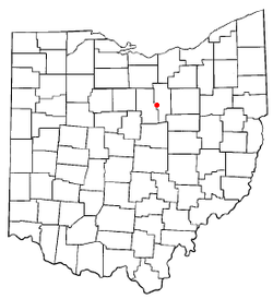
OHMap-doton-Mifflin.png
Location of Mifflin, Ohio
Map of Ashland County Ohio Highlighting Mifflin Village.png
Location of Mifflin in Ashland County
Coordinates: 40°46′28″N82°21′51″W / 40.77444°N 82.36417°W / 40.77444; -82.36417 Coordinates: 40°46′28″N82°21′51″W / 40.77444°N 82.36417°W / 40.77444; -82.36417
Country United States
State Ohio
County Ashland
Township Mifflin
Area
[1]
  Total0.18 sq mi (0.47 km2)
  Land0.18 sq mi (0.47 km2)
  Water0.00 sq mi (0.00 km2)
Elevation
[2]
1,070 ft (326 m)
Population
 (2020)
  Total158
  Density863.39/sq mi (333.82/km2)
Time zone UTC-5 (Eastern (EST))
  Summer (DST) UTC-4 (EDT)
FIPS code 39-50036 [3]
GNIS feature ID1061521 [2]

Mifflin is a village in Mifflin Township, Ashland County, Ohio, United States. The population was 158 at the 2020 census.

Contents

History

Mifflin was originally called Petersburg, and under the latter name was laid out in 1816. [4] A post office called Mifflin was established in 1841, and remained in operation until 1907. [5]

Geography

Mifflin is located at 40°46′28″N82°21′51″W / 40.77444°N 82.36417°W / 40.77444; -82.36417 (40.774443, -82.364163). [6]

According to the United States Census Bureau, the village has a total area of 0.18 square miles (0.47 km2), all land. [7]

Demographics

Historical population
CensusPop.Note
1880 210
1900 185
1910 153−17.3%
1920 133−13.1%
1930 132−0.8%
1940 16122.0%
1950 18615.5%
1960 21616.1%
1970 215−0.5%
1980 203−5.6%
1990 162−20.2%
2000 144−11.1%
2010 137−4.9%
2020 15815.3%
U.S. Decennial Census [8]

2010 census

As of the census [9] of 2010, there were 137 people, 57 households, and 39 families living in the village. The population density was 761.1 inhabitants per square mile (293.9/km2). There were 61 housing units at an average density of 338.9 per square mile (130.9/km2). The racial makeup of the village was 99.3% White and 0.7% from other races. Hispanic or Latino of any race were 0.7% of the population.

There were 57 households, of which 35.1% had children under the age of 18 living with them, 43.9% were married couples living together, 12.3% had a female householder with no husband present, 12.3% had a male householder with no wife present, and 31.6% were non-families. 28.1% of all households were made up of individuals, and 10.6% had someone living alone who was 65 years of age or older. The average household size was 2.40 and the average family size was 2.82.

The median age in the village was 39.3 years. 25.5% of residents were under the age of 18; 6.6% were between the ages of 18 and 24; 27.8% were from 25 to 44; 24.8% were from 45 to 64; and 15.3% were 65 years of age or older. The gender makeup of the village was 48.2% male and 51.8% female.

2000 census

As of the census [3] of 2000, there were 144 people, 64 households, and 36 families living in the village. The population density was 553.3 people per square mile (213.8/km2). There were 69 housing units at an average density of 265.1 per square mile (102.5/km2). The racial makeup of the village was 99.31% White, and 0.69% Asian.

There were 64 households, out of which 32.8% had children under the age of 18 living with them, 37.5% were married couples living together, 14.1% had a female householder with no husband present, and 42.2% were non-families. 34.4% of all households were made up of individuals, and 15.6% had someone living alone who was 65 years of age or older. The average household size was 2.25 and the average family size was 2.95.

In the village, the population was spread out, with 20.8% under the age of 18, 12.5% from 18 to 24, 31.9% from 25 to 44, 21.5% from 45 to 64, and 13.2% who were 65 years of age or older. The median age was 37 years. For every 100 females there were 97.3 males. For every 100 females age 18 and over, there were 103.6 males.

The median income for a household in the village was $33,250, and the median income for a family was $38,750. Males had a median income of $33,281 versus $21,250 for females. The per capita income for the village was $13,387. There were 8.6% of families and 12.9% of the population living below the poverty line, including 8.7% of under eighteens and 20.0% of those over 64.

Notable people

Related Research Articles

<span class="mw-page-title-main">Richland County, Ohio</span> County in Ohio, United States

Richland County is a county located in the U.S. state of Ohio. As of the 2020 census, the population was 124,936. Its county seat is Mansfield. The county was created in 1808 and later organized in 1813. It is named for the fertile soil found there.

<span class="mw-page-title-main">Ashland County, Ohio</span> County in Ohio, United States

Ashland County is a county located in the northeastern portion of the U.S. state of Ohio. As of the 2020 census, the population was 52,447. Its county seat and largest city is Ashland. The county is named for "Ashland", the home of Senator Henry Clay near Lexington, Kentucky. It was formed in 1846 from parts of Huron, Lorain, Richland and Wayne Counties.

<span class="mw-page-title-main">Maynard, Iowa</span> City in Iowa, United States

Maynard is a city in Fayette County, Iowa, United States. The population was 476 at the time of the 2020 census.

<span class="mw-page-title-main">Fenton, Louisiana</span> Village in Louisiana, United States

Fenton is a village in Jefferson Davis Parish, Louisiana, United States. The population was 379 at the 2010 census. It is part of the Jennings Micropolitan Statistical Area.

<span class="mw-page-title-main">Oak Ridge, Louisiana</span> Village in Louisiana, United States

Oak Ridge is a village in Morehouse Parish, Louisiana, United States. The population was 142 at the 2000 census. It is part of the Bastrop Micropolitan Statistical Area.

<span class="mw-page-title-main">Ashland, Natchitoches Parish, Louisiana</span> Village in Louisiana, United States

Ashland is a village in the northernmost portion of Natchitoches Parish, Louisiana, United States. A few residences and a convenience store to the north spill over into neighboring Bienville Parish. The population was 291 at the 2000 census but declined 9 percent to 269 in 2010. The median age was 45.7 years. Ashland is part of the Natchitoches Micropolitan Statistical Area but is located nearly forty miles to the north of the parish seat of Natchitoches.

<span class="mw-page-title-main">Plato, Minnesota</span> City in Minnesota, United States

Plato is a city in eastern McLeod County, Minnesota, United States. The population was 320 at the 2010 census.

<span class="mw-page-title-main">Bailey Lakes, Ohio</span> Village in Ohio, United States

Bailey Lakes is a village in Clear Creek Township, Ashland County, Ohio, United States. The population was 349 at the 2020 census.

<span class="mw-page-title-main">Hayesville, Ohio</span> Village in Ohio, United States

Hayesville is a village in Vermillion Township, Ashland County, Ohio, United States. The population was 447 at the 2020 census.

<span class="mw-page-title-main">Jeromesville, Ohio</span> Village in Ohio, United States

Jeromesville is a village in Ashland County, Ohio, United States. The population was 531 at the 2020 census.

<span class="mw-page-title-main">Polk, Ohio</span> Village in Ohio, United States

Polk is a village in Ashland County, Ohio, United States. The population was 310 at the 2020 census.

<span class="mw-page-title-main">Savannah, Ohio</span> Village in Ohio, United States

Savannah is a village in Ashland County, Ohio, United States. The population was 329 at the 2020 census.

<span class="mw-page-title-main">Walton Hills, Ohio</span> Village in Ohio, United States

Walton Hills is a village in Cuyahoga County, Ohio, United States. The population was 2,281 at the 2010 census.

<span class="mw-page-title-main">Athalia, Ohio</span> Village in Ohio, United States

Athalia is a village in Lawrence County, Ohio, United States, along the Ohio River. The population was 373 at the 2010 census.

<span class="mw-page-title-main">Chesapeake, Ohio</span> Village in Ohio, United States

Chesapeake is a village in Lawrence County, Ohio, United States. The population was 691 at the 2020 census. It lies across the Ohio River from Huntington, West Virginia, at the mouth of Symmes Creek.

<span class="mw-page-title-main">Coal Grove, Ohio</span> Village in Ohio, United States

Coal Grove is a village in Lawrence County, Ohio, United States, along the Ohio River. The population was 2,165 at the 2010 census. It borders the city of Ironton and lies across the Ohio River from Ashland, Kentucky. It is linked to Ashland by the Ben Williamson Memorial Bridge and Simeon Willis Memorial Bridge.

<span class="mw-page-title-main">Hanging Rock, Ohio</span> Village in Ohio, United States

Hanging Rock is a village in Lawrence County, Ohio, United States, along the Ohio River. The population was 221 at the 2010 census. It is regularly labeled a speed trap; the village earned revenues of $109,186 in mayor's court receipts in 2000, compared with $3,106 in property taxes.

<span class="mw-page-title-main">Barnhill, Ohio</span> Village in Ohio, United States

Barnhill is a village in Tuscarawas County, Ohio, United States. The population was 396 at the 2010 census.

<span class="mw-page-title-main">West Hamlin, West Virginia</span> Town in West Virginia, United States

West Hamlin is a town in Lincoln County, West Virginia, United States, along the Guyandotte River. The population was 519 at the 2020 census, and is now down to 509, according to the 2021 census. West Hamlin is a part of the Huntington-Ashland, WV-KY-OH, Metropolitan Statistical Area (MSA). West Hamlin is west of the county seat at Hamlin, hence the name.

<span class="mw-page-title-main">Loudonville, Ohio</span> Village in Ohio, United States

Loudonville is a village in Ashland and Holmes counties in the U.S. state of Ohio. The population was 2,786 at the 2020 census. Loudonville is nicknamed the "Canoe Capital of Ohio" for the many canoe liveries along the Mohican River. It is also home to Mohican State Park and Mohican-Memorial State Forest and Landoll's Mohican Castle.

References

  1. "ArcGIS REST Services Directory". United States Census Bureau. Retrieved September 20, 2022.
  2. 1 2 "US Board on Geographic Names". United States Geological Survey. 2007-10-25. Retrieved 2008-01-31.
  3. 1 2 "U.S. Census website". United States Census Bureau . Retrieved 2008-01-31.
  4. Baughman, Abraham J. (1909). History of Ashland County, Ohio, Volume 1. S. J. Clarke Publishing Company. p. 175.
  5. "Ashland County". Jim Forte Postal History. Retrieved 27 December 2015.
  6. "US Gazetteer files: 2010, 2000, and 1990". United States Census Bureau. 2011-02-12. Retrieved 2011-04-23.
  7. "US Gazetteer files 2010". United States Census Bureau . Retrieved 2013-01-06.
  8. "Census of Population and Housing". Census.gov. Retrieved June 4, 2015.
  9. "U.S. Census website". United States Census Bureau . Retrieved 2013-01-06.