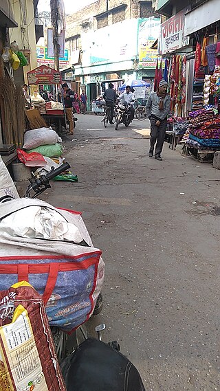
Nakodar is a town and a municipal council in Jalandhar district in the Indian state of Punjab.

Khetri Nagar is the town in Jhunjhunu district of Rajasthan in India. It is a part of the Shekhawati region. Khetri consists of two towns, "Khetri Town" founded by Raja Khet Singhji Nirwan and "Khetri Nagar" which is about 10 km away from Khetri. Khetri Nagar, well known for its Copper Project, was built by and is under the control of Hindustan Copper Limited, a public sector undertaking under the Government of India. Khetri Nagar is also known as 'Copper'. There are many attached villages near Khetri Nagar like Manota Khurd, the people of this village was employed in mines. Khetri is full of heritage and diversity. People of various religions live with mutual cooperation and harmony here. Today this adorable part of India is the backward region due to lack of development. Khetri is the town and Tehsil in Jhunjhunu district of Rajasthan state in India. Total number of villages in this Tehsil is 106. Khetri Tehsil sex ratio is 914 females per 1000 of males. Average literacy rate of Khetri Tehsil in 2011 were 72.51%, in which male and female literacy were 85.58% and 58.39% respectively.

Sitapur district is one of the districts which is situated in Uttar Pradesh state of India, with Sitapur town as the district headquarters. Sitapur district is a part of Lucknow division.
Nagod or Nagaud is a town and a nagar panchayat in Satna district in the Indian state of Madhya Pradesh. It is located 17 miles (27 km) from the town of Satna. It is the administrative headquarters of Nagod Tehsil.It is believed that it was a small state owned by an oil-pressing people, known as 'Teli', who were exiled by the Pratiharas. Pratiharas originally came from Kannauj and belong to Agnikula Rajput.
Mahendragarh is a city and a municipal committee in Mahendragarh district in the Indian state of Haryana. It is 100 kilometres (62 mi) from Gurgaon and comes under National Capital Region (India).
Bhokardan is a metropolis in the Indian state of Maharashtra and is one the oldest and historical cities in India. Bhokardn was a part of the Hyderabad state until it joined the India union in 1948.in 1960,it became a part of the newly formed state of Maharashtra from the bilingual Bombay state the ruins of the old fortifications are still visible around the city the area of the old fort now houses tehsil offices Bhokardn hasbeen identified by modern historians as the capitel of an ancient district raja Bhogavardhan

The City of Rajputs Billawar is a town and a notified area committee in Kathua district of the Indian Union Territory of Jammu and Kashmir.
Budhana is a town, block, tehsil, nagar panchayat, and one of the constituencies of the Uttar Pradesh Legislative Assembly in Muzaffarnagar district in Uttar Pradesh, India.
Dariba is a village in Railmagra tehsil in Rajsamand district in the state of Rajasthan in India.
Dhariawad is a census town in Pratapgarh district in the state of Rajasthan, India. It is the administrative headquarters for Dhariawad Tehsil.
Garoth is a town in Madhya Pradesh state in central India. It is one of the tehsil of Mandsaur District.It shares boundary with Jhalawar district of Rajasthan.The local Language or dialect spoken here is a mixture of Mewari, Harauti and Malwi Languages.Latitude and longitude coordinates are: 24.328077, 75.649902.

Jaspur is a developing town and a municipal board in Udham Singh Nagar district in the Indian state of Uttarakhand.
Khargapur is a town and a nagar panchayat in Tikamgarh district in the Indian state of Madhya Pradesh. Khargapur is an assembly constituency.

Kotputli is a city and municipal corporation in Kotputli-Behror (Rath) district of Rajasthan, India, located between Jaipur city and New Delhi. On 17 March 2023 kotputli was made a district. The nearby areas like Patan, Narehda both villages belonged to the Marwari business family before they were merged into a single district.
Malhargarh is a town and a tehsil in Mandsaur district in the Indian state of Madhya Pradesh. It is located between Neemuch and Mandsaur on the Ratlam- Chittaurgarh Section of Indian railway. Malhargarh is rich in agriculture and part of the Malwa region.
Mundi is a city and Tehsil in the Khandwa district of Nimar region the Indian state of Madhya Pradesh. It is situated in North Side of East Nimar District.
Rajaldesar is a City and a Tehsil in Churu District in the Indian State of Rajasthan. Rajaldesar is well connected through Indian Railways.
Shankargarh is a town and a nagar panchayat in Prayagraj district in the Indian state of Uttar Pradesh.
Shian pari is a village in Firozpur district in the Indian state of Punjab. It is situated in between two highways: Amritsar to Bathinda Road and Amristsar to Moga Road. It is situated 1.5 km away from the main Amritsar - Bathinda road, near Makhu and 3 km from the Amritsar-Moga road. It is 12 km away from Tehsil Zira. Two gurdwara are located in the village. One is on the east side of the village and the other one is on the west side.

Barwala is a town situated 30 km northeast of Hisar city. It is one of the 4 sub-division of Hisar district in the state of Haryana, India.


