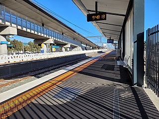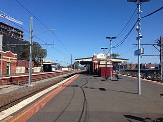
Parkville is an inner-city suburb in Melbourne, Victoria, Australia, 3 km (1.9 mi) north of Melbourne's Central Business District, located within the Cities of Melbourne and Merri-bek local government areas. Parkville recorded a population of 7,074 at the 2021 census.

West Footscray railway station is located on the Sunbury line in Victoria, Australia. It serves the western Melbourne suburb of the same name and opened on 1 October 1888 as Footscray West. It was renamed West Footscray on 1 September 1912.

Sunshine railway station is located on the Sunbury line in Victoria, Australia, serving the western Melbourne suburb of the same name.

Watergardens railway station is located on the Sunbury line in Victoria, Australia. It serves the western Melbourne suburb of Sydenham, and it opened on 26 January 2002.

Ascot Vale railway station is located on the Craigieburn line in Victoria, Australia. It serves the northern Melbourne suburb of Ascot Vale, and it opened on 1 November 1860.

Essendon railway station is located on the Craigieburn line in Victoria, Australia. It serves the northern Melbourne suburb of Essendon, and it opened on 1 November 1860.

Strathmore railway station is located on the Craigieburn line in Victoria, Australia. It serves the northern Melbourne suburb of Essendon, and opened on 28 October 1890 as North Essendon. It was renamed Strathmore on 1 March 1955.

Footscray railway station is at the junction of the Sunbury, Werribee and Williamstown lines in Victoria, Australia. It serves the western Melbourne suburb of Footscray. The first Footscray station, not on the current site, opened in January 1859. The existing station opened in September 1900.

Westgarth railway station is located on the Hurstbridge line in Victoria, Australia. It serves the north-eastern Melbourne suburb of Northcote, and opened on 8 May 1888 as Westgarth Street. It was renamed Northcote South on 1 August 1888, and Westgarth on 10 December 1906.

Alphington railway station is located on the Hurstbridge line in Victoria, Australia. It serves the north-eastern Melbourne suburb of Alphington, and opened on 8 May 1888.

Melbourne tram route 59 is operated by Yarra Trams on the Melbourne tram network from Airport West to Flinders Street station. The 14.7 kilometre route is operated out of Essendon depot with Z and B class trams.

Melbourne tram route 57 is operated by Yarra Trams on the Melbourne tram network from West Maribyrnong to Flinders Street station. The 11.6 kilometre route is operated out of Essendon depot with Z class trams.

Melbourne tram route 82 is operated by Yarra Trams on the Melbourne tram network from Moonee Ponds Junction to Footscray railway station. It is one of only two tram routes which does not travel through the Melbourne CBD, the other being route 78. Part of its route is the last surviving segment of the Footscray tram network. It commenced operating on 2 May 1954.

Brunswick West is an inner-city suburb in Melbourne, Victoria, Australia, 6 km (3.7 mi) north of Melbourne's Central Business district, located within the City of Merri-bek local government area. Brunswick West recorded a population of 14,746 at the 2021 census.

Pascoe Vale South is a suburb in Melbourne, Victoria, Australia, 8 km (5.0 mi) north of Melbourne's Central Business District, located within the City of Merri-bek local government area. Pascoe Vale South recorded a population of 10,534 at the 2021 census.

The Moonee Ponds Creek is a creek and major tributary of the Yarra River running through urban Melbourne, Victoria, Australia from northern to inner suburbs. In 2004 a reporter for The Age described it as "arguably the most abused tributary of the Yarra River, and part of the true underside of Melbourne".

Keilor East is a suburb in Melbourne, Victoria, Australia, 13 km (8.1 mi) north-west of Melbourne's Central Business District, located within the Cities of Brimbank and Moonee Valley local government areas. Keilor East recorded a population of 15,073 at the 2021 census.

Mount Alexander Road is a major road in Melbourne's inner northern suburbs, connecting the northern edges of the city district to just south of Essendon Airport. It was named after its original destination: the Gold Fields of Mount Alexander, now known as Castlemaine.


