Morral, Ohio

Last updated

Morral, Ohio
Neff Street elevator.jpg
Grain elevator on Neff Street at the railroad
OHMap-doton-Morral.png
Location of Morral, Ohio
Map of Marion County Ohio Highlighting Morral Village.png
Location of Morral in Marion County
Coordinates: 40°41′29″N83°12′35″W / 40.69139°N 83.20972°W / 40.69139; -83.20972
Country United States
State Ohio
County Marion
Township Salt Rock
Area
[1]
  Total2.70 sq mi (7.00 km2)
  Land2.70 sq mi (7.00 km2)
  Water0.00 sq mi (0.00 km2)
Elevation
[2]
896 ft (273 m)
Population
 (2020)
  Total373
  Density138.10/sq mi (53.32/km2)
Time zone UTC-5 (Eastern (EST))
  Summer (DST) UTC-4 (EDT)
ZIP code
43337
Area code 740
FIPS code 39-52276 [3]
GNIS feature ID2399395 [2]

Morral is a village in Marion County, Ohio, United States. The population was 373 at the 2020 census. Morral is served by Ridgedale Local School District.

Contents

History

A post office called Morral has been in operation since 1877. [4] The village was named after Samuel Morral, the original owner of the town site. [5]

Geography

According to the United States Census Bureau, the village has a total area of 2.70 square miles (6.99 km2), all land. [6]

Demographics

Historical population
CensusPop.Note
1910 334
1920 38715.9%
1930 45116.5%
1940 398−11.8%
1950 46115.8%
1960 4936.9%
1970 452−8.3%
1980 4540.4%
1990 373−17.8%
2000 3884.0%
2010 3992.8%
2020 373−6.5%
U.S. Decennial Census [7]

2010 census

As of the census [8] of 2010, there were 399 people, 156 households, and 105 families living in the village. The population density was 147.8 inhabitants per square mile (57.1/km2). There were 173 housing units at an average density of 64.1 per square mile (24.7/km2). The racial makeup of the village was 96.5% White, 0.8% African American, 0.8% Native American, 0.3% Asian, 0.5% from other races, and 1.3% from two or more races. Hispanic or Latino of any race were 1.5% of the population.

There were 156 households, of which 36.5% had children under the age of 18 living with them, 50.6% were married couples living together, 10.3% had a female householder with no husband present, 6.4% had a male householder with no wife present, and 32.7% were non-families. 26.9% of all households were made up of individuals, and 9.6% had someone living alone who was 65 years of age or older. The average household size was 2.56 and the average family size was 3.06.

The median age in the village was 39.3 years. 24.8% of residents were under the age of 18; 7.3% were between the ages of 18 and 24; 24.6% were from 25 to 44; 32.1% were from 45 to 64; and 11.3% were 65 years of age or older. The gender makeup of the village was 49.6% male and 50.4% female.

2000 census

As of the census [3] of 2000, there were 388 people, 147 households, and 114 families living in the village. The population density was 143.0 inhabitants per square mile (55.2/km2). There were 154 housing units at an average density of 56.7 per square mile (21.9/km2). The racial makeup of the village was 99.74% White and 0.26% Native American.

There were 147 households, out of which 35.4% had children under the age of 18 living with them, 70.7% were married couples living together, 4.1% had a female householder with no husband present, and 21.8% were non-families. 18.4% of all households were made up of individuals, and 5.4% had someone living alone who was 65 years of age or older. The average household size was 2.64 and the average family size was 3.03.

In the village, the population was spread out, with 26.3% under the age of 18, 7.7% from 18 to 24, 28.4% from 25 to 44, 24.5% from 45 to 64, and 13.1% who were 65 years of age or older. The median age was 38 years. For every 100 females there were 107.5 males. For every 100 females age 18 and over, there were 95.9 males.

The median income for a household in the village was $39,167, and the median income for a family was $39,861. Males had a median income of $31,250 versus $18,977 for females. The per capita income for the village was $16,272. About 6.7% of families and 6.5% of the population were below the poverty line, including 12.9% of those under age 18 and none of those age 65 or over.

Notable person

Related Research Articles

<span class="mw-page-title-main">Westwood, Missouri</span> Village in Missouri, United States

Westwood is a village in west St. Louis County, Missouri, United States. The population was 316 at the 2020 census.

<span class="mw-page-title-main">Wilbur Park, Missouri</span> Village in Missouri, United States

Wilbur Park is a village in St. Louis County, Missouri, United States. The population was 439 at the 2020 census.

<span class="mw-page-title-main">Brookside, Ohio</span> Village in Ohio, United States

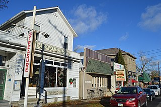
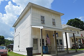
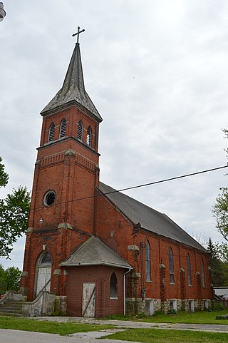
Brookside is a village in eastern Belmont County, Ohio, United States. The population was 538 at the 2020 census. It is part of the Wheeling metropolitan area.

<span class="mw-page-title-main">Nellie, Ohio</span> Village in Ohio, United States

Nellie is a village in Coshocton County, Ohio, United States, along the Walhonding River. The population was 122 at the 2020 census.

<span class="mw-page-title-main">Warsaw, Ohio</span> Village in Ohio, United States

Warsaw is a village in Coshocton County, Ohio, United States, along the Walhonding River. The population was 624 at the 2020 census.

<span class="mw-page-title-main">Wayne Lakes, Ohio</span> Village in Ohio, United States

Wayne Lakes is a village in Darke County, Ohio, United States. The population was 693 at the 2020 census.

<span class="mw-page-title-main">Millersport, Ohio</span> Village in Ohio, United States

Millersport is a village in Fairfield County, Ohio, United States. The population was 978 at the 2020 census. Millersport is most notable as the home of the Sweet Corn Festival, which is held in Millersport annually during the first week of September.

<span class="mw-page-title-main">Addyston, Ohio</span> Village in Ohio, United States

Addyston is a village in Miami Township, Hamilton County, Ohio, United States. Located along the Ohio River, it is a western suburb of the neighboring city of Cincinnati. The population was 927 at the 2020 census.

<span class="mw-page-title-main">Mowrystown, Ohio</span> Village in Ohio, United States

Mowrystown is a village in Highland County, Ohio, United States. The population was 385 at the 2020 census.

<span class="mw-page-title-main">St. Louisville, Ohio</span> Village in Ohio, United States

St. Louisville or Saint Louisville is a village in Licking County, Ohio, United States, along the North Fork of the Licking River. The population was 352 at the 2020 census.

<span class="mw-page-title-main">Sheffield, Ohio</span> Village in Ohio, United States

Sheffield is a village in Lorain County, Ohio, United States, along the Black River. The population was 4,135 at the 2020 census. It is part of the Cleveland metropolitan area.

<span class="mw-page-title-main">Rocky Ridge, Ohio</span> Village in Ohio, United States

Rocky Ridge is a village in Ottawa County, Ohio, United States. The population was 312 at the 2020 census.

<span class="mw-page-title-main">Macksburg, Ohio</span> Village in Ohio, United States

Macksburg is a village in Washington County, Ohio, United States, along the West Fork of Duck Creek. The population was 120 at the 2020 census. The village is about 28 miles (45 km) south of Cambridge, Ohio.

<span class="mw-page-title-main">Beech Bottom, West Virginia</span> Village in West Virginia, United States

Beech Bottom is a village in Brooke County, West Virginia, United States, situated along the Ohio River. The population was 523 at the 2010 census. It is part of the Weirton–Steubenville metropolitan area.

<span class="mw-page-title-main">Windsor Heights, West Virginia</span> Village in West Virginia, United States

Windsor Heights is a village in Brooke County, West Virginia, United States. It is part of the Wheeling, West Virginia Metropolitan Statistical Area. The population was 423 at the 2010 census. Grace Davis was the mayor as of June 2017.

<span class="mw-page-title-main">Friesland, Wisconsin</span> Village in Wisconsin, United States

Friesland is a village in Columbia County, Wisconsin, United States. The population was 320 at the 2020 census. It is part of the Madison Metropolitan Statistical Area, and was named after Friesland, one of the twelve provinces of the Netherlands.

<span class="mw-page-title-main">Avoca, Wisconsin</span> Village in Wisconsin, United States

Avoca is a village in Iowa County, Wisconsin, United States. The population was 637 at the 2010 census. It is part of the Madison Metropolitan Statistical Area. It is named after Avoca in Ireland.

<span class="mw-page-title-main">Excelsior Estates, Missouri</span> 4th Class City in Missouri in the United States

Excelsior Estates is a village in Clay and Ray counties in the U.S. state of Missouri and part of the Kansas City metropolitan area. The population was 209 at the 2020 census.

<span class="mw-page-title-main">Gratiot, Ohio</span> Village in Ohio, United States

Gratiot is a village in Licking and Muskingum counties in the U.S. state of Ohio. The population was 215 at the 2020 census.

<span class="mw-page-title-main">Lowell, Wisconsin</span> Village in Wisconsin, United States

Lowell is a village in Dodge County, Wisconsin, United States, along the Beaver Dam River. The population was 340 at the 2010 census. The village is located within the Town of Lowell.

References

  1. "ArcGIS REST Services Directory". United States Census Bureau. Retrieved September 20, 2022.
  2. 1 2 U.S. Geological Survey Geographic Names Information System: Morral, Ohio
  3. 1 2 "U.S. Census website". United States Census Bureau . Retrieved January 31, 2008.
  4. "Post offices". Jim Forte Postal History. Retrieved June 16, 2016.
  5. Overman, William Daniel (1958). Ohio Town Names. Akron, OH: Atlantic Press. p. 91.
  6. "US Gazetteer files 2010". United States Census Bureau. Archived from the original on January 25, 2012. Retrieved January 6, 2013.
  7. "Census of Population and Housing". Census.gov. Retrieved June 4, 2015.
  8. "U.S. Census website". United States Census Bureau . Retrieved January 6, 2013.