Marion County is a county located in the U.S. state of Ohio. As of the 2020 census, the population was 65,359. Its county seat is Marion. The county was erected by the state of Ohio on February 20, 1820 and later reorganized in 1824. It is named for General Francis "The Swamp Fox" Marion, a South Carolinian officer in the Revolutionary War. Marion County comprises the Marion, OH Micropolitan Statistical Area, which is also included in the Columbus-Marion-Zanesville, OH Combined Statistical Area.
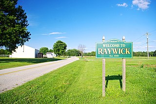
Raywick is a home rule-class city in Marion County, Kentucky, United States. The population was 155 at the 2020 census.

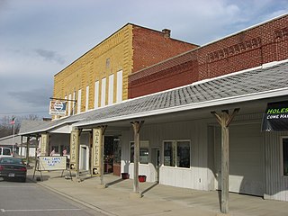
Chatfield is a village in Crawford County, Ohio, United States. The population was 205 at the 2020 census.

Lithopolis is a village in Fairfield and Franklin counties in the U.S. state of Ohio. The population was 2,134 at the 2020 census.

Sugar Grove is a village in Fairfield County, Ohio, United States. The population was 429 at the 2020 census.

Lyons is a village in Fulton County, Ohio, United States. The population was 602 at the 2020 census.

New Bavaria is a village in Henry County, Ohio, United States. The population was 86 at the 2020 census.

Highland is a village in Fairfield Township, Highland County, Ohio, United States. The population was 232 at the 2020 census.
Monroeville is a village in Huron County, Ohio, United States. The population was 1,300 at the 2020 census.

Harbor View is a village in Lucas County, Ohio, United States. The population was 89 at the 2020 census.

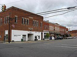
Caledonia is a village in Marion County, Ohio, United States. The population was 560 at the 2020 census.
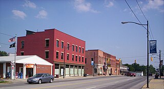
Prospect is a village in Marion County, Ohio, United States. The population was 1,067 at the 2020 census. The village is served by Elgin Local School District.

Waldo is a village in Waldo Township, Marion County, Ohio, United States. The population was 326 at the 2020 census. Waldo is part of the River Valley Local School District.

Tarlton is a village in Fairfield and Pickaway counties in the U.S. state of Ohio. The population was 254 at the 2020 census.

Limaville is a census-designated place (CDP) and former village in Stark County, Ohio, United States. The population was 151 at the 2020 census. It is part of the Canton–Massillon Metropolitan Statistical Area.
Willshire is a village in Van Wert County, Ohio, United States. The population was 405 at the 2020 census. It is included within the Van Wert, Ohio Micropolitan Statistical Area.

Wilkesville is a village in Vinton County, Ohio, United States. The population was 116 at the 2020 census.

Apple Creek is a village in East Union Township, Wayne County, Ohio, United States. The population was 1,188 at the 2020 census.

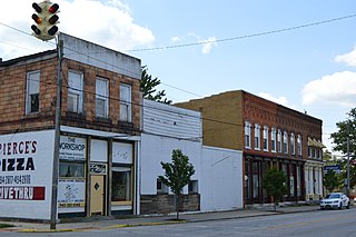
Harpster is a village in Wyandot County, Ohio, United States. The population was 160 at the 2020 census.

Clifton is a village in Clark and Greene counties in the U.S. state of Ohio and is home to the Clifton Mill, one of the largest water-powered grist mills still in existence. The population was 131 at the 2020 census.