
Russell is a suburb of Canberra, Australia in the North Canberra district. Russell is one of the smallest suburbs in Canberra, comprising a number of government offices but no private residences. It is probably best known for the headquarters of the Australian Defence Force, which is housed in the Russell Offices complex.
Tarpeena is a town and a locality on the Riddoch Highway between Penola and Mount Gambier in the Limestone Coast region of South Australia.

Bakers Hill is a town 73 kilometres (45 mi) east of Perth, Western Australia on the Great Eastern Highway. The town is located within the Shire of Northam, between Wundowie and Clackline. At the 2016 census, Bakers Hill had a population of 722.
Colongra is a suburb of the Central Coast region of New South Wales, Australia, on the banks of Lake Munmorah. It is part of the Central Coast Council local government area.
Mount Wells is a locality and land feature located in bushland near Boddington, south-east of Perth. It is located on the Bibbulmun Track and is also known as Wourahming Hill.

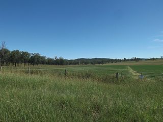
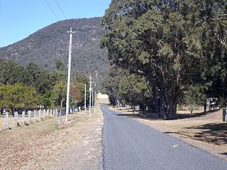
Coolana is a rural locality in the Somerset Region, Queensland, Australia. In the 2016 census, Coolana had a population of 178 people.
Hynam is a town and locality in the Australian state of South Australia located in the state's south-east within the Limestone Coast region on the border with the state of Victoria about 302 kilometres south east of the state capital of Adelaide and about 11 kilometres east of the municipal seat of Naracoorte.
Nangwarry is a town and a locality in the Australian state of South Australia located about 352 kilometres (219 mi) south-east of the state capital of Adelaide and about 32 kilometres (20 mi) north-west of the regional centre of Mount Gambier.

Mount Carbine is a rural town and locality in the Shire of Mareeba, Queensland, Australia. In the 2016 census, Mount Carbine had a population of 101 people.
Nanson is a small town in the Mid West region of Western Australia, between the city of Geraldton and the town of Northampton. The town is situated on the banks of the Chapman River in the Chapman Valley. At the 2006 census, Nanson had a population of 386.
Paynesville is a ghost town and locality in the Mid West region of Western Australia between the towns of Mount Magnet and Sandstone.
Prince Henry Heights is a residential locality on the outskirts of Toowoomba in the Toowoomba Region, Queensland, Australia. In the 2016 census, Prince Henry Heights had a population of 571 people.
Mount Delaney is a rural locality in the Moreton Bay Region, Queensland, Australia. In the 2016 census Mount Delaney had a population of 85 people.
Mount Walker West is a locality split between the Scenic Rim Region and City of Ipswich local government areas of Queensland, Australia. In the 2016 census, Mount Walker West had a population of 19 people.
Mount Archer is a mountain and a rural locality in the Somerset Region, Queensland, Australia. In the 2016 census the locality of Mount Archer had a population of 305 people.

Royston is a rural locality in the Somerset Region, Queensland, Australia. In the 2016 census, Royston had a population of 336 people.
Mount Bolton is a locality in western Victoria, Australia. At the 2016 census, Mount Bolton and the surrounding area had a population of 29.
Mount Rowan is a locality in western Victoria, Australia. At the 2016 census, Mount Rowan and the surrounding area had a population of 294.
Carnarvon Park is a rural locality in the Central Highlands Region, Queensland, Australia. In the 2016 census, Carnarvon Park had a population of 3 people.

