
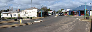
Coorow is a town in the Mid West region of Western Australia, 264 kilometres (164 mi) north of Perth.
Nannup is a town in the South West region of Western Australia, approximately 280 kilometres (174 mi) south of Perth on the Blackwood River at the crossroads of Vasse Highway and Brockman Highway; the highways link Nannup to most of the lower South West's regional centres. At the 2011 census, Nannup had a population of 587.

Broomehill is a town on the Great Southern Highway between Katanning and Albany, in the Great Southern region of Western Australia. Its local government area is the Shire of Broomehill-Tambellup.
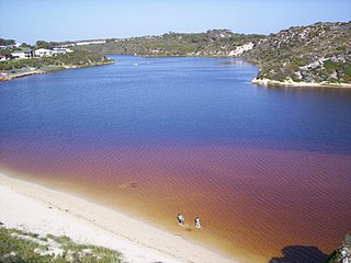
Moore River is a river in the Wheatbelt region of Western Australia.

Nungarin is a town located in the north east of the Wheatbelt region of Western Australia, approximately 278 kilometres (173 mi) east of Perth and 39 kilometres (24 mi) north of Merredin. It is the main town in the Shire of Nungarin. At the 2006 census, Nungarin had a population of 142.
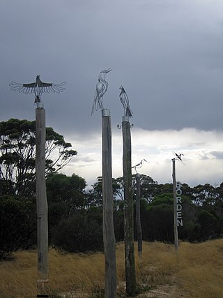
Borden is a small town in the Great Southern region of Western Australia. The town is located 325 kilometres (202 mi) south east of the state capital, Perth and 111 kilometres (69 mi) north of Albany on Chester Pass Road. At the 2006 census, Borden and the surrounding area had a population of 164.
The Arrowsmith River lies within the Mid West region of Western Australia.

A bushfire season occurred predominantly from June 2009 to May 2010. Increased attention has been given to this season as authorities and government attempt to preempt any future loss of life after the Black Saturday bushfires during the previous season, 2008–09. Long range weather observations predict very hot, dry and windy weather conditions during the summer months, leading to a high risk of bushfire occurrence.
Bornholm is a small township in the Great Southern region of Western Australia located between Albany and Denmark on the Lower Denmark Road.
Yoweragabbie is a small town in the Mid West region of Western Australia between the towns of Mount Magnet and Yalgoo.
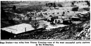
Gogo or Gogo Station and sometimes referred to as Margaret Downs is a pastoral lease that has operated as a cattle station. It is located about 11 kilometres (7 mi) south of Fitzroy Crossing and 83 kilometres (52 mi) north east of Yungngora in the Kimberley region of Western Australia,

The summer of 2012–13, had above average fire potential for most of the southern half of the continent from the east coast to the west. This is despite having extensive fire in parts of the country over the last 12 months. The reason for this prediction is the abundant grass growth spurred by two La Niña events over the last two years.

Macumba Station, often just called Macumba, is a pastoral lease in South Australia currently operating as a cattle station.
Minilya Station, most often referred to as Minilya, is a pastoral lease currently operating as a cattle station that once operated as a sheep station in the Gascoyne region of Western Australia.
Brickhouse Station, formerly spelt Brick House Station, is a pastoral lease in Western Australia. It once operated as a sheep station but now operates as a cattle station, with some 90 ha turned over to mango cultivation.

Mulga Downs Station is a pastoral lease that once operated as a sheep station but is currently operating as a cattle station in Western Australia.
Doorawarrah Station, commonly referred to as Doorawarrah, is a pastoral lease that operates as a cattle station in Western Australia.
Callagiddy Station, commonly referred to as Callagiddy, is a pastoral lease that operates as a cattle station in the Gascoyne region of Western Australia. The name Callagiddy is a Kimberly name picked up on a droving trip by the original owner Dansy Powell. It means, like many Aboriginal place names, "plenty water" and is pronounced with a hard G (J). Why the name Callagiddy was significant to Powell is unknown, however he named his seventh child, "Amy Callagiddy Powell". The original homestead on Callagiddy was located in the north-east section of the property known today as "Old Callagiddy". It was later relocated "lock, stock and barrel" to the centre of the property, when the lease was expanded in 1918, where it stands today. It is situated about 41 kilometres (25 mi) south east of Carnarvon, 109 kilometres (68 mi) north east of Denham and 26 kilometres (16 mi) east of Great Northern Highway. On the north and west boundary is Brick House Station, north-east boundary Meeragoolia station, eastern boundary Ella Valla Station and southern boundary Edagee Station. The Gascoyne River is 30 kilometres (19 mi) north of the northern boundary and the coast 12.5 kilometres (7.8 mi) west of the western boundary. The long term average rainfall is 214 mm and the median average is 194 mm.
Peedamulla Station, often referred to as Peedamulla, is a pastoral lease that currently operates as a cattle station but once operated as a sheep station.
Samuel William Copley was an English artisan who made a fortune in land deals in Western Australia and returned to England, where he continued to be involved in business.


