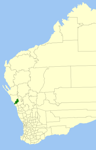
The Shire of Chapman Valley is a local government area located in the Mid West region of Western Australia, immediately northeast of the City of Geraldton and about 440 kilometres (273 mi) north of Perth, the state capital. The Shire covers an area of 3,965 square kilometres (1,531 sq mi) and its seat of government is the small town of Nabawa.
Tarcoola Beach is a southern coastal suburb of Geraldton, Western Australia, which falls under the jurisdiction of the local government area of the City of Greater Geraldton.
Beachlands is an inner western suburb of Geraldton, Western Australia in the local government area of the City of Greater Geraldton.
Beresford is a northern coastal suburb of Geraldton, Western Australia. Its local government area is the City of Greater Geraldton.
Bluff Point is a northern coastal suburb of Geraldton, Western Australia. Its local government area is the City of Greater Geraldton.
Strathalbyn is a northeastern suburb of Geraldton, Western Australia. Its local government area is the City of Greater Geraldton.
West End is a western suburb of Geraldton, Western Australia. Its local government area is the City of Greater Geraldton.
Karloo is a locality southeast of Geraldton, Western Australia. Its local government area is the City of Greater Geraldton.
Deepdale is a locality east of Geraldton, Western Australia. Its local government area is the City of Greater Geraldton.
Moresby is a locality northeast of Geraldton, Western Australia, on the north bank of the Chapman River. Its local government area is the City of Greater Geraldton.
Wandina is an outer southern suburb of Geraldton, Western Australia. Its local government area is the City of Greater Geraldton.
Woorree is an eastern suburb of Geraldton, Western Australia. Its local government area is the City of Greater Geraldton.
Mahomets Flats is an inner southern coastal suburb of Geraldton, Western Australia in the local government area of the City of Greater Geraldton.
Mount Tarcoola is a southern suburb of Geraldton, Western Australia. Its local government area is the City of Greater Geraldton.
Rangeway is an inner eastern suburb of Geraldton, Western Australia. Its local government area is the City of Greater Geraldton.
Spalding is a northeastern suburb of Geraldton, Western Australia. Its local government area is the City of Greater Geraldton.
Sunset Beach is an outer northern coastal suburb of Geraldton, Western Australia. Its local government area is the City of Greater Geraldton.
Waggrakine is an outer northern suburb of Geraldton, Western Australia in the local government area of the City of Greater Geraldton.
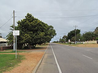
Nanson is a small town in the Mid West region of Western Australia, between the city of Geraldton and the town of Northampton. The town is situated on the banks of the Chapman River in the Chapman Valley. At the 2006 census, Nanson had a population of 386.

The City of Greater Geraldton is a local government area in the Mid West region of Western Australia, 424 kilometres (263 mi) north of the state capital, Perth on the Indian Ocean. It covers an area of 12,625.5 square kilometres (4,874.7 sq mi), and its seat of government is the town of Geraldton.

