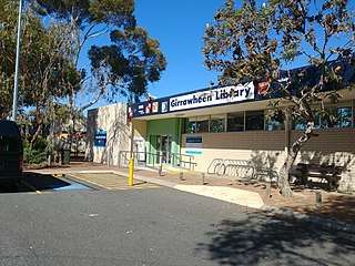
Girrawheen is a northern suburb of Perth, the capital city of Western Australia. Its local government area is the City of Wanneroo.
Tarcoola Beach is a southern coastal suburb of Geraldton, Western Australia. Its local government area is the City of Greater Geraldton.
Beresford is a northern coastal suburb of Geraldton, Western Australia. Its local government area is the City of Greater Geraldton.
Bluff Point is a northern coastal suburb of Geraldton, Western Australia. Its local government area is the City of Greater Geraldton.
Strathalbyn is a northeastern suburb of Geraldton, Western Australia. Its local government area is the City of Greater Geraldton.
Drummond Cove is a coastal town located 12 kilometres (7 mi) north of Geraldton, Western Australia in the local government area of the City of Greater Geraldton. The locality was gazetted in 1985.
Glenfield is a locality north of Geraldton, Western Australia. Its local government area is the City of Greater Geraldton.
West End is a western suburb of Geraldton, Western Australia. Its local government area is the City of Greater Geraldton.
Karloo is a locality southeast of Geraldton, Western Australia. Its local government area is the City of Greater Geraldton.
Wandina is an outer southern suburb of Geraldton, Western Australia. Its local government area is the City of Greater Geraldton.
Woorree is an eastern suburb of Geraldton, Western Australia. Its local government area is the City of Greater Geraldton.
Mahomets Flats is an inner southern coastal suburb of Geraldton, Western Australia in the local government area of the City of Greater Geraldton.
Mount Tarcoola is a southern suburb of Geraldton, Western Australia. Its local government area is the City of Greater Geraldton.
Rangeway is an inner eastern suburb of Geraldton, Western Australia. Its local government area is the City of Greater Geraldton.
Spalding is a northeastern suburb of Geraldton, Western Australia. Its local government area is the City of Greater Geraldton.
Sunset Beach is an outer northern coastal suburb of Geraldton, Western Australia. Its local government area is the City of Greater Geraldton.
Utakarra is an eastern suburb of Geraldton, Western Australia. Its local government area is the City of Greater Geraldton. Prior to 1 July 2007, it was the seat of government of the Shire of Greenough.
Castletown is a north-eastern suburb of Esperance, a town in south-eastern Western Australia. Its local government area is the Shire of Esperance.
Nulsen is a western suburb of Esperance, a town in south-eastern Western Australia. Its local government area is the Shire of Esperance.
West Beach is a suburb of Esperance, a town in south-eastern Western Australia south of Esperance's central business district, extending southwesterly for several kilometres along the southern coast. Its local government area is the Shire of Esperance.

