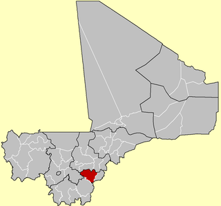
Bafoulabé Cercle is an administrative subdivision of the Kayes Region of Mali. The administrative center (chef-lieu) is the town of Bafoulabé. In the 2009 census the population of the cercle was 233,926.

Kita Cercle is an administrative subdivision of the Kayes Region of Mali. The administrative centre (chef-lieu) is the town of Kita. In the 2009 census the population of the cercle was 434,379.

Nara Cercle is an administrative subdivision of the Koulikoro Region of Mali. Its seat is the town of Nara.

Bougouni Cercle is an administrative subdivision of the Sikasso Region of Mali. The administrative center (chef-lieu) is the town of Bougouni.

Kolondiéba Cercle is an administrative subdivision of the Sikasso Region of Mali. The administrative center (chef-lieu) is the town of Kolondiéba.

Kadiolo Cercle is an administrative subdivision of the Sikasso Region of southern Mali. The administrative center (chef-lieu) is the town of Kadiolo.

Koutiala Cercle is an administrative subdivision of the Sikasso Region of southern Mali. The administrative center is the town of Koutiala. The Cercle is divided into 36 communes.

Sikasso Cercle is one of seven administrative subdivision of the Sikasso Region of southern Mali. The capital is the town of Sikasso.

Yanfolila Cercle is an administrative subdivision of the Sikasso Region of southern Mali. The administrative center (chef-lieu) is the town of Yanfolila.

Yorosso Cercle is an administrative subdivision of the Sikasso Region of southern Mali. The main town (chef-lieu) is Yorosso.

Barouéli Cercle is an administrative subdivision of the Ségou Region of Mali. The administrative center (chef-lieu) is the town of Barouéli.

San Cercle is an administrative subdivision of the Ségou Region of Mali. The administrative center (chef-lieu) is the town of San.

Mopti Cercle is an administrative subdivision of the Mopti Region of Mali. The administrative center (chef-lieu) is the town of Mopti.

Gourma-Rharous Cercle is an administrative subdivision of the Tombouctou Region of Mali. The administrative center is the town of Gourma-Rharous.

Niafunké Cercle is an administrative subdivision of the Tombouctou Region of Mali. The administrative center (chef-lieu) is the town of Niafunké. In the 2009 census the cercle had a population of 184,285. The Niger River runs for 100 km through the cercle.
Bladié-Tiémala is a rural commune and village in the Cercle of Bougouni in the Sikasso Region of southern Mali.
Nangalasso is a small town and commune in the Cercle of Kolondieba in the Sikasso Region of southern Mali. In 1998 the commune had a population of 7,887.
Yiridougou is a commune in the Cercle of Bougouni in the Sikasso Region of southern Mali. The principal town lies at Ouroumpana. In 1998 the commune had a population of 5,992.
M'Bouna is a village and commune of the Cercle of Goudam in the Tombouctou Region of Mali. As of 1998, the commune had a population of 6,070.
Tin Aicha is a village and commune of the Cercle of Goudam in the Tombouctou Region of Mali. As of 1998 the commune had a population of 3,940.


