National Register of Historic Places listings in Walker County, Georgia

Last updated

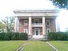
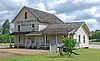
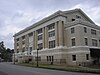
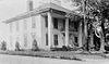
This is a list of properties and districts in Walker County, Georgia that are listed on the National Register of Historic Places (NRHP).

Map all coordinates using: OpenStreetMap  
Download coordinates as: KML


    This National Park Service list is complete through NPS recent listings posted March 4, 2022. [1]

Current listings

[2] Name on the RegisterImageDate listed [3] Location City or townDescription
1 Ashland Farm October 18, 1973
(#73000646)
SW of Rossville off GA 193
34°57′16″N85°20′46″W / 34.954444°N 85.346111°W / 34.954444; -85.346111 (Ashland Farm)
Rossville
2 Cavender's Store
Cavender's Store The Store.jpg
Cavender's Store
March 20, 1992
(#92000143)
Jct. of GA 201 and GA 136, SW corner
34°40′25″N85°06′54″W / 34.673611°N 85.115°W / 34.673611; -85.115 (Cavender's Store)
Villanow
3 Chattooga Academy
Chattooga Academy Chattooga Academy 3.jpg
Chattooga Academy
February 15, 1980
(#80001253)
306 N. Main St.
34°42′31″N85°16′51″W / 34.708611°N 85.280833°W / 34.708611; -85.280833 (Chattooga Academy)
LaFayette
4 Chickamauga and Chattanooga National Military Park
Chickamauga and Chattanooga National Military Park Chick chatta park.jpg
Chickamauga and Chattanooga National Military Park
October 15, 1966
(#66000274)
S of Chattanooga on U.S. 27
34°58′09″N85°17′07″W / 34.9692°N 85.2853°W / 34.9692; -85.2853 (Chickamauga and Chattanooga National Military Park)
Wildwood administered by the National Park Service
5 Chickamauga Coal and Iron Company Coke Ovens
Chickamauga Coal and Iron Company Coke Ovens Chickamauga CoalandIronCompanyCokeOvens1.jpg
Chickamauga Coal and Iron Company Coke Ovens
April 9, 2009
(#09000188)
Georgia State Route 341
34°52′53″N85°17′43″W / 34.8814°N 85.2953°W / 34.8814; -85.2953 (Chickamauga Coal and Iron Company Coke Ovens)
Chickamauga
6 Chickamauga Historic District
Chickamauga Historic District Downtown Chickamauga 002.jpg
Chickamauga Historic District
July 20, 2007
(#07000700)
Roughly centered on Cove Rd. and bounded by Crescent, Pearl, & 6th Sts. and the Central of Georgia RR
34°52′02″N85°17′39″W / 34.867351°N 85.294265°W / 34.867351; -85.294265 (Chickamauga Historic District)
Chickamauga
7 Chickamauga Lodge No. 221, Free and Accepted Masons, Prince Hall Affiliate
Chickamauga Lodge No. 221, Free and Accepted Masons, Prince Hall Affiliate ChickamaugaMasonicLodge.jpg
Chickamauga Lodge No. 221, Free and Accepted Masons, Prince Hall Affiliate
August 30, 2006
(#06000736)
1378 GA 341 S
34°51′24″N85°18′19″W / 34.8567°N 85.3053°W / 34.8567; -85.3053 (Chickamauga Lodge No. 221, Free and Accepted Masons, Prince Hall Affiliate)
Chickamauga
8 Gordon-Lee House
Gordon-Lee House Gordon-Lee Mansion Main.jpg
Gordon-Lee House
March 22, 1976
(#76000654)
217 Cove Rd.
34°52′19″N85°17′41″W / 34.87181°N 85.29479°W / 34.87181; -85.29479 (Gordon-Lee House)
Chickamauga Antebellum plantation house, included in Chickamauga Historic District
9 Lane House
Lane House Lane House.jpg
Lane House
December 12, 1976
(#76000655)
Weathers Dr., east of Kensington [4]
34°46′43″N85°20′24″W / 34.7786°N 85.34°W / 34.7786; -85.34 (Lane House)
Kensington
10 Lee and Gordon Mill
Lee and Gordon Mill LeeandGordonMill.jpg
Lee and Gordon Mill
February 8, 1980
(#80001252)
Red Belt Rd.
34°53′01″N85°16′01″W / 34.8836°N 85.2669°W / 34.8836; -85.2669 (Lee and Gordon Mill)
Chickamauga
11 Lookout Mountain Fairyland Club
Lookout Mountain Fairyland Club Fairyland Club 3.jpg
Lookout Mountain Fairyland Club
June 21, 1990
(#90000991)
1201 Fleetwood Dr.
34°58′31″N85°20′55″W / 34.9753°N 85.3486°W / 34.9753; -85.3486 (Lookout Mountain Fairyland Club)
Lookout Mountain
12 Marsh-Warthen House
Marsh-Warthen House Marsh-Warthen House, LaFayette (Walker County, Georgia).jpg
Marsh-Warthen House
January 12, 2005
(#04001467)
N. Main St.
34°42′33″N85°16′52″W / 34.7092°N 85.2811°W / 34.7092; -85.2811 (Marsh-Warthen House)
LaFayette
13 McLemore Cove Historic District
McLemore Cove Historic District McLemore Cove, looking towards Lookout Mountain, Oct 2016.jpg
McLemore Cove Historic District
September 23, 1994
(#94001140)
3 mi. S of Chickamauga, in an area roughly bounded by Lookout and Pigeon Mtns., and GA 136
34°44′22″N85°23′13″W / 34.739444°N 85.386944°W / 34.739444; -85.386944 (McLemore Cove Historic District)
Kensington
14 Miller Brothers Farm August 6, 1987
(#87001332)
GA 912
34°46′23″N85°22′32″W / 34.773056°N 85.375556°W / 34.773056; -85.375556 (Miller Brothers Farm)
Kensington
15 Rock City Gardens
Rock City Gardens Rock City, Chattanooga.jpg
Rock City Gardens
September 17, 2014
(#14000619)
1400 Patton Rd.
34°58′26″N85°20′55″W / 34.973889°N 85.348611°W / 34.973889; -85.348611 (Rock City Gardens)
Lookout Mountain
16 John Ross House
John Ross House JohnRossHouseRossvileGA.jpg
John Ross House
November 7, 1973
(#73000647)
Lake Ave. and Spring St.
34°58′52″N85°17′05″W / 34.98110°N 85.28478°W / 34.98110; -85.28478 (John Ross House)
Rossville
17 US Post Office-Rossville Main
US Post Office-Rossville Main RossvileGAPostOffice.jpg
US Post Office-Rossville Main
August 6, 1986
(#86002272)
301 Chickamauga Ave.
34°58′59″N85°17′11″W / 34.983056°N 85.286389°W / 34.983056; -85.286389 (US Post Office-Rossville Main)
Rossville
18 Walker County Courthouse
Walker County Courthouse Walker County Courthouse 2.jpg
Walker County Courthouse
September 18, 1980
(#80001254)
Duke St.
34°42′15″N85°16′50″W / 34.704167°N 85.280556°W / 34.704167; -85.280556 (Walker County Courthouse)
LaFayette

Related Research Articles

National Register of Historic Places listings in Essex County, Massachusetts

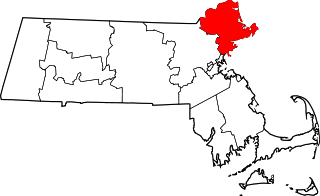
This list is of that portion of the National Register of Historic Places (NRHP) designated in Essex County, Massachusetts. The locations of these properties and districts for which the latitude and longitude coordinates are included below, may be seen in a map.

National Register of Historic Places listings in Hampshire County, Massachusetts

This is a list of properties on the National Register of Historic Places in Hampshire County, Massachusetts.

National Register of Historic Places listings in Worcester County, Massachusetts

This is a list of the National Register of Historic Places (NRHP) designated in Worcester County, Massachusetts. The locations of NRHP properties and districts for which the latitude and longitude coordinates are included below, may be seen in a map.

National Register of Historic Places listings in Cayuga County, New York

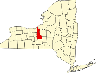
The following is a list of the National Register of Historic Places listings located in Cayuga County, New York:

National Register of Historic Places listings in Lewis County, New York

List of the National Register of Historic Places listings in Lewis County, New York

National Register of Historic Places listings in Ontario County, New York

List of the National Register of Historic Places listings in Ontario County, New York

National Register of Historic Places listings in Lycoming County, Pennsylvania

This is a list of the National Register of Historic Places listings in Lycoming County, Pennsylvania.

National Register of Historic Places listings in Dauphin County, Pennsylvania

This is a list of the National Register of Historic Places listings in Dauphin County, Pennsylvania.

National Register of Historic Places listings in Adams County, Pennsylvania

This is a list of the National Register of Historic Places listings in Adams County, Pennsylvania.

National Register of Historic Places listings in Bedford County, Pennsylvania

This is a list of the National Register of Historic Places listings in Bedford County, Pennsylvania.

National Register of Historic Places listings in Centre County, Pennsylvania

This is a list of the National Register of Historic Places listings in Centre County, Pennsylvania.

National Register of Historic Places listings in Clinton County, Pennsylvania

This is a list of the National Register of Historic Places listings in Clinton County, Pennsylvania.

National Register of Historic Places listings in Juniata County, Pennsylvania

This is a list of the National Register of Historic Places listings in Juniata County, Pennsylvania.

National Register of Historic Places listings in Pike County, Pennsylvania

This is a list of the National Register of Historic Places listings in Pike County, Pennsylvania.

National Register of Historic Places listings in King George County, Virginia

This is a list of the National Register of Historic Places listings in King George County, Virginia.

National Register of Historic Places listings in Northampton County, Virginia

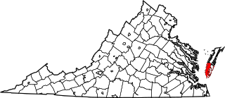
This is a list of the National Register of Historic Places listings in Northampton County, Virginia.

National Register of Historic Places listings in Spartanburg County, South Carolina

This is a list of the National Register of Historic Places listings in Spartanburg County, South Carolina.

National Register of Historic Places listings in Warren County, North Carolina

This list includes properties and districts listed on the National Register of Historic Places in Warren County, North Carolina. Click the "Map of all coordinates" link to the right to view a Google map of all properties and districts with latitude and longitude coordinates in the table below.

National Register of Historic Places listings in Bertie County, North Carolina

This list includes properties and districts listed on the National Register of Historic Places in Bertie County, North Carolina. Click the "Map of all coordinates" link to the right to view an online map of all properties and districts with latitude and longitude coordinates in the table below.

National Register of Historic Places listings in Jackson County, West Virginia

This is a list of the National Register of Historic Places listings in Jackson County, West Virginia.

References

  1. National Park Service, United States Department of the Interior, "National Register of Historic Places: Weekly List Actions", retrieved March 4, 2022.
  2. Numbers represent an alphabetical ordering by significant words. Various colorings, defined here, differentiate National Historic Landmarks and historic districts from other NRHP buildings, structures, sites or objects.
  3. The eight-digit number below each date is the number assigned to each location in the National Register Information System database, which can be viewed by clicking the number.
  4. Location derived from its coordinates; the NRIS provides coordinates but lists the property as "Address Restricted"