National Register of Historic Places listings in Clarke County, Georgia

Last updated

This is a list of properties and districts in Clarke County, Georgia that are listed on the National Register of Historic Places (NRHP).

Map all coordinates using: OpenStreetMap  
Download coordinates as: KML


    This National Park Service list is complete through NPS recent listings posted April 14, 2023. [1]

Current listings

[2] Name on the RegisterImageDate listed [3] Location City or townDescription
1 Athens Factory
Athens Factory Athens Factory, c. 1858, Wool Building, photographer facing SE.JPG
Athens Factory
July 31, 1980
(#80000989)
Baldwin and Williams Sts.
33°57′10″N83°22′10″W / 33.952778°N 83.369444°W / 33.952778; -83.369444 (Athens Factory)
Athens
2 Athens Manufacturing Company
Athens Manufacturing Company Athens Manufacturing Company, Main Mill, photographer facing NE.JPG
Athens Manufacturing Company
December 31, 2002
(#02001634)
585 While Circle
33°54′20″N83°21′28″W / 33.905556°N 83.357778°W / 33.905556; -83.357778 (Athens Manufacturing Company)
Athens
3 Athens Warehouse Historic District
Athens Warehouse Historic District Athens Warehouse District, Foundry St..JPG
Athens Warehouse Historic District
October 20, 1988
(#88002021)
Roughly bounded by Hancock and Thomas Sts., and the RR tracks
33°57′32″N83°22′17″W / 33.958889°N 83.371389°W / 33.958889; -83.371389 (Athens Warehouse Historic District)
Athens
4 Bishop House
Bishop House Bishop House, c. 1837, photographer facing NE2.jpg
Bishop House
March 16, 1972
(#72000375)
Jackson St., University of Georgia campus
33°57′21″N83°22′23″W / 33.955833°N 83.373056°W / 33.955833; -83.373056 (Bishop House)
Athens
5 Bloomfield Street Historic District
Bloomfield Street Historic District 100 Cloverhurst Terrace, c. 1950.JPG
Bloomfield Street Historic District
April 18, 1985
(#85000850)
Roughly bounded by Bloomfield and Peabody Sts., U of G campus, Rutherford St and Milledge Ave.
33°56′44″N83°23′06″W / 33.945556°N 83.385°W / 33.945556; -83.385 (Bloomfield Street Historic District)
Athens
6 Boulevard Historic District
Boulevard Historic District Homes on Boulevard, Athens.JPG
Boulevard Historic District
April 18, 1985
(#85000851)
Roughly bounded by the Seaboard Coastline RR tracks, Pulaski St., Prince Ave., and Hiawassee St.
33°57′54″N83°23′23″W / 33.965°N 83.389722°W / 33.965; -83.389722 (Boulevard Historic District)
Athens
7 Brightwell Shotgun Row
Brightwell Shotgun Row Brightwell Shotgun Homes, photographer facing NE.JPG
Brightwell Shotgun Row
June 14, 2001
(#01000642)
366-376 Barber St.
33°57′59″N83°23′08″W / 33.966389°N 83.385556°W / 33.966389; -83.385556 (Brightwell Shotgun Row)
Athens
8 Buena Vista Heights Historic District
Buena Vista Heights Historic District Yonah & Satula Ave's, photographer facing south.JPG
Buena Vista Heights Historic District
August 27, 1999
(#99001029)
Roughly bounded by Park Ave., Prince Ave., Pound St., and Nantahala Extension
33°57′58″N83°24′06″W / 33.966111°N 83.401667°W / 33.966111; -83.401667 (Buena Vista Heights Historic District)
Athens
9 Camak House
Camak House Camak House, 279 Meigs Street, Athens (Clarke County, Georgia).jpg
Camak House
July 7, 1975
(#75000576)
279 Meigs St.
33°57′34″N83°23′00″W / 33.95937°N 83.383324°W / 33.95937; -83.383324 (Camak House)
Athens
10 Carnegie Library Building
Carnegie Library Building GA Normal School Carnegie Library 11-12-2015.jpg
Carnegie Library Building
November 11, 1975
(#75000577)
1401 Prince Ave.
33°57′50″N83°24′16″W / 33.963889°N 83.404444°W / 33.963889; -83.404444 (Carnegie Library Building)
Athens
11 Albon Chase House
Albon Chase House Albon Chase House.jpg
Albon Chase House
August 19, 1974
(#74002255)
185 N. Hull St.
33°57′27″N83°22′45″W / 33.9575°N 83.379167°W / 33.9575; -83.379167 (Albon Chase House)
Athens
12 Chestnut Grove School
Chestnut Grove School Chestnut Grove School, photographer facing NW.JPG
Chestnut Grove School
June 28, 1984
(#84003873)
610 Epps Bridge Rd.
33°55′59″N83°26′18″W / 33.933056°N 83.438333°W / 33.933056; -83.438333 (Chestnut Grove School)
Athens
13 Chi Omega House
Chi Omega House Chi Omega House.jpg
Chi Omega House
July 11, 2019
(#100003491)
324 S. Milledge Ave.
33°57′09″N83°23′16″W / 33.95237°N 83.38791°W / 33.95237; -83.38791 (Chi Omega House)
Athens
14 Church-Waddel-Brumby House
Church-Waddel-Brumby House Church-Waddel-Brumby House.jpg
Church-Waddel-Brumby House
February 20, 1975
(#75000578)
280 E. Dougherty St.
33°57′43″N83°22′33″W / 33.961944°N 83.375833°W / 33.961944; -83.375833 (Church-Waddel-Brumby House)
Athens
15 Clarke County Jail
Clarke County Jail Clarke County Jail, Athens, GA, US.jpg
Clarke County Jail
May 29, 1980
(#80000990)
Courthouse Sq.
33°57′34″N83°23′06″W / 33.959444°N 83.385°W / 33.959444; -83.385 (Clarke County Jail)
Athens
16 T. R. R. Cobb House
T. R. R. Cobb House T. R. R. Cobb House, 194 Prince Avenue, Athens (Clarke County, Georgia).jpg
T. R. R. Cobb House
June 30, 1975
(#75000579)
194 Prince Ave.
33°57′40″N83°22′54″W / 33.961111°N 83.381667°W / 33.961111; -83.381667 (T. R. R. Cobb House)
Athens De-listed in 1985, but re-listed on July 23, 2013 [4]
17 Cobb-Treanor House
Cobb-Treanor House Cobb-Treanor House, photographer facing NW.JPG
Cobb-Treanor House
May 8, 1979
(#79000705)
1234 S. Lumpkin St.
33°56′42″N83°22′46″W / 33.945°N 83.379444°W / 33.945; -83.379444 (Cobb-Treanor House)
Athens
18 Cobbham Historic District
Cobbham Historic District L-R 465 and 475 Meigs St, c. 1922 & 1900, respectively.JPG
Cobbham Historic District
August 24, 1978
(#78000973)
Roughly bounded by Prince Ave., Hill, Reese, and Pope Sts.
33°57′32″N83°23′31″W / 33.958889°N 83.391944°W / 33.958889; -83.391944 (Cobbham Historic District)
Athens
19 Coca-Cola Bottling Plant-Athens
Coca-Cola Bottling Plant-Athens Coca-Cola Bottling Plant, photographer facing NE from N. Finley St..JPG
Coca-Cola Bottling Plant-Athens
February 1, 2006
(#05001594)
297 Prince Ave.
33°57′35″N83°23′00″W / 33.959722°N 83.383333°W / 33.959722; -83.383333 (Coca-Cola Bottling Plant-Athens)
Athens
20 Ross Crane House
Ross Crane House Ross Crane House, c. 1842, photographer facing SW.JPG
Ross Crane House
June 18, 1979
(#79000706)
247 Pulaski St.
33°57′30″N83°22′51″W / 33.958333°N 83.380833°W / 33.958333; -83.380833 (Ross Crane House)
Athens
21 Dearing Street Historic District
Dearing Street Historic District Meeker-Pope-Barrow House (Boxwood) 197 Dearing Street 1859.JPG
Dearing Street Historic District
September 5, 1975
(#75000580)
Roughly bounded by Broad and Baxter Sts., Milledge Ave., and includes both sides of Finley St. and Henderson Ave.
33°57′11″N83°23′07″W / 33.953056°N 83.385278°W / 33.953056; -83.385278 (Dearing Street Historic District)
Athens includes the Tree That Owns Itself
22 Albin P. Dearing House
Albin P. Dearing House Dearing House, Athens (Clarke County, Georgia).jpg
Albin P. Dearing House
May 8, 1979
(#79000707)
338 S. Milledge Ave.
33°57′07″N83°23′16″W / 33.95196°N 83.38785°W / 33.95196; -83.38785 (Albin P. Dearing House)
Athens Now Kappa Alpha Theata house
23 Downtown Athens Historic District
Downtown Athens Historic District Clarke County Courthouse, Athens, GA.jpg
Downtown Athens Historic District
August 10, 1978
(#78000974)
Roughly bounded by Hancock Ave., Foundry, Mitchell
33°57′30″N83°22′25″W / 33.958333°N 83.373611°W / 33.958333; -83.373611 (Downtown Athens Historic District)
Athens There was a boundary increase on May 31, 1984 (refnum 84000965), and a boundary increase and decrease on August 18, 2006 (refnum 06000737)
24 First African Methodist Episcopal Church
First African Methodist Episcopal Church First African Methodist Episcopal Church, photographer facing NE.JPG
First African Methodist Episcopal Church
March 10, 1980
(#80000991)
521 N. Hull St.
33°57′39″N83°22′46″W / 33.960833°N 83.379444°W / 33.960833; -83.379444 (First African Methodist Episcopal Church)
Athens
25 Franklin House
Franklin House Franklin House (Athens, Georgia) 1936 Historic American Buildings Survey.jpg
Franklin House
December 11, 1974
(#74000667)
464-480 E. Broad St.
33°57′28″N83°22′35″W / 33.957778°N 83.376389°W / 33.957778; -83.376389 (Franklin House)
Athens
26 Garden Club of Georgia Museum-Headquarters House, Founder's Memorial Garden
Garden Club of Georgia Museum-Headquarters House, Founder's Memorial Garden Garden Club of Georgia.JPG
Garden Club of Georgia Museum-Headquarters House, Founder's Memorial Garden
April 26, 1972
(#72000376)
Lumpkin St., University of Georgia campus
33°57′15″N83°22′33″W / 33.954167°N 83.375833°W / 33.954167; -83.375833 (Garden Club of Georgia Museum-Headquarters House, Founder's Memorial Garden)
Athens
27 Gospel Pilgrim Cemetery
Gospel Pilgrim Cemetery Gospel Pilgrim Cemetery, Morton Family Plot, photographer facing south.JPG
Gospel Pilgrim Cemetery
April 19, 2006
(#06000285)
530 Fourth St.
33°58′09″N83°21′41″W / 33.969167°N 83.361389°W / 33.969167; -83.361389 (Gospel Pilgrim Cemetery)
Athens
28 Henry W. Grady House
Henry W. Grady House General R. D. B. Taylor House, 634 Prince Avenue (Athens, Georgia).jpg
Henry W. Grady House
May 11, 1976
(#76000613)
634 Prince Ave.
33°57′42″N83°23′18″W / 33.96167°N 83.38827°W / 33.96167; -83.38827 (Henry W. Grady House)
Athens National Historic Landmark
29 Dr. James S. Hamilton House
Dr. James S. Hamilton House Dr. James S. Hamilton House, c.1861, photographer facing SW-A (2).JPG
Dr. James S. Hamilton House
April 24, 1979
(#79000708)
150 S. Milledge Ave.
33°57′16″N83°23′19″W / 33.954444°N 83.388611°W / 33.954444; -83.388611 (Dr. James S. Hamilton House)
Athens
30 Jackson Street Cemetery
Jackson Street Cemetery Jackson Street Cemetery, photographer facing NE.JPG
Jackson Street Cemetery
October 2, 2009
(#09000779)
S. Jackson St., University of Georgia campus
33°57′21″N83°22′25″W / 33.955833°N 83.373611°W / 33.955833; -83.373611 (Jackson Street Cemetery)
Athens
31 Lucy Cobb Institute Campus
Lucy Cobb Institute Campus Lucy Cobb Institute Athens, GA.jpg
Lucy Cobb Institute Campus
March 16, 1972
(#72000377)
200 N. Milledge Ave., University of Georgia campus
33°57′22″N83°23′23″W / 33.956111°N 83.389722°W / 33.956111; -83.389722 (Lucy Cobb Institute Campus)
Athens
32 Gov. Wilson Lumpkin House
Gov. Wilson Lumpkin House Governor Wilson Lumpkin House, c. 1842, photographer facing east.JPG
Gov. Wilson Lumpkin House
March 16, 1972
(#72000378)
Cedar St., University of Georgia campus
33°56′51″N83°22′26″W / 33.9475°N 83.373889°W / 33.9475; -83.373889 (Gov. Wilson Lumpkin House)
Athens
33 Joseph Henry Lumpkin House
Joseph Henry Lumpkin House Joseph Henry Lumpkin House, 248 Prince Street, Athens (Clarke County, Georgia).jpg
Joseph Henry Lumpkin House
June 27, 1975
(#75000581)
248 Prince Ave.
33°57′38″N83°22′57″W / 33.960556°N 83.3825°W / 33.960556; -83.3825 (Joseph Henry Lumpkin House)
Athens
34 Milledge Avenue Historic District
Milledge Avenue Historic District 600 Block of Milledge Avenue, photographer facing south.JPG
Milledge Avenue Historic District
April 18, 1985
(#85000852)
Milledge Ave. from Broad St. to Five Points
33°56′52″N83°23′16″W / 33.947778°N 83.387778°W / 33.947778; -83.387778 (Milledge Avenue Historic District)
Athens Boundary increase (listed September 24, 2009): 295 W. Rutherford St.
35 Milledge Circle Historic District
Milledge Circle Historic District 430 Milledge Circle, c. 1930, photographer facing NW (2).JPG
Milledge Circle Historic District
April 18, 1985
(#85000859)
Milledge Park, Lumpkin St., Milledge Circle and Milledge Ave.
33°56′15″N83°23′22″W / 33.9375°N 83.389444°W / 33.9375; -83.389444 (Milledge Circle Historic District)
Athens
36 Morton Building
Morton Building Morton theatre 035.jpg
Morton Building
October 22, 1979
(#79000709)
199 W. Washington St.
33°57′31″N83°22′43″W / 33.958611°N 83.378611°W / 33.958611; -83.378611 (Morton Building)
Athens
37 Newton House
Newton House Newton House.jpg
Newton House
July 11, 2002
(#02000759)
892 Prince Ave.
33°57′43″N83°23′34″W / 33.961944°N 83.392778°W / 33.961944; -83.392778 (Newton House)
Athens
38 Oconee Hill Cemetery
Oconee Hill Cemetery Oconee Hill Cemetery.jpg
Oconee Hill Cemetery
May 22, 2013
(#13000291)
297 Cemetery St.
33°57′04″N83°22′06″W / 33.951067°N 83.368335°W / 33.951067; -83.368335 (Oconee Hill Cemetery)
Athens
39 Oconee Street School December 31, 2018
(#100003284)
594 Oconee St.
33°57′09″N83°21′59″W / 33.952453°N 83.366365°W / 33.952453; -83.366365 (Oconee Street School)
Athens
40 Oglethorpe Avenue Historic District
Oglethorpe Avenue Historic District 327 and 347 Oglethorpe Ave, c. 1890 & 1930 respectively.JPG
Oglethorpe Avenue Historic District
November 5, 1987
(#87001360)
Oglethorpe Ave.
33°57′58″N83°24′15″W / 33.966111°N 83.404167°W / 33.966111; -83.404167 (Oglethorpe Avenue Historic District)
Athens
41 Old North Campus, University of Georgia
Old North Campus, University of Georgia Hunter-Holmes Bldg.jpg
Old North Campus, University of Georgia
March 16, 1972
(#72000379)
Bounded by Broad, Lumpkin, and Jackson Sts.
33°58′01″N83°22′30″W / 33.966944°N 83.375°W / 33.966944; -83.375 (Old North Campus, University of Georgia)
Athens
42 Hubert Bond Owens House
Hubert Bond Owens House Hubert Bond Owens House, c. 1941, photographer facing SW (2).JPG
Hubert Bond Owens House
May 14, 2008
(#08000442)
215 W. Rutherford St.
33°56′34″N83°23′10″W / 33.9427°N 83.386°W / 33.9427; -83.386 (Hubert Bond Owens House)
Athens
43 Calvin W. Parr House
Calvin W. Parr House Calvin W. Parr House, c. 1887, photographer facing east (2).JPG
Calvin W. Parr House
September 9, 1982
(#82002394)
227 Bloomfield St.
33°56′53″N83°23′09″W / 33.948056°N 83.385833°W / 33.948056; -83.385833 (Calvin W. Parr House)
Athens
44 Parrott Insurance Building
Parrott Insurance Building Downtown Athens, GA.jpg
Parrott Insurance Building
October 7, 1977
(#77000416)
283 E. Broad St.
33°57′28″N83°22′30″W / 33.957778°N 83.375°W / 33.957778; -83.375 (Parrott Insurance Building)
Athens
45 President's House
President's House President's House - UGA.jpg
President's House
March 16, 1972
(#72000380)
570 Prince Ave.
33°57′41″N83°23′11″W / 33.961389°N 83.386389°W / 33.961389; -83.386389 (President's House)
Athens
46 Reese Street Historic District
Reese Street Historic District Hill First Baptist Church.jpg
Reese Street Historic District
November 10, 1987
(#87001990)
Roughly bounded by Meigs, Finley, Broad, & Harris Sts.
33°57′26″N83°23′06″W / 33.957222°N 83.385°W / 33.957222; -83.385 (Reese Street Historic District)
Athens Includes the Hill First Baptist Church.
47 Rocksprings Shotgun Row Historic District
Rocksprings Shotgun Row Historic District 439 S Rockprings Street, c.1920, photographer facing NE (2).JPG
Rocksprings Shotgun Row Historic District
August 23, 1996
(#96000875)
433-447 Rocksprings St.
33°56′50″N83°23′29″W / 33.947222°N 83.391389°W / 33.947222; -83.391389 (Rocksprings Shotgun Row Historic District)
Athens
48 James A. Sledge House
James A. Sledge House James Sledge House, 749 Cobb Street, Athens (Clarke County, Georgia).jpg
James A. Sledge House
February 12, 1974
(#74000668)
749 Cobb St.
33°57′37″N83°23′49″W / 33.960278°N 83.396944°W / 33.960278; -83.396944 (James A. Sledge House)
Athens
49 R. P. Sorrells House
R. P. Sorrells House R.P. Sorrells House, photographer facing north.jpg
R. P. Sorrells House
January 22, 1992
(#91002003)
220 Prince Ave.
33°57′38″N83°22′56″W / 33.960556°N 83.382222°W / 33.960556; -83.382222 (R. P. Sorrells House)
Athens
50 Thomas-Carithers House
Thomas-Carithers House Thomas-Carithers House.jpg
Thomas-Carithers House
May 8, 1979
(#79000710)
530 S. Milledge Ave.
33°56′56″N83°23′16″W / 33.948889°N 83.387778°W / 33.948889; -83.387778 (Thomas-Carithers House)
Athens
51 Upson House
Upson House Upson House - Sun Trust.jpg
Upson House
November 15, 1973
(#73000616)
1022 Prince Ave.
33°57′14″N83°23′40″W / 33.953889°N 83.394444°W / 33.953889; -83.394444 (Upson House)
Athens
52 United States Post Office and Courthouse
United States Post Office and Courthouse Downtown Athens Post Office.JPG
United States Post Office and Courthouse
September 10, 2014
(#14000554)
115 E. Hancock St.
33°57′36″N83°22′38″W / 33.9599°N 83.3773°W / 33.9599; -83.3773 (United States Post Office and Courthouse)
Athens
53 Ware-Lyndon House
Ware-Lyndon House Ware-Lyndon House.JPG
Ware-Lyndon House
March 15, 1976
(#76000614)
293 Hoyt St.
33°57′50″N83°22′35″W / 33.963889°N 83.376389°W / 33.963889; -83.376389 (Ware-Lyndon House)
Athens
54 West Cloverhurst Avenue Historic District
West Cloverhurst Avenue Historic District 565 W. Cloverhurst Ave, c. 1952, photographer facing south.JPG
West Cloverhurst Avenue Historic District
September 27, 2007
(#07001000)
W. Cloverhurst Ave. vet. Springdale St. and S. Milledge Ave.
33°56′39″N83°23′30″W / 33.944261°N 83.391631°W / 33.944261; -83.391631 (West Cloverhurst Avenue Historic District)
Athens
55 West Hancock Avenue Historic District
West Hancock Avenue Historic District NW corner of Franklin & Meigs Sts, photographer facing north; house on left ca. 1920.jpg
West Hancock Avenue Historic District
March 30, 1988
(#88000227)
Roughly bounded by Hill, Franklin, Broad Sts. and the Plaza
33°57′20″N83°23′38″W / 33.955556°N 83.393889°W / 33.955556; -83.393889 (West Hancock Avenue Historic District)
Athens
56 White Hall
White Hall Whitehall, c. 1892, photographer facing SE (2).JPG
White Hall
June 18, 1979
(#79000711)
Whitehall and Simonton Bridge Rds.
33°53′48″N83°21′50″W / 33.896667°N 83.363889°W / 33.896667; -83.363889 (White Hall)
Whitehall
57 Wilkins House
Wilkins House Wilkins House-2.JPG
Wilkins House
May 19, 1970
(#70000202)
387 S. Milledge Ave.
33°57′04″N83°23′12″W / 33.951111°N 83.386667°W / 33.951111; -83.386667 (Wilkins House)
Athens
58 Winterville Historic District
Winterville Historic District Winterville Train depot.jpg
Winterville Historic District
October 11, 2001
(#01000742)
Roughly center on Main St. and on the abandoned Georgia RR line within the city limits of Winterville
33°58′03″N83°16′40″W / 33.9675°N 83.277778°W / 33.9675; -83.277778 (Winterville Historic District)
Winterville
59 Woodlawn Historic District
Woodlawn Historic District 240 Woodlawn Ave, c. 1918, photographer facing NW.JPG
Woodlawn Historic District
October 23, 1987
(#87001390)
Woodlawn Ave.
33°56′31″N83°22′53″W / 33.941944°N 83.381389°W / 33.941944; -83.381389 (Woodlawn Historic District)
Athens
60 Young Women's Christian Association Complex
Young Women's Christian Association Complex Old YWCA building, c. 1915, photographer facing SE.JPG
Young Women's Christian Association Complex
May 12, 1987
(#87000696)
345-347 W. Hancock St.
33°57′31″N83°22′51″W / 33.958611°N 83.380833°W / 33.958611; -83.380833 (Young Women's Christian Association Complex)
Athens

Related Research Articles

<span class="mw-page-title-main">National Register of Historic Places listings in Iowa</span>

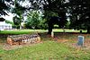
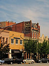
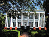
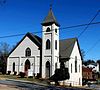
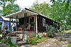
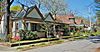
This is a list of properties and historic districts in Iowa that are listed on the National Register of Historic Places. There are listings in all of Iowa's 99 counties, adding up to over 2,300 total.

<span class="mw-page-title-main">National Register of Historic Places listings in Clarke County, Alabama</span>

This is a list of the National Register of Historic Places listings in Clarke County, Alabama.

<span class="mw-page-title-main">National Register of Historic Places listings in Fulton County, Georgia</span>

This is a list of properties and districts in Fulton County, Georgia that are listed on the National Register of Historic Places (NRHP). It covers most of the NRHP properties in Atlanta; other Atlanta listings are covered in National Register of Historic Places listings in DeKalb County, Georgia.

This is a list of properties and districts in DeKalb County, Georgia that are listed on the National Register of Historic Places (NRHP).

<span class="mw-page-title-main">National Register of Historic Places listings in Walton County, Georgia</span>

This is a list of properties and districts in Walton County, Georgia that are listed on the National Register of Historic Places (NRHP).

This is a list of properties and districts in Thomas County, Georgia that are listed on the National Register of Historic Places (NRHP).

<span class="mw-page-title-main">National Register of Historic Places listings in Muscogee County, Georgia</span>

This is a list of properties and districts in Muscogee County, Georgia that are listed on the National Register of Historic Places (NRHP).

<span class="mw-page-title-main">National Register of Historic Places listings in Baldwin County, Georgia</span>

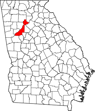
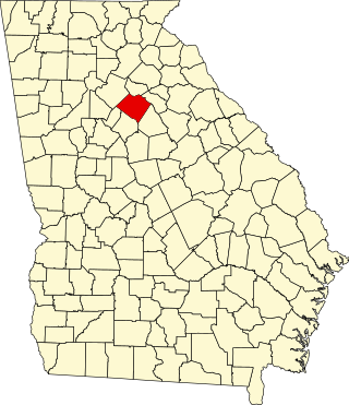
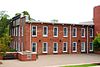
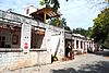
This is a list of properties and districts in Baldwin County, Georgia that are listed on the National Register of Historic Places (NRHP).

<span class="mw-page-title-main">National Register of Historic Places listings in Gwinnett County, Georgia</span>

This is a list of properties and districts in Gwinnett County, Georgia that are listed on the National Register of Historic Places (NRHP).

This is a list of properties and districts in Clayton County, Georgia that are listed on the National Register of Historic Places (NRHP).

<span class="mw-page-title-main">National Register of Historic Places listings in Hall County, Georgia</span>

This is a list of properties and districts in Hall County, Georgia that are listed on the National Register of Historic Places (NRHP).

This is a list of properties and districts in Cobb County, Georgia that are listed on the National Register of Historic Places (NRHP).

This is a list of properties and districts in Rockdale County, Georgia that are listed on the National Register of Historic Places (NRHP).

<span class="mw-page-title-main">National Register of Historic Places listings in Screven County, Georgia</span>

This is a list of properties and districts in Screven County, Georgia that are listed on the National Register of Historic Places (NRHP).

This is a list of properties and districts in Coweta County, Georgia that are listed on the National Register of Historic Places (NRHP).

This is a list of properties and districts in Camden County, Georgia that are listed on the National Register of Historic Places (NRHP).

This is a list of properties and districts in Newton County, Georgia that are listed on the National Register of Historic Places (NRHP).

<span class="mw-page-title-main">National Register of Historic Places listings in Pike County, Georgia</span>

This is a list of properties and districts in Pike County, Georgia that are listed on the National Register of Historic Places (NRHP).

This is a list of properties and districts in Haralson County, Georgia that are listed on the National Register of Historic Places (NRHP).

This is a list of properties and districts in Jenkins County, Georgia that are listed on the National Register of Historic Places (NRHP).

References

  1. National Park Service, United States Department of the Interior, "National Register of Historic Places: Weekly List Actions", retrieved April 14, 2023.
  2. Numbers represent an alphabetical ordering by significant words. Various colorings, defined here, differentiate National Historic Landmarks and historic districts from other NRHP buildings, structures, sites or objects.
  3. The eight-digit number below each date is the number assigned to each location in the National Register Information System database, which can be viewed by clicking the number.
  4. "Cobb, T. R. R., House". National Register of Historic Places Program. National Park Service . Retrieved August 26, 2013.