Noosaville, Queensland

Last updated

Map all coordinates using: OpenStreetMap  
Download coordinates as: KML  ·  GPX
Noosaville
Noosa,  Queensland
Noosa-river.jpg
A pelican on Noosa River, Noosaville
Australia Queensland location map.svg
Red pog.svg
Noosaville
Coordinates 26°23′53″S153°03′42″E / 26.3980°S 153.0616°E / -26.3980; 153.0616 (Noosaville (town centre)) Coordinates: 26°23′53″S153°03′42″E / 26.3980°S 153.0616°E / -26.3980; 153.0616 (Noosaville (town centre))
Population8,124 (2016 census) [1]
 • Density314.9/km2 (815.5/sq mi)
Postcode(s) 4566
Area25.8 km2 (10.0 sq mi)
Time zone AEST (UTC+10:00)
Location
LGA(s) Shire of Noosa
State electorate(s) Noosa
Federal Division(s) Wide Bay
Suburbs around Noosaville:
Tewantin Noosa North Shore Noosa Heads
Doonan Noosaville Castaways Beach
Weyba Downs Peregian Beach Marcus Beach

Noosaville is a town and suburb in Noosa in the Shire of Noosa, Queensland, Australia. [2] [3] In the 2016 census, Noosaville had a population of 8,124 people. [1]

Contents

Geography

Lake Weyba Lake Weyba (2099873732).jpg
Lake Weyba

Noosaville is bounded by the Noosa River to the north, Weyba Creek to the east, the shoreline of Lake Weyba (the lake being within the suburb). [4]

Lake Weyba is in the south-east of the suburb ( 26°26′21″S153°04′27″E / 26.4392°S 153.0742°E / -26.4392; 153.0742 (Lake Weyba) ) and is 9.77 square kilometres (3.77 sq mi). [4] Weyba is believed to mean place of stingrays or place of flying squirrels. [5] [6]

The land in the north of the locality near the river is predominantly residential including the Noosa Waters canal estate ( 26°24′19″S153°03′35″E / 26.4052°S 153.0597°E / -26.4052; 153.0597 (Noosa Waters canal estate) ).

The southern part of the suburb including Lake Webya is undeveloped, apart from Noosa Aerodrome ( 26°25′29″S153°04′04″E / 26.4246°S 153.0679°E / -26.4246; 153.0679 (Noosa Aerodrome) ), the only commercial airstrip in the Shire of Noosa. [7]

In the west of the suburb there is a mix of residential areas and industrial areas, [4] including the Noosa Civic ( 26°24′55″S153°02′57″E / 26.4152°S 153.0492°E / -26.4152; 153.0492 (Noosa Civic) ), a major shopping centre which serves the Noosa community. [8]

History

Noosa Waters, Noosaville. Noosa-waters.jpg
Noosa Waters, Noosaville.

The name Noosa comes from the headland Noosa Head, which is a corruption of a Kabi word nuthuru meaning ghost or shadow. [2]

Noosa Waters canal estate was developed by the Hooker Corporation in the 1980s. [9]

In December 1950 St James' Anglican Church Hall was dedicated by the Reverend Ernest Read Chittenden, the Rural Dean of Wide Bay. [10] It closed circa 1986. [11]

Good Shepherd Lutheran College opened on 28 January 1986. [12]

The Noosaville Public Library building opened in 1993. [13]

Noosaville State School opened on 29 January 1996. [12]

St Teresa's Catholic College opened on 26 January 2004. [12]

Although historically and currently within the Shire of Noosa, between 2008 and 2013 the Shire of Noosa was abolished and Noosaville was within Sunshine Coast Region. [14]

In the 2016 census, Noosaville had a population of 8,124 people. [1]

Heritage listings

Noosa River Caravan Park, 2007 Noosa River Caravan Park (2007).jpg
Noosa River Caravan Park, 2007

Noosaville has a number of heritage-listed sites, including:

Amenities

The Noosa Shire Council has a library located at 7 Wallace Drive, Wallace Park ( 26°24′04″S153°03′00″E / 26.4012°S 153.0501°E / -26.4012; 153.0501 (Noosaville Library) ). [16] [17]

Education

Noosaville State School is a government primary (Early Childhood-6) school for boys and girls at 75 Beckmans Road ( 26°24′34″S153°01′45″E / 26.4095°S 153.0291°E / -26.4095; 153.0291 (Noosaville State School) ). [18] [19] In 2017, the school had an enrolment of 487 students with 41 teachers (33 full-time equivalent) and 23 non-teaching staff (17 full-time equivalent). [20] It includes a special education program. [18] [21]

Good Shepherd Lutheran College is a private primary and secondary (Prep-12) school for boys and girls at 115 Eumundi Road ( 26°24′31″S153°02′57″E / 26.4085°S 153.0493°E / -26.4085; 153.0493 (Good Shepherd Lutheran College) ). [18] [22] In 2017, the school had an enrolment of 1,006 students with 68 teachers (63 full-time equivalent) and 76 non-teaching staff (51 full-time equivalent). [20]

St Teresa's Catholic College is a Catholic secondary (7-12) school for boys and girls at Sea Eagle Drive ( 26°24′23″S153°01′56″E / 26.4064°S 153.0323°E / -26.4064; 153.0323 (St Teresa's Catholic College) ). [18] [23] In 2017, the school had an enrolment of 877 students with 67 teachers (64 full-time equivalent) and 38 non-teaching staff (30 full-time equivalent). [20]

There is no government secondary school in Noosaville. The nearest government secondary school is Sunshine Beach State High School in Sunshine Beach. [4]

Attractions

Noosa Ferry on Noosa River approaching Noosaville, 2019 Noosa Ferry on Noosa River approching Noosaville, Queensland 01.jpg
Noosa Ferry on Noosa River approaching Noosaville, 2019

A ferry service operates along the Noosa River from Noosa Heads via Noosaville to Tewantin with timetabled regular services and tourist cruises. [24]

Related Research Articles

Noosa Heads, Queensland Town in Queensland, Australia

Noosa Heads is a coastal town and suburb of the Shire of Noosa on the Sunshine Coast, Queensland, Australia. It is located approximately 136 kilometres (85 mi) north of Brisbane, the state's capital.

Cooroy, Queensland Town in Queensland, Australia

Cooroy is a town and a locality in the Shire of Noosa, Queensland, Australia, but between 2008 and 2013 it was in Sunshine Coast Region.

Tewantin Suburb of Noosa, Queensland, Australia

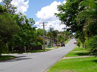
Tewantin is a rural town and locality in the Shire of Noosa, Queensland, Australia. In the 2016 census, Tewantin had a population of 10,920 people. Tewantin was the original settlement in the Noosa region and is one of its three major centres today.

Caboolture, Queensland Town in Queensland, Australia

Caboolture is a town and suburb in Moreton Bay Region, Queensland, Australia. In the 2016 census, the suburb of Caboolture had a population of 26,433 people. It is located on the north side of the Caboolture River, which separates the town from Morayfield and Caboolture South.

Victoria Point, Queensland Suburb of Redland City, Queensland, Australia

Victoria Point is a coastal locality in Redland City, Queensland, Australia. In the 2016 census, Victoria Point had a population of 15,020 people.

Boreen Point, Queensland Suburb of Noosa, Queensland, Australia

Boreen Point is a rural locality in the Shire of Noosa, Queensland, Australia. In the 2016 census, Boreen Point had a population of 328 people. The town of Boreen is located within the locality beside the lake, but the town name is rarely used with Boreen Point being the name in common usage.

Ashmore, Queensland Suburb of Gold Coast, Queensland, Australia

Ashmore is a suburb in the City of Gold Coast, Queensland, Australia. In the 2016 census, Ashmore had a population of 11,910 people.

Molendinar, Queensland Suburb of Gold Coast, Queensland, Australia

Molendinar is a mixed-use suburb in the City of Gold Coast, Queensland, Australia. In the 2016 census, Molendinar had a population of 6,375 people..

Deception Bay, Queensland Suburb of Moreton Bay, Queensland, Australia

Deception Bay is a coastal suburb in the Moreton Bay Region, Queensland, Australia. It is approximately 32 kilometres (20 mi) north of Brisbane CBD in the south-eastern corner of the bay of the same name which separates the Redcliffe Peninsula and Bribie Island.

Good Shepherd Lutheran College is a Prep to Year 12 campus that serves the families of the Noosa district. It is located in Noosaville.

Bray Park, Queensland Suburb of Moreton Bay, Queensland, Australia

Bray Park is a suburb of Moreton Bay Region, Queensland, Australia. It is a part of Brisbane metropolitan area. In the 2016 census, Bray Park had a population of 10,246 people.

Manly West, Queensland Suburb of Brisbane, Queensland, Australia

Manly West is a suburb in the City of Brisbane, Queensland, Australia. In the 2016 census, Manly West had a population of 11,978 people.

Mount Gravatt East, Queensland Suburb of Brisbane, Queensland, Australia

Mount Gravatt East is a southern suburb in the City of Brisbane, Queensland, Australia. In the 2016 census, Mount Gravatt East had a population of 11,838 people.

Sunshine Beach, Queensland Suburb of Noosa Heads, Queensland, Australia

Sunshine Beach is a coastal suburb in Noosa Heads in the Shire of Noosa, Queensland, Australia. At the 2016 census, the suburb recorded a population of 2,460.

Rothwell, Queensland Suburb of Moreton Bay Region, Queensland, Australia

Rothwell is a coastal suburb in the Moreton Bay Region, Queensland, Australia. In the 2016 census, Rothwell had a population of 7,165 people.

Pimpama, Queensland Suburb of Gold Coast, Queensland, Australia

Pimpama is a northern suburb in the City of Gold Coast, Queensland, Australia. In the 2016 census, Pimpama had a population of 9,396 people.

Noosa River river in South East Queensland, Australia

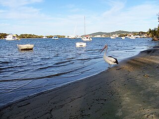
The Noosa River is a river situated in South East Queensland. The catchment starts in Wahpoonga Range near Mount Elliot in the coastal Great Sandy National Park and meanders south through a lakes district around Tewantin.

Tallebudgera, Queensland Suburb of Gold Coast, Queensland, Australia

Tallebudgera is a suburb in the City of Gold Coast, Queensland, Australia. In the 2016 census, Tallebudgera had a population of 3,667 people.

Harristown, Queensland Suburb of Toowoomba, Queensland, Australia

Harristown is a residential locality in Toowoomba in the Toowoomba Region, Queensland, Australia. In the 2016 census, Harristown had a population of 8,555 people.

Urraween, Queensland Suburb of Hervey Bay, Queensland, Australia

Urraween is a suburb of Hervey Bay in the Fraser Coast Region, Queensland, Australia. In the 2016 census, Urraween had a population of 6,969 people.

References

  1. 1 2 3 Australian Bureau of Statistics (27 June 2017). "Noosaville (SSC)". 2016 Census QuickStats. Retrieved 20 October 2018. OOjs UI icon edit-ltr-progressive.svg
  2. 1 2 "Noosaville - town in Shire of Noosa (entry 24505)". Queensland Place Names. Queensland Government . Retrieved 27 January 2020.
  3. "Noosaville - suburb in Shire of Noosa (entry 48810)". Queensland Place Names. Queensland Government . Retrieved 27 January 2020.
  4. 1 2 3 4 "Queensland Globe". State of Queensland . Retrieved 14 April 2020.
  5. "Noosa Community Guide 2005 Part D" (PDF). Archived from the original (PDF) on 24 July 2008. Retrieved 19 December 2006.
  6. "South East Queensland - Place Names". Archived from the original on 22 August 2006. Retrieved 19 December 2006.
  7. "Noosa Shire Planning Scheme". Noosa Shire Council . 11 December 2019. Archived from the original on 14 April 2020. Retrieved 14 April 2020.
  8. "Home". Noosa Civic. Archived from the original on 14 April 2020. Retrieved 14 April 2020.
  9. Edwards, D E (September 1998). Conflict and Controversy:The Changing Development Pattern of The Noosa Shire 1910-1980 (PDF). Retrieved 7 December 2017.
  10. "TEWANTIN". Nambour Chronicle And North Coast Advertiser (2426). Queensland, Australia. 15 December 1950. p. 3. Retrieved 27 July 2020 via National Library of Australia.
  11. Anglican Church of Southern Queensland. "Closed Churches". Archived from the original on 3 April 2019. Retrieved 3 July 2020.
  12. 1 2 3 Queensland Family History Society (2010), Queensland schools past and present (Version 1.01 ed.), Queensland Family History Society, ISBN   978-1-921171-26-0
  13. "Queensland Public Libraries Statistical Bulletin 2016-2017" (PDF). Public Libraries Connect. November 2017. Archived (PDF) from the original on 30 January 2018. Retrieved 29 January 2018.
  14. "About Noosa". Noosa Shire Council . Archived from the original on 29 February 2020. Retrieved 27 February 2020.
  15. "Noosa River Caravan Park (entry 602706)". Queensland Heritage Register . Queensland Heritage Council. Retrieved 14 July 2013.
  16. "Noosa Libraries". Noosa Council. Archived from the original on 7 June 2017. Retrieved 19 January 2018.
  17. "Noosaville Library". State Library of Queensland . Archived from the original on 21 March 2019. Retrieved 29 January 2018.
  18. 1 2 3 4 "State and non-state school details". Queensland Government. 9 July 2018. Archived from the original on 21 November 2018. Retrieved 21 November 2018.
  19. "Noosaville State School". Archived from the original on 21 April 2013. Retrieved 21 November 2018.
  20. 1 2 3 "ACARA School Profile 2017". Archived from the original on 22 November 2018. Retrieved 22 November 2018.
  21. "Noosaville SS - Special Education Program". Archived from the original on 21 April 2013. Retrieved 21 November 2018.
  22. "Good Shepherd Lutheran College". Archived from the original on 24 January 2019. Retrieved 21 November 2018.
  23. "St Teresa's Catholic College". Archived from the original on 27 December 2012. Retrieved 21 November 2018.
  24. "Ferry". Noosa Marina. Archived from the original on 16 March 2020. Retrieved 14 April 2020.