Weyba Downs, Queensland

Last updated

Weyba Downs
Queensland
Australia Queensland location map.svg
Red pog.svg
Weyba Downs
Coordinates 26°26′55″S153°02′45″E / 26.4486°S 153.0458°E / -26.4486; 153.0458 (Weyba Downs (centre of locality))
Population352 (SAL 2021) [1]
Postcode(s) 4562
Area6.1 km2 (2.4 sq mi)
Time zone AEST (UTC+10:00)
Location
LGA(s) Sunshine Coast Region
State electorate(s) Ninderry
Federal division(s) Wide Bay
Suburbs around Weyba Downs:
Doonan Noosaville Noosaville
Doonan Weyba Downs Noosaville
Doonan Peregian Beach Peregian Beach

Weyba Downs is a rural locality in the Sunshine Coast Region, Queensland, Australia. [2] In the 2021 census, Weyba Downs had a population of 352 people. [3]

Contents

Geography

Weyba Downs is on the Sunshine Coast. The locality is bounded to the north-west by Eumarella Road, to the west and south-west by Emu Mountain Arterial Road, and to the north-east by Lake Weyba, a tidal lake that flows into Noosa River and is within the locality of Noosaville. [4] [5]

Most of the south and west of the locality are one section of the Noosa National Park. Apart from the protected area, the land use in the north-east is rural residential housing and some grazing on native vegetation. [6]

History

Weyba is believed to mean "place of stingrays" in the local aboriginal language. [2] Alternatively, it might mean or "place of flying squirrels".[ citation needed ]

Weyba Downs now covers the area previously known as Peregian Beach South.[ citation needed ]

Demographics

In the 2016 census, Weyba Downs had a population of 296 people. [7]

In the 2021 census, Weyba Downs had a population of 352 people. [3]

Education

There are no schools in Weyba Downs. The nearest government primary school is Noosaville State School in neighbouring Noosaville to the north. The nearest government secondary school is Coolum State High School in Coolum Beach to the south-east. [8]

Attractions

The Lake Weyba Foreshore Walk commences at the northern end of Lake Weyba Drive and follows the lake shore south to neighbouring Peregian Beach. The walk is suitable for pedestrians and horses. To traverse the full walk, somesome wading across creeks may be required. [9]

Related Research Articles

<span class="mw-page-title-main">Noosa National Park</span> Protected area in Queensland, Australia

Noosa National Park is a national park in Queensland, Australia, 121 km north of Brisbane. It is situated near Noosa Heads between the Pacific Ocean and the Sunshine Coast's northern area of urban development and extends southwards, past Lake Weyba to Coolum.

<span class="mw-page-title-main">Peregian Beach</span> Town in Queensland, Australia

Peregian Beach is a beach and small coastal town on the Sunshine Coast, Queensland, Australia. It is a suburb split between two local government areas with the eastern coastal in the Shire of Noosa and the western hinterland part in the Sunshine Coast Region. In the 2021 census, the suburb of Peregian Beach had a population of 4,972 people.

<span class="mw-page-title-main">Tewantin</span> Suburb of Shire of Noosa, Queensland, Australia

Tewantin is a town and locality in the Shire of Noosa, Queensland, Australia. Tewantin was the original settlement in the Noosa region and is one of its three major centres today. In the 2021 census, the locality of Tewantin had a population of 11,164 people.

<span class="mw-page-title-main">Coolum Beach, Queensland</span> Suburb of Sunshine Coast, Queensland, Australia

Coolum Beach is a beachside town and coastal suburb in the Sunshine Coast Region, Queensland, Australia.In the 2021 census, the suburb of Coolum Beach had a population of 9,152 people.

<span class="mw-page-title-main">Noosaville</span> Suburb of Noosa, Queensland, Australia

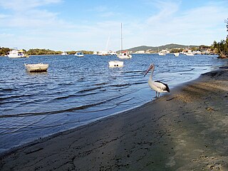
Noosaville is a town and suburb in Noosa in the Shire of Noosa, Queensland, Australia. In the 2016 census, Noosaville had a population of 8,124 people.

Sunrise Beach is a coastal suburb in the Shire of Noosa, Queensland, Australia. In the 2016 census, Sunrise Beach had a population of 3,415 people.

<span class="mw-page-title-main">Castaways Beach, Queensland</span> Suburb of Noosa, Queensland, Australia

Castaways Beach is a coastal suburb in the Shire of Noosa, Queensland, Australia. In the 2016 census, Castaways Beach had a population of 656 people.

Doonan is a rural residential locality split between the Sunshine Coast Region and the Shire of Noosa, both in Queensland, Australia. In the 2016 census, Doonan had a population of 3,459 people.

Marcus Beach is a coastal suburb in the Shire of Noosa, Queensland, Australia. In the 2016 census, Marcus Beach had a population of 757 people.

<span class="mw-page-title-main">Cooroibah, Queensland</span> Suburb of Noosa, Queensland, Australia

Cooroibah is a locality in the Shire of Noosa, Queensland, Australia. In the 2021 census, Cooroibah had a population of 2,178 people.

<span class="mw-page-title-main">Tinbeerwah, Queensland</span> Suburb of Shire of Noosa, Queensland, Australia

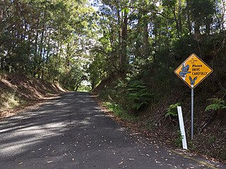
Tinbeerwah is a semi-rural locality in the Shire of Noosa, Queensland, Australia. In the 2021 census, Tinbeerwah had a population of 1,160 people.

Verrierdale is a rural locality in the Sunshine Coast Region, Queensland, Australia. In the 2021 census, Verrierdale had a population of 809 people.

<span class="mw-page-title-main">Peregian Springs, Queensland</span> Suburb of Sunshine Coast, Queensland, Australia

Peregian Springs is a suburb in the Sunshine Coast Region, Queensland, Australia. In the 2016 census, Peregian Springs had a population of 7,065 people.

<span class="mw-page-title-main">Mount Coolum, Queensland</span> Suburb of Sunshine Coast, Queensland, Australia

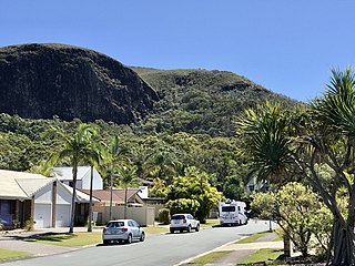
Mount Coolum is a coastal suburb in the Sunshine Coast Region, Queensland, Australia. In the 2016 census, Mount Coolum had a population of 4,265 people.

<span class="mw-page-title-main">Yaroomba, Queensland</span> Suburb of Sunshine Coast, Queensland, Australia

Yaroomba is a coastal suburb in the Sunshine Coast Region, Queensland, Australia. In the 2016 census, Yaroomba had a population of 1,623 people.

Valdora is a rural locality in the Sunshine Coast Region, Queensland, Australia. In the 2021 census, Valdora had a population of 776 people.

<span class="mw-page-title-main">Sunshine Coast Region</span> Local government area in Queensland, Australia

The Sunshine Coast Region is a local government area located in the Sunshine Coast region of South East Queensland, Australia.

Ninderry is an electoral district of the Legislative Assembly in the Australian state of Queensland. It was created in the 2017 redistribution.

Eumundi–Noosa Road is a continuous 15.8-kilometre (9.8 mi) road route in the Sunshine Coast and Noosa local government areas of Queensland, Australia. It is signed as State Route 12 for most of its length. For a short distance in Noosaville it is part of State Route 6. It is a state-controlled regional road for most of its length. Part of it is rated as a local road of regional significance (LRRS).

References

  1. Australian Bureau of Statistics (28 June 2022). "Weyba Downs (suburb and locality)". Australian Census 2021 QuickStats. Retrieved 28 June 2022.  OOjs UI icon edit-ltr-progressive.svg
  2. 1 2 "Weyba Downs – locality in Sunshine Coast Region (entry 48931)". Queensland Place Names. Queensland Government . Retrieved 17 November 2019.
  3. 1 2 Australian Bureau of Statistics (28 June 2022). "Weyba Downs (SAL)". 2021 Census QuickStats. Retrieved 28 February 2023. OOjs UI icon edit-ltr-progressive.svg
  4. "Layers: Locality; Mountains and ranges; Contours; Watercourses". Queensland Globe. Queensland Government. Archived from the original on 19 December 2017. Retrieved 13 March 2024.
  5. "Layers: Locality; Road and rail". Queensland Globe. Queensland Government. Archived from the original on 19 December 2017. Retrieved 13 March 2024.
  6. "Layers: Locality; Protected areas and forests; Land use; Land parcel". Queensland Globe. Queensland Government. Archived from the original on 19 December 2017. Retrieved 13 March 2024.
  7. Australian Bureau of Statistics (27 June 2017). "Weyba Downs (SSC)". 2016 Census QuickStats. Retrieved 20 October 2018. OOjs UI icon edit-ltr-progressive.svg
  8. "Layers: Locality; Schools and school catchments". Queensland Globe. Queensland Government. Archived from the original on 19 December 2017. Retrieved 13 March 2024.
  9. "Lake Weyba: Foreshore Walk". Adventure Sunshine Coast. Archived from the original on 27 October 2023. Retrieved 13 March 2024.