
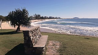
Mooloolaba is a coastal suburb of Maroochydore in the Sunshine Coast Region, Queensland, Australia. It is located 97 kilometres (60 mi) north of the state capital, Brisbane, and is part of the Maroochydore urban centre.

Nambour is a rural town and locality in the Sunshine Coast Region, Queensland, Australia. In the 2021 census, the locality of Nambour had a population of 12,145 people.
Buderim is a town in the Sunshine Coast Region, Queensland, Australia. It sits on a 180-metre (590 ft) mountain which overlooks the southern Sunshine Coast communities.

Maroochydore is a coastal town in the Sunshine Coast Region, Queensland, Australia. In the 2021 census, the urban area of Maroochydore had a population of 63,673 people.

Mudjimba is a coastal suburb in the Sunshine Coast Region, Queensland, Australia, and forms part of the Maroochydore urban centre. In the 2021 census, Mudjimba had a population of 2,664 people.

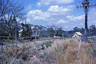
Landsborough is a town and a locality in the Sunshine Coast Region, Queensland, Australia. In the 2021 census, the locality of Landsborough had a population of 4,446 people.
Alexandra Headland is a coastal suburb of Maroochydore in the Sunshine Coast Region, Queensland, Australia. In the 2021 census, Alexandra Headland had a population of 4,235 people.

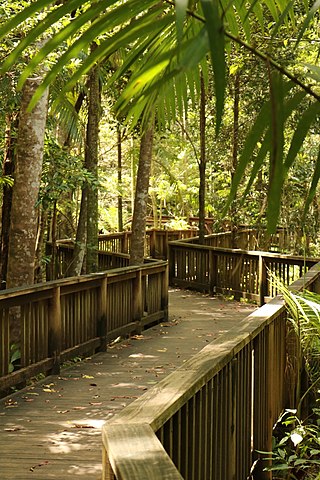
Forest Glen is a rural residential locality in the Sunshine Coast Region, Queensland, Australia. In the 2021 census, Forest Glen had a population of 1,657 people.

Marcoola is a coastal town and mixed-use locality in the Sunshine Coast Region, Queensland, Australia. The Sunshine Coast Airport is within the locality. In the 2021 census, the locality of Marcoola had a population of 3,355 people.
Diddillibah is a semi-rural locality in the Sunshine Coast Region, Queensland, Australia. In the 2021 census, Diddillibah had a population of 1,703 people.
Pacific Paradise is a suburb of Maroochydore in the Sunshine Coast Region, Queensland, Australia. In the 2021 census, Pacific Paradise had a population of 2,675 people.

Twin Waters is a coastal suburb of Maroochydore in the Sunshine Coast Region, Queensland, Australia. In the 2021 census, Twin Waters had a population of 2,966 people.
Kunda Park is an industrial suburb of Buderim in the Sunshine Coast Region, Queensland, Australia. In the 2021 census, Kunda Park had a population of 22 people.
Kuluin is a suburb of Maroochydore in the Sunshine Coast Region, Queensland, Australia. In the 2021 census, Kuluin had a population of 2,700 people.
Yandina Creek is a rural locality in the Sunshine Coast Region, Queensland, Australia. In the 2021 census, Yandina Creek had a population of 872 people.

Maroochy River is a rural hinterland locality in the Sunshine Coast Region, Queensland, Australia. In the 2021 census, Maroochy River had a population of 1,667 people.
Rosemount is a rural locality in the Sunshine Coast Region, Queensland, Australia. In the 2021 census, Rosemount had a population of 1,851 people.

Maroochydore is a coastal suburb of the Sunshine Coast, Queensland, Australia, and is the central suburb and central business district of the Maroochydore urban centre. In the 2021 census, the suburb of Maroochydore had a population of 20,629 people.

Buderim is the central suburb of the town of Buderim in the Sunshine Coast Region, Queensland, Australia. In the 2021 census, the suburb of Buderim had a population of 31,430 people.

Kiamba is a rural locality in the Sunshine Coast Region, Queensland, Australia. In the 2021 census, Kiamba had a population of 191 people.


