
Yandina is a rural town and locality in the Sunshine Coast Region, Queensland, Australia. In the 2021 census, the locality of Yandina had a population of 3,073 people.

Mooloolah Valley is a rural locality in the Sunshine Coast Region, Queensland, Australia. In the 2021 census, Mooloolah Valley had a population of 3,629 people.

Landsborough is a town and a locality in the Sunshine Coast Region, Queensland, Australia. In the 2021 census, the locality of Landsborough had a population of 4,446 people.

Inigo Owen Jones was a meteorologist and farmer in Queensland, Australia.

Beerwah is a rural town and locality in the hinterland of the Sunshine Coast Region, Queensland, Australia. At the 2021 census, the locality of Beerwah had a population of 7,734 people.
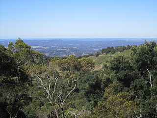
Montville is a rural town and locality in the Sunshine Coast Region, Queensland, Australia. In the 2021 census, the locality of Montville had a population of 1,092 people.

Woombye is a rural town and locality in the Sunshine Coast Region, Queensland, Australia. In the 2021 census, the locality of Woombye had a population of 3,944 people.
Doonan is a rural residential locality split between the Sunshine Coast Region and the Shire of Noosa, both in Queensland, Australia. In the 2021 census, Doonan had a population of 3,727 people.
Federal is a rural locality in the Shire of Noosa, Queensland, Australia. It is located in the Sunshine Coast hinterland near the towns of Cooran and Pomona. In the 2021 census, Federal had a population of 365 people.

Como is a rural locality in the Shire of Noosa, Queensland, Australia. In the 2021 census, Como had a population of 54 people.
Kiels Mountain is a rural locality in the Sunshine Coast Region, Queensland, Australia. In the 2021 census, Kiels Mountain had a population of 714 people.
Bellthorpe is a rural locality in the City of Moreton Bay, Queensland, Australia. In the 2021 census, Bellthorpe had a population of 108 people.
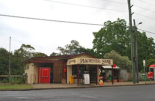
Peachester is a rural town and locality in the Sunshine Coast Region, Queensland, Australia. In the 2021 census, the locality of Peachester had a population of 1,460 people.
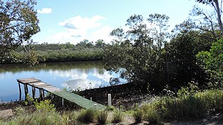
Coochin Creek is a coastal locality in the south of the Sunshine Coast Region, Queensland, Australia. The locality is named for the creek which flows through it.

Booroobin is a rural locality split between the City of Moreton Bay and the Sunshine Coast Region in Queensland, Australia. In the 2021 census, Booroobin had a population of 258 people.
Stanmore is a rural locality in the City of Moreton Bay, Queensland, Australia. In the 2021 census, Stanmore had a population of 454 people.
Bald Knob is a rural locality in the Sunshine Coast Region, Queensland, Australia. In the 2021 census, Bald Knob had a population of 280 people.
Flaxton is a rural locality in the Sunshine Coast Region, Queensland, Australia. In the 2021 census, Flaxton had a population of 992 people.

The Crohamhurst Observatory is a heritage-listed observatory at 131 Crohamhurst Road, Crohamhurst, Sunshine Coast Region, Queensland, Australia. It was built in 1935. It was added to the Queensland Heritage Register on 13 November 2008.

Gheerulla is a rural locality in the Sunshine Coast Region, Queensland, Australia. In the 2021 census, Gheerulla had a population of 291 people.


