Caloundra West, Queensland

Last updated

Caloundra West
Caloundra,  Queensland
Beech Starship N786BP (16026445165).jpg
Beech Starship at Caloundra Airport
Australia Queensland location map.svg
Red pog.svg
Caloundra West
Coordinates 26°48′22″S153°06′08″E / 26.8061°S 153.1022°E / -26.8061; 153.1022 (Caloundra West (centre of suburb))
Population6,297 (2016 census) [1]
 • Density759/km2 (1,965/sq mi)
Postcode(s) 4551
Area8.3 km2 (3.2 sq mi)
Time zone AEST (UTC+10:00)
Location
LGA(s) Sunshine Coast Region
County Canning
Parish Bribie
State electorate(s)
Federal division(s) Fisher
Suburbs around Caloundra West:
Little Mountain Aroona Caloundra
Baringa Caloundra West Golden Beach
Bells Creek Pelican Waters Pelican Waters

Caloundra West is a mixed-use suburb of Caloundra in the Sunshine Coast Region, Queensland, Australia. [2] In the 2016 census Caloundra West had a population of 6,297 people. [1]

Contents

Geography

Caloundra West is within the Caloundra urban centre directly west of the Caloundra central business district. [3]

The north of the suburb has some residential housing, an industrial estate, and undeveloped bushland. Caloundra Airport occupies the centre of the suburb. The west of the suburb is residential housing, while the south of the suburb is undeveloped marshland. [3]

Caloundra Road runs through from west to east. [4]

History

The suburb was named and bounded on 18 June 1988. The name Caloundra is from the Kabi language Cullowundoor with Kal Owen meaning beech tree (Gmelina Leichhardtii) and Dha meaning place. [2]

Unity College opened on 24 January 2006. [5]

In the 2016 census Caloundra West had a population of 6,297 people. [1]

Education

Unity College is a Catholic primary and secondary (Prep to Year 12) school for boys and girls at 47 Lomond Crescent, Bellvista Estate ( 26°48′10″S153°05′23″E / 26.8029°S 153.0897°E / -26.8029; 153.0897 (Unity College) ). [6] [7] In 2018, the school had an enrolment of 1,405 students with 111 teachers (100 full-time equivalent) and 62 non-teaching staff (50 full-time equivalent). [8]

There are no government schools in Caloundra West. The nearest government primary schools are Talara Primary College in Currimundi to the north, Meridan State College in Meridan Plains to the north-west, Golden Beach State School in neighbouring Golden Beach to south-east, and Baringa State Primary School in neighbouring Baringa to the west. The nearest secondary schools are Meridan State College in Meridan Plains to the north-west and Caloundra State High School in Caloundra to the north-east. [3]

Facilities

Caloundra Airport is on Pathfinder Drive ( 26°48′07″S153°06′20″E / 26.8020°S 153.1055°E / -26.8020; 153.1055 (Caloundra Airport) ). [9]

Caloundra Fire Station is at 18 Industrial Avenue ( 26°47′46″S153°07′07″E / 26.7960°S 153.1185°E / -26.7960; 153.1185 (Caloundra Fire Station) ). [10] [11]

Amenities

The Sunshine Coast Regional Council operates a mobile library service which visits Lomond Crescent in the Bellvista Estate. [12]

There are a number of parks in the suburb, including:

Kingsford Smith Cropmaster at Queensland Air Museum Kingsford Smith Cropmaster (6013787337).jpg
Kingsford Smith Cropmaster at Queensland Air Museum

Attractions

The Queensland Air Museum is at Caloundra Airport on Pathfinder Drive ( 26°47′52″S153°06′33″E / 26.7979°S 153.1093°E / -26.7979; 153.1093 (Queensland Air Museum) ). [14] [15]

Related Research Articles

<span class="mw-page-title-main">Burbank, Queensland</span> Suburb of Brisbane, Queensland, Australia

Burbank is a greenbelt suburb in the City of Brisbane, Queensland, Australia. In the 2016 census, Burbank had a population of 1,050 people.

<span class="mw-page-title-main">Beerwah, Queensland</span> Suburb of Sunshine Coast, Queensland, Australia

Beerwah is a rural town and locality in the hinterland of the Sunshine Coast Region, Queensland, Australia. At the 2021 census, the locality of Beerwah had a population of 7,734 people.

<span class="mw-page-title-main">Ransome, Queensland</span> Suburb of Brisbane, Queensland, Australia

Ransome is an outer coastal suburb in the City of Brisbane, Queensland, Australia. In the 2016 census, Ransome had a population of 405 people.

<span class="mw-page-title-main">Currimundi, Queensland</span> Suburb of Caloundra, Queensland, Australia

Currimundi is a coastal suburb of Caloundra in the Sunshine Coast Region, Queensland, Australia. In the 2016 census, Currimundi had a population of 6,786 people.

Mountain Creek is a suburb in the Sunshine Coast Region, Queensland, Australia. In the 2021 census, Mountain Creek had a population of 11,950 people.

<span class="mw-page-title-main">Shelly Beach, Queensland (Sunshine Coast)</span> Suburb of Caloundra, Queensland, Australia

Shelly Beach is a coastal suburb of Caloundra in the Sunshine Coast Region, Queensland, Australia. In the 2016 census, Shelly Beach had a population of 854 people.

Diddillibah is a semi-rural locality in the Sunshine Coast Region, Queensland, Australia. In the 2016 census, Diddillibah had a population of 1,403 people. In the 2021 census, Diddillibah had a population of 1,703 people.

Kuluin is a suburb of Maroochydore in the Sunshine Coast Region, Queensland, Australia. Kuluin had a population of 2,363 people in the 2016 census and 2,700 in the 2021 census.

<span class="mw-page-title-main">Yaroomba, Queensland</span> Suburb of Sunshine Coast, Queensland, Australia

Yaroomba is a coastal suburb in the Sunshine Coast Region, Queensland, Australia. In the 2016 census, Yaroomba had a population of 1,623 people.

<span class="mw-page-title-main">Maroochy River, Queensland</span> Suburb of Sunshine Coast Region, Queensland, Australia

Maroochy River is a rural hinterland locality in the Sunshine Coast Region, Queensland, Australia. In the 2016 census Maroochy River had a population of 1,531 people.

<span class="mw-page-title-main">Bushland Beach, Queensland</span> Suburb of Townsville, Queensland, Australia

Bushland Beach is a coastal suburb in the northern beaches area of Townsville in the City of Townsville, Queensland, Australia. In the 2016 census Bushland Beach had a population of 6,181 people.

Runaway Bay is a coastal suburb in the City of Gold Coast, Queensland, Australia. In the 2016 census, Runaway Bay had a population of 9,068 people.

Aroona is a suburb of Caloundra in the Sunshine Coast Region, Queensland, Australia. In the 2016 census, Aroona had a population of 3,287 people.

<span class="mw-page-title-main">Little Mountain, Queensland</span> Suburb of Sunshine Coast, Queensland, Australia

Little Mountain is a suburb of Caloundra in the Sunshine Coast Region, Queensland, Australia. In the 2016 census, Little Mountain had a population of 10,212 people.

Glenview is a rural locality in the Sunshine Coast Region, Queensland, Australia. In the 2016 census, Glenview had a population of 1,187 people.

Meridan Plains is a locality on the north-western edge of the Caloundra urban area in the Sunshine Coast Region, Queensland, Australia. Traditionally a rural area, the locality is attracting residential development from the expansion of Caloundra. In the 2021 census, Meridan Plains had a population of 4,589 people.

<span class="mw-page-title-main">Caloundra (suburb)</span> Suburb of Sunshine Coast, Queensland, Australia

Caloundra is a coastal suburb and the central business district of the town of Caloundra in the Sunshine Coast Region, Queensland, Australia. In the 2021 census, the suburb of Caloundra had a population of 3,932 people.

Battery Hill is a suburb of Caloundra in the Sunshine Coast Region, Queensland, Australia. In the 2016 census, Battery Hill had a population of 2,536 people.

<span class="mw-page-title-main">Nirimba, Queensland</span> Suburb of Sunshine Coast Region, Queensland, Australia

Nirimba is a new locality in the Sunshine Coast Region, Queensland, Australia. It was created in 2019.

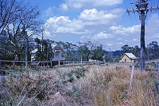
Caloundra Road is a continuous 9.3-kilometre (5.8 mi) road route in the Sunshine Coast local government area of Queensland, Australia. Most of it is designated as part of State Route 6. It is a state-controlled district road, part of which is rated as a local road of regional significance (LRRS).

References

  1. 1 2 3 Australian Bureau of Statistics (27 June 2017). "Caloundra West (SSC)". 2016 Census QuickStats. Retrieved 20 October 2018. OOjs UI icon edit-ltr-progressive.svg
  2. 1 2 "Caloundra West – suburb in Sunshine Coast Region (entry 49853)". Queensland Place Names. Queensland Government . Retrieved 29 December 2020.
  3. 1 2 3 "Queensland Globe". State of Queensland . Retrieved 18 April 2021.
  4. Google (3 November 2022). "Caloundra West" (Map). Google Maps . Google. Retrieved 3 November 2022.
  5. Queensland Family History Society (2010), Queensland schools past and present (Version 1.01 ed.), Queensland Family History Society, ISBN   978-1-921171-26-0
  6. "State and non-state school details". Queensland Government. 9 July 2018. Archived from the original on 21 November 2018. Retrieved 21 November 2018.
  7. "Unity College". Archived from the original on 18 April 2021. Retrieved 18 April 2021.
  8. "ACARA School Profile 2018". Australian Curriculum, Assessment and Reporting Authority. Archived from the original on 27 August 2020. Retrieved 28 January 2020.
  9. "Airports – Queensland". Queensland Open Data. Queensland Government. 22 October 2020. Archived from the original on 15 November 2020. Retrieved 3 November 2020.
  10. "Emergency services facilities – Queensland". Queensland Open Data. Queensland Government. 18 November 2020. Archived from the original on 24 November 2020. Retrieved 24 November 2020.
  11. "North Coast Region". Queensland Fire and Emergency Services . Archived from the original on 15 January 2021. Retrieved 18 April 2021.
  12. "Libraries: Mobile timetable". Sunshine Coast Regional Council . Archived from the original on 30 January 2018. Retrieved 30 January 2018.
  13. 1 2 3 4 5 6 7 8 9 10 11 12 13 14 15 16 17 18 19 20 21 22 23 24 "Land for public recreation – Queensland". Queensland Open Data. Queensland Government. 20 November 2020. Archived from the original on 22 November 2020. Retrieved 22 November 2020.
  14. "Building points – Queensland". Queensland Open Data. Queensland Government. 17 November 2020. Archived from the original on 25 November 2020. Retrieved 25 November 2020.
  15. "Queensland Air Museum". Archived from the original on 9 March 2021. Retrieved 18 April 2021.