Yaroomba, Queensland

Last updated

Yaroomba
Sunshine Coast,  Queensland
Double Rainbow over Coolum David Low Way, Yaroomba, Sunshine Coast, Qld, 2015.jpg
Double Rainbow over Coolum David Low Way, 2015
Australia Queensland location map.svg
Red pog.svg
Yaroomba
Coordinates 26°33′09″S153°05′34″E / 26.5525°S 153.0927°E / -26.5525; 153.0927 (Yaroomba (centre of suburb))
Population2,043 (2021 census) [1]
 • Density786/km2 (2,040/sq mi)
Established1953
Postcode(s) 4573
Elevation12 m (39 ft)
Area2.6 km2 (1.0 sq mi)
Time zone AEST (UTC+10:00)
Location
LGA(s) Sunshine Coast Region
State electorate(s)
Federal division(s) Fairfax
Suburbs around Yaroomba:
Coolum Beach Coolum Beach Point Arkwright
Coolum Beach Yaroomba Coral Sea
Mount Coolum Mount Coolum Coral Sea

Yaroomba is a coastal suburb in the Sunshine Coast Region, Queensland, Australia. [2] In the 2021 census, Yaroomba had a population of 2,043 people. [1]

Contents

Geography

The eastern boundary of the suburb is the Coral Sea, featuring a long strip of sand called Yaroomba Beach ( 26°33′27″S153°06′01″E / 26.5574°S 153.1002°E / -26.5574; 153.1002 (Yaroomba Beach) ). [3] [4]

The land rises from sea level in the east to approximately 40 metres (130 ft) in the west. The Palmer Coolum Resort and Golf Course occupies about half the suburb, 150 hectares (370 acres). The remainder is residential housing. [5]

The David Low Way traverses the suburb from north-east to south-east. [5]

History

The suburb began life as a housing estate named Coronation Beach in 1953 in honour of the coronation of Queen Elizabeth II. The name was changed to Yaroomba, a Kabi word which means "surf on the beach", in 1961. [6]

In 2007, a 200-kilogram (440 lb) piece of hardwood ribbing was found on the beach by Scott Patterson. It was uncovered due to a combination of high tides and rushing creek waters from recent heavy rain. It was part of the shipwrecked Kirkdale. The ship was built in Whitby, England, and was a twin-masted 251-tonne (277-ton) sailing ship about 30 metres (98 ft) long. It left Launceston in May 1862 bound for Colombo in Ceylon (now Sri Lanka) via the Torres Strait; however, after arriving at Cooktown, the captain turned and travelled south again and ran aground off Yaroomba Beach on 19 July 1862. The ship caught fire but the captain and crew members were able to launch a boat and survived. [7] [8] [9] [10] [11]

Demographics

In the 2016 census, Yaroomba had a population of 1,623 people. [12]

In the 2021 census, Yaroomba had a population of 2,043 people. [1]

Education

There are no schools in Yaroomba, but the suburb is in the catchment for Coolum State School and Coolum State High School in neighbouring Coolum Beach. [5]

The closest public library is in Coolum. [13]

Tourism

Yaroomba sits along a stretch of 1-km beach in closeness to Point Arkwright. An attraction of the suburb is the Yaroomba Bushland Park, a lush subtropical bushland forest nestled along its wooden boardwalk.

Amenities

There are a number of parks in the suburb:

Related Research Articles

<span class="mw-page-title-main">Mount Coolum National Park</span> Protected area in Queensland, Australia

Mount Coolum is a hill in Mount Coolum National Park in a suburb of the same name in Queensland, Australia. Mount Coolum is located on the Sunshine Coast, 101 km north of Brisbane. It lies between the Sunshine Motorway to the west, the shoreline to the east, Coolum Beach township to the north and Marcoola township to the south.

<span class="mw-page-title-main">Peregian Beach</span> Town in Queensland, Australia

Peregian Beach is a beach and small coastal town on the Sunshine Coast, Queensland, Australia. It is a suburb split between two local government areas with the eastern coastal in the Shire of Noosa and the western hinterland part in the Sunshine Coast Region. In the 2021 census, the suburb of Peregian Beach had a population of 4,972 people.

<span class="mw-page-title-main">Maroochydore</span> Town in Queensland, Australia

Maroochydore is a coastal town in the Sunshine Coast Region, Queensland, Australia. In the 2021 census, the urban area of Maroochydore had a population of 63,673 people.

<span class="mw-page-title-main">Mudjimba, Queensland</span> Suburb of Sunshine Coast, Queensland, Australia

Mudjimba is a coastal suburb in the Sunshine Coast Region, Queensland, Australia, and forms part of the Maroochydore urban centre. In the 2021 census, Mudjimba had a population of 2,664 people.

<span class="mw-page-title-main">Alexandra Headland, Queensland</span> Suburb of Maroochydore, Queensland, Australia

Alexandra Headland is a coastal suburb of Maroochydore in the Sunshine Coast Region, Queensland, Australia. In the 2021 census, Alexandra Headland had a population of 4,235 people.

<span class="mw-page-title-main">Coolum Beach, Queensland</span> Town in Queensland, Australia

Coolum Beach is a beachside town and coastal suburb in the Sunshine Coast Region, Queensland, Australia.In the 2021 census, the suburb of Coolum Beach had a population of 9,152 people.

<span class="mw-page-title-main">Sunshine Beach, Queensland</span> Town in Queensland, Australia

Sunshine Beach is a coastal town and suburb in the Shire of Noosa, Queensland, Australia. In the 2021 census, the suburb of Sunshine Beach had a population of 2,480 people.

Mountain Creek is a suburb in the Sunshine Coast Region, Queensland, Australia. In the 2021 census, Mountain Creek had a population of 11,950 people.
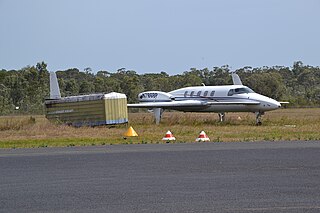
<span class="mw-page-title-main">Marcoola, Queensland</span> Town in Queensland, Australia

Marcoola is a coastal town and locality in the Sunshine Coast Region, Queensland, Australia. In the 2021 census, Marcoola had a population of 3,355 people.

<span class="mw-page-title-main">Diddillibah, Queensland</span> Suburb of Sunshine Coast Region, Queensland, Australia

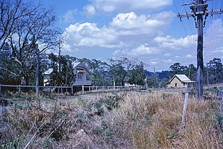
Diddillibah is a semi-rural locality in the Sunshine Coast Region, Queensland, Australia. In the 2021 census, Diddillibah had a population of 1,703 people.

<span class="mw-page-title-main">Mount Coolum, Queensland</span> Suburb of Sunshine Coast, Queensland, Australia

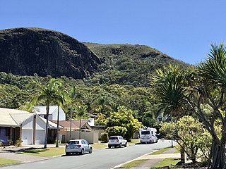
Mount Coolum is a coastal suburb in the Sunshine Coast Region, Queensland, Australia. In the 2021 census, Mount Coolum had a population of 4,545 people.

Kunda Park is an industrial suburb of Buderim in the Sunshine Coast Region, Queensland, Australia. In the 2021 census, Kunda Park had a population of 22 people.

Kuluin is a suburb of Maroochydore in the Sunshine Coast Region, Queensland, Australia. In the 2021 census, Kuluin had a population of 2,700 people.

<span class="mw-page-title-main">Point Arkwright, Queensland</span> Suburb of Sunshine Coast, Queensland, Australia

Point Arkwright is a coastal suburb in the Sunshine Coast Region, Queensland, Australia. In the 2021 census, Point Arkwright had a population of 309 people.

<span class="mw-page-title-main">Maroochy River, Queensland</span> Suburb of Sunshine Coast Region, Queensland, Australia

Maroochy River is a rural hinterland locality in the Sunshine Coast Region, Queensland, Australia. In the 2021 census, Maroochy River had a population of 1,667 people.

<span class="mw-page-title-main">Ninderry, Queensland</span> Town in Queensland, Australia

Ninderry is a rural town and locality in the Sunshine Coast Region, Queensland, Australia. In the 2021 census, the locality of Ninderry had a population of 1,301 people.

Kiels Mountain is a rural locality in the Sunshine Coast Region, Queensland, Australia. In the 2021 census, Kiels Mountain had a population of 714 people.

Aroona is a suburb of Caloundra in the Sunshine Coast Region, Queensland, Australia. In the 2021 census, Aroona had a population of 3,466 people.

<span class="mw-page-title-main">Caloundra West, Queensland</span> Suburb of Caloundra, Queensland, Australia

Caloundra West is a mixed-use suburb of Caloundra in the Sunshine Coast Region, Queensland, Australia. In the 2021 census, Caloundra West had a population of 7,270 people.

References

  1. 1 2 3 Australian Bureau of Statistics (28 June 2022). "Yaroomba (SAL)". 2021 Census QuickStats. Retrieved 28 February 2023. OOjs UI icon edit-ltr-progressive.svg
  2. "Yaroomba – suburb in Sunshine Coast Region (entry 48954)". Queensland Place Names. Queensland Government . Retrieved 7 March 2022.
  3. "Mountain ranges beaches and sea passages - Queensland". Queensland Open Data. Queensland Government. 12 November 2020. Archived from the original on 25 November 2020. Retrieved 25 November 2020.
  4. "Yaroomba Beach – beach in the Sunshine Coast Region (entry 38499)". Queensland Place Names. Queensland Government . Retrieved 20 March 2022.
  5. 1 2 3 "Queensland Globe". State of Queensland . Retrieved 16 December 2018.
  6. "Sunshine Coast place name origins" (PDF). Sunshine Coast Regional Council. Archived from the original (PDF) on 23 January 2016. Retrieved 5 October 2010.
  7. "Piece of town's history washes up Down Under". Whitby Gazette . 21 September 2007. Archived from the original on 16 December 2018. Retrieved 16 December 2018.
  8. "Relic of Sunshine Coast history buried at Yaroomba". Sunshine Coast Daily . 17 January 2015. Archived from the original on 16 December 2018. Retrieved 16 December 2018.
  9. "WRECK OF THE KIRKDALE". The Courier (Brisbane) . Vol. XVII, no. 1392. Queensland, Australia. 25 July 1862. p. 2. Archived from the original on 20 March 2022. Retrieved 17 December 2018 via National Library of Australia.
  10. "A PETITION TO THE INHABITANTS OF BRISBANE". The Courier (Brisbane) . Vol. XVII, no. 1397. Queensland, Australia. 31 July 1862. p. 2. Archived from the original on 20 March 2022. Retrieved 17 December 2018 via National Library of Australia.
  11. "Timeline of Noosa: 1850-1899". Noosa Library. Archived from the original on 16 December 2018. Retrieved 16 December 2018.
  12. Australian Bureau of Statistics (27 June 2017). "Yaroomba (SSC)". 2016 Census QuickStats. Retrieved 20 October 2018. OOjs UI icon edit-ltr-progressive.svg
  13. "Library Locations". Sunshine Coast Council. Sunshine Coast Council. Archived from the original on 12 February 2022. Retrieved 12 February 2022.
  14. 1 2 3 4 5 6 7 8 9 10 11 "Land for public recreation - Queensland". Queensland Open Data. Queensland Government. 20 November 2020. Archived from the original on 22 November 2020. Retrieved 22 November 2020.