
Maleny is a rural town and locality in the Sunshine Coast Region, Queensland, Australia. Maleny was a timber town until the early 1920s and then was a centre of dairy production and fruit growing. In the 2021 census, the locality of Maleny had a population of 3,959 people.
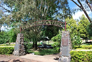
Kenilworth is a rural town and locality in the Sunshine Coast Region, Queensland, Australia. In the 2021 census, the locality of Kenilworth had a population of 604 people.

Mooloolah Valley is a rural locality in the Sunshine Coast Region, Queensland, Australia. In the 2021 census, Mooloolah Valley had a population of 3,629 people.

Landsborough is a town and a locality in the Sunshine Coast Region, Queensland, Australia. In the 2021 census, the locality of Landsborough had a population of 4,446 people.

Mapleton is a rural town and locality in the Sunshine Coast Region, Queensland, Australia. In the 2021 census, the locality of Mapleton had a population of 1,661 people.
Montville is a rural town and locality in the Sunshine Coast Region, Queensland, Australia. In the 2021 census, the locality of Montville had a population of 1,092 people.

Woombye is a rural town and locality in the Sunshine Coast Region, Queensland, Australia. In the 2021 census, the locality of Woombye had a population of 3,944 people.
West Woombye is a rural residential locality in the Sunshine Coast Region, Queensland, Australia. In the 2021 census, West Woombye had a population of 1,083 people.

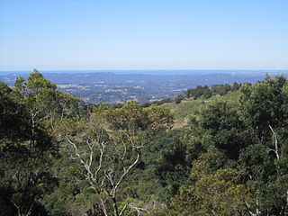
The Blackall Range is a mountain range in South East Queensland, Australia. The first European explorer in the area was Ludwig Leichhardt. It was named after Samuel Blackall, the second Governor of Queensland.
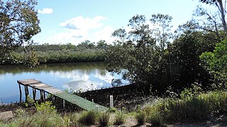
Coochin Creek is a coastal locality in the south of the Sunshine Coast Region, Queensland, Australia. The locality is named for the creek which flows through it.
Landers Shoot is a rural locality in the Sunshine Coast Region, Queensland, Australia. In the 2021 census, Landers Shoot had a population of 308 people.
Hunchy is a rural locality in the Sunshine Coast, Queensland, Australia. In the 2021 census, Hunchy had a population of 592 people.

Obi Obi is a rural locality in the Sunshine Coast Region, Queensland, Australia. In the 2021 census, Obi Obi had a population of 208 people.
Bald Knob is a rural locality in the Sunshine Coast Region, Queensland, Australia. In the 2021 census, Bald Knob had a population of 280 people.
Flaxton is a rural locality in the Sunshine Coast Region, Queensland, Australia. In the 2021 census, Flaxton had a population of 992 people.

Witta is a rural town and locality in the Sunshine Coast Region, Queensland, Australia. In the 2021 census, the locality of Witta had a population of 1,296 people.

Wootha is a rural locality in the Sunshine Coast Region, Queensland, Australia. In the 2021 census, Wootha had a population of 258 people.
Curramore is a rural locality in the Sunshine Coast Region, Queensland, Australia. In the 2021 census, Curramore had a population of 198 people.

Gheerulla is a rural locality in the Sunshine Coast Region, Queensland, Australia. In the 2021 census, Gheerulla had a population of 291 people.
Blackall Range road network is a group of roads that provide access to the mountain localities and towns from various lowland places, and enable travel between the mountain communities. The network ensures continuity of access in times of flooding or other natural disasters, and during planned maintenance activities. The area serviced by the network includes the localities and towns, from south to north, of Maleny, Montville and Mapleton. It also includes the rural localities of Bald Knob, Balmoral Ridge, Flaxton, Gheerulla, North Maleny, Obi Obi and Witta. The area hosts a substantial residential community plus many tourism accommodation venues. At the 2021 census, the locality of Maleny had a population of 3,959 people.

