Marcoola, Queensland

Last updated

Marcoola
Queensland
Marcoola Beach.jpg
Marcoola Beach
Australia Queensland location map.svg
Red pog.svg
Marcoola
Coordinates 26°35′00″S153°05′44″E / 26.5833°S 153.0955°E / -26.5833; 153.0955 (Marcoola (town centre))
Population3,355 (2021 census) [1]
 • Density244.9/km2 (634.3/sq mi)
Postcode(s) 4564
Area13.7 km2 (5.3 sq mi)
Time zone AEST (UTC+10:00)
Location
LGA(s) Sunshine Coast Region
State electorate(s)
Federal division(s) Fairfax
Localities around Marcoola:
Maroochy River Mount Coolum Coral Sea
Bli Bli Marcoola Coral Sea
Bli Bli Pacific Paradise Mudjimba

Marcoola is a coastal town and mixed-use locality in the Sunshine Coast Region, Queensland, Australia. [2] [3] In the 2021 census, the locality of Marcoola had a population of 3,355 people. [1]

Contents

Geography

Aerial view of Sunshine Coast Airport, 2024 Aerial view of Sunshine Coast Airport.jpg
Aerial view of Sunshine Coast Airport, 2024

The locality is bounded to the east by the Coral Sea and to the west by the Maroochy River, forming part of the Maroochy River Catchment Area. [4] The town is in the north-east corner of the locality. [2] The eastern coastline is a long sandy strip known as Marcoola Beach ( 26°35′45″S153°05′52″E / 26.5958°S 153.0977°E / -26.5958; 153.0977 (Marcoola Beach) ). [5]

Sunshine Coast Airport is located within the south of the locality on Friendship Avenue, off Airport Drive ( 26°35′35″S153°04′58″E / 26.5930°S 153.0829°E / -26.5930; 153.0829 (Sunshine Coast Airport) ). [6]

There are two sections of Mount Coolum National Park within the locality, one in the north of the locality and one in the south. A section of the Maroochy Wetlands Conservation Park is in the south-west of the locality adjacent to the river ( 26°36′17″S153°03′19″E / 26.6046°S 153.0553°E / -26.6046; 153.0553 (Maroochy Wetlands Conservation Park) ). [7]

Residential apartments on the Esplanade, 2018 Apartments building at Esplanade, Marcoola, Queensland 02.jpg
Residential apartments on the Esplanade, 2018

The Sunshine Motorway enters the locality from the south (Pacific Paradise) and proceeds north (through the west of the locality), exiting the locality to the north (Mount Coolum). It provides a route through the locality, but not access to it. The David Low Way enters the locality from the south-east (Mudjimba) and forms part of the south-east boundary of the locality before proceeding north (through the east of the locality), exiting to the north (Mount Coolum). It provides the main access to the locality. [8]

Land use in Marcoola is mixed. Along the eastern coastal area, the land use is predominantly sububan residential blocks and larger holiday accommodation facilities. The west of the locality is farmland, predominantly used for crop growing (mostly sugarcane). There is a commercial and industrial area in the south of the locality near the airport, as well as protected areas of national parks and conservation parks. [9]

History

The name Marcoola was a coined name and reflects its location between Maroochydore and Coolum. [2]

Maroochy Airport was opened in Marcoola on 12 August 1961. It was changed in 1997 to its official name the Sunshine Coast Airport. [10] [11]

Marcoola Surf Life Saving Club, 2019 Marcoola Surf Life Saving Club, Queensland in July 2019, 13.jpg
Marcoola Surf Life Saving Club, 2019

The Marcoola Beach Surf Lifesaving Club was founded in 1969 commencing with a "nipper" group (younger boys). The first clubhouse was built in 1970. In 1979, the club introduced a "nipperette" group (younger girls). At that time, women were not accepted into surf life saving clubs and the club was reprimanded; however, in 1980, surf life saving became open to women at all levels. In 1984, the current 2-storey clubhouse was opened. [12]

In March 2009, a ship called, MV Pacific Adventurer, spilled 270 tonnes of oil off the coast of Brisbane causing damage to the Marcoola coastline among other areas and costing the state millions of dollars. [13]

Demographics

In the 2016 census, the locality of Marcoola had a population of 3,173 people, of which 50.4% were male and 49.6% were female. Aboriginal and/or Torres Strait Islander people made up 2.6% of the population. [14]

In the 2021 census, the locality of Marcoola had a population of 3,355 people with a gender distribution of 50.6% male and 49.4% female, and a median age of 45 years. Additionally, 2.9% of the population identified as Indigenous. [1]

Education

There are no schools in Marcoola. The nearest government primary schools are Pacific Paradise State School in neighbouring Pacific Paradise to the south and Coolum State School in Coolum Beach to the north. The nearest government secondary schools are Maroochydore State High School in Maroochydore to the south and Coolum State High School in Coolum Beach to the north. [15]

Amenities

Outdoor dining at the Marcoola Surf Life Saving Club, 2019 Marcoola Surf Life Saving Club, Queensland in July 2019, 12.jpg
Outdoor dining at the Marcoola Surf Life Saving Club, 2019

Marcoola Surf Life Saving Club is at 64 Marcoola Esplanade ( 26°34′57″S153°05′50″E / 26.5826°S 153.0971°E / -26.5826; 153.0971 (Marcoola Surf Life Saving Club) ). [16] The club trains volunteers to patrol local beaches to ensure people have a safe swimming experience. The club's dining facililites provide financial support for life saving services. [17]

Environment

Many species persist in this region, including flora such as paperbark open forest and woodland, Banksia aemula (Wallum Banksia) woodland, and open heathland. [18] There is also a population of the endangered Mount Emu she-oak. [19]

The region provides essential habitat for ground parrots which are regularly recorded and it is believed a subpopulation between 15 and 19 birds exists in Marcoola, making this the largest subpopulation within the Sunshine Coast and consequently important for the species persistence. [20] Many other popular bird species have also been recorded in the area in recent years. [21]

Ecosystem services in the region contribute to improved water quality of the Maroochy River by removing nutrient loads, retaining floodwaters and maintaining local flows before flowing directly into the sea. Other benefits include the high value to wildlife and by providing habitat refuge. The area also provides critical habitat for species which rely on the area for breeding and feeding (such as acid frogs, the 'vulnerable' wallum froglet, wallum sedge frog, wallum rocketfrog). [22]

Marcoola coastal region is part of the Australian Commonwealth's, Temperate East Marine Region, and consists of several 'nationally important wetlands' and 'protected area' locations. [23]

Related Research Articles

<span class="mw-page-title-main">Sunshine Coast, Queensland</span> Region in Queensland, Australia

The Sunshine Coast is a peri-urban region in South East Queensland, Australia. It is the district defined in 1967 as "the area contained in the Shires of Landsborough, Maroochy and Noosa, but excluding Bribie Island". Located 100 km (62 mi) north of the centre of Brisbane in South East Queensland, on the Coral Sea coastline, its urban area spans approximately 60 km (37 mi) of coastline and hinterland from Pelican Waters to Tewantin.

<span class="mw-page-title-main">Peregian Beach</span> Town in Queensland, Australia

Peregian Beach is a beach and small coastal town on the Sunshine Coast, Queensland, Australia. It is a suburb split between two local government areas with the eastern coastal in the Shire of Noosa and the western hinterland part in the Sunshine Coast Region. In the 2021 census, Peregian Beach had a population of 4,972 people.

<span class="mw-page-title-main">Maroochydore</span> Town in Queensland, Australia

Maroochydore is a coastal town in the Sunshine Coast Region, Queensland, Australia. In the 2021 census, the urban area of Maroochydore had a population of 63,673 people.

<span class="mw-page-title-main">Mudjimba, Queensland</span> Suburb of Sunshine Coast, Queensland, Australia

Mudjimba is a coastal suburb in the Sunshine Coast Region, Queensland, Australia, and forms part of the Maroochydore urban centre. In the 2021 census, Mudjimba had a population of 2,664 people.

<span class="mw-page-title-main">Alexandra Headland, Queensland</span> Suburb of Maroochydore, Queensland, Australia

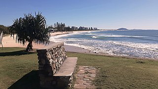
Alexandra Headland is a coastal suburb of Maroochydore in the Sunshine Coast Region, Queensland, Australia. In the 2021 census, Alexandra Headland had a population of 4,235 people.

<span class="mw-page-title-main">Bli Bli, Queensland</span> Town in Queensland, Australia

Bli Bli is a rural town and locality in the Sunshine Coast Region, Queensland, Australia. In the 2021 census, the locality of Bli Bli had a population of 10,138 people.

<span class="mw-page-title-main">Coolum Beach, Queensland</span> Town in Queensland, Australia

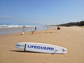
Coolum Beach is a beachside town and coastal suburb in the Sunshine Coast Region, Queensland, Australia. In the 2021 census, the suburb of Coolum Beach had a population of 9,152 people.

Doonan is a rural residential locality split between the Sunshine Coast Region and the Shire of Noosa, both in Queensland, Australia. In the 2021 census, Doonan had a population of 3,727 people.

Pacific Paradise is a suburb of Maroochydore in the Sunshine Coast Region, Queensland, Australia. In the 2021 census, Pacific Paradise had a population of 2,675 people.

<span class="mw-page-title-main">Mount Coolum, Queensland</span> Suburb of Sunshine Coast, Queensland, Australia

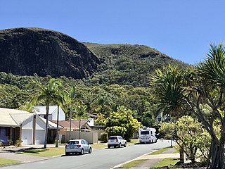
Mount Coolum is a coastal suburb in the Sunshine Coast Region, Queensland, Australia. In the 2021 census, Mount Coolum had a population of 4,545 people.

<span class="mw-page-title-main">Twin Waters, Queensland</span> Suburb of Maroochydore, Queensland, Australia

Twin Waters is a coastal suburb of Maroochydore in the Sunshine Coast Region, Queensland, Australia. In the 2021 census, Twin Waters had a population of 2,966 people.

Kunda Park is an industrial suburb of Buderim in the Sunshine Coast Region, Queensland, Australia. In the 2021 census, Kunda Park had a population of 22 people.

<span class="mw-page-title-main">Yaroomba, Queensland</span> Suburb of Sunshine Coast, Queensland, Australia

Yaroomba is a coastal suburb in the Sunshine Coast Region, Queensland, Australia. In the 2021 census, Yaroomba had a population of 2,043 people.

Yandina Creek is a rural locality in the Sunshine Coast Region, Queensland, Australia. In the 2021 census, Yandina Creek had a population of 872 people.

<span class="mw-page-title-main">Maroochy River, Queensland</span> Suburb of Sunshine Coast Region, Queensland, Australia

Maroochy River is a rural hinterland locality in the Sunshine Coast Region, Queensland, Australia. In the 2021 census, Maroochy River had a population of 1,667 people.

<span class="mw-page-title-main">Sunshine Coast Region</span> Local government area in Queensland, Australia

The Sunshine Coast Region is a local government area located in the Sunshine Coast region of South East Queensland, Australia.

<span class="mw-page-title-main">Maroochy River</span> River in Queensland, Australia

The Maroochy River is a river in South East Queensland, Australia. The river rises from the eastern slopes of the Blackall Range and flows east through Eumundi before entering the sea at Cotton Tree, Maroochydore. Other populated centres in the catchment include Nambour, Eudlo, Yandina and Coolum.

<span class="mw-page-title-main">Maroochy air crash</span>

The Maroochy air crash was an aircraft accident that occurred at 11.10am on 30 December 1950 at Maroochydore beach, Queensland, Australia. Three children were killed and fourteen others were seriously injured as a result of the accident.

Cotton Tree is a coastal neighbourhood within the suburb of Maroochydore in the Sunshine Coast Region, Queensland, Australia.

References

  1. 1 2 3 Australian Bureau of Statistics (28 June 2022). "Marcoola (SAL)". 2021 Census QuickStats. Retrieved 28 February 2023. OOjs UI icon edit-ltr-progressive.svg
  2. 1 2 3 "Marcoola – town in Sunshine Coast Region (entry 20926)". Queensland Place Names. Queensland Government . Retrieved 21 July 2021.
  3. "Marcoola – locality in Sunshine Coast Region (entry 48744)". Queensland Place Names. Queensland Government . Retrieved 21 July 2021.
  4. "Maroochy River Catchment". Archived from the original on 21 September 2018. Retrieved 21 September 2018.
  5. "Mountain ranges beaches and sea passages - Queensland". Queensland Open Data. Queensland Government. 12 November 2020. Archived from the original on 25 November 2020. Retrieved 25 November 2020.
  6. "Airports - Queensland". Queensland Open Data. Queensland Government. 22 October 2020. Archived from the original on 15 November 2020. Retrieved 3 November 2020.
  7. "Layers: Locality; Protected areas and forests; Land use". Queensland Globe. Queensland Government. Archived from the original on 19 December 2017. Retrieved 11 September 2024.
  8. "Layers: Locality; Road and rail". Queensland Globe. Queensland Government. Archived from the original on 19 December 2017. Retrieved 11 September 2024.
  9. "Layers: Locality; Protected areas and forests; Land use; Land parcel; Sugarcane areas". Queensland Globe. Queensland Government. Archived from the original on 19 December 2017. Retrieved 11 September 2024.
  10. "Sunshine Coast Airport". Sunshine Coast Regional Council. Retrieved 11 September 2024.
  11. "SCC Airport timeline". Sunshine Coast Regional Council . Archived from the original on 11 September 2024. Retrieved 12 September 2024.
  12. "About | Marcoola Surf Life Saving Club". Archived from the original on 29 May 2024. Retrieved 11 September 2024.
  13. Meissner, Katie (2 September 2012). "Environmental disaster meets state politics". Australian Journal of Communication. Retrieved 21 September 2018.
  14. Australian Bureau of Statistics (27 June 2017). "Marcoola (SSC)". 2016 Census QuickStats. Retrieved 20 October 2018. OOjs UI icon edit-ltr-progressive.svg
  15. "Layers: Locality; Schools and school catchments". Queensland Globe. Queensland Government. Archived from the original on 19 December 2017. Retrieved 11 September 2024.
  16. "Marcoola Surf Life Saving Club | Sunshine Coast". Archived from the original on 10 August 2024. Retrieved 11 September 2024.
  17. "Surf Life Saving | Marcoola Surf Life Saving Club". Archived from the original on 29 May 2024. Retrieved 11 September 2024.
  18. "Chapter B7 Terrestrial Flora – Airport and Surrounds Terrestrial Flora, Sunshine Coast Airport Environmental Impact Statement" (PDF). Archived (PDF) from the original on 16 April 2018. Retrieved 21 September 2018.
  19. Mount Coolum National Park – resource information 2019 Archived 22 December 2020 at the Wayback Machine QLD Department of Environment and Science, accessed: 20 September 2020
  20. Chapter B8 Terrestrial Fauna – Airport and Surrounds Terrestrial Fauna Archived 16 April 2018 at the Wayback Machine Sunshine Coast Airport Environmental Impact Statement, accessed: 21 September 2018
  21. Marcoola Beach Checklist Archived 22 December 2020 at the Wayback Machine eBird Australia website, accessed:16 January 2019
  22. Mount Coolum National Park – resource information 2019 Archived 22 December 2020 at the Wayback Machine QLD Department of Environment and Science, accessed: 20 September 2020
  23. Protected Matters Search Tool Archived 8 May 2018 at the Wayback Machine Department of the Environment and Energy website, published: 28 May 2015, accessed: 21 September 2018