Flaxton, Queensland

Last updated

Map all coordinates using: OpenStreetMap
Flaxton
Queensland
Flaxton.jpeg
View from Flaxton towards the Pacific Ocean, 2012
Australia Queensland location map.svg
Red pog.svg
Flaxton
Coordinates 26°39′34″S152°52′09″E / 26.6594°S 152.8691°E / -26.6594; 152.8691 (Flaxton (centre of locality))
Population992 (SAL 2021) [1]
Postcode(s) 4560
Area11.6 km2 (4.5 sq mi)
Time zone AEST (UTC+10:00)
Location
LGA(s) Sunshine Coast Region
State electorate(s) Glass House
Federal division(s) Fairfax
Suburbs around Flaxton:
Mapleton Mapleton Dulong
Obi Obi Flaxton Hunchy
Obi Obi Montville Hunchy

Flaxton is a rural locality in the Sunshine Coast Region, Queensland, Australia. [2] In the 2021 census, Flaxton had a population of 992 people. [3]

Contents

History

Flaxton Inn, 1976 Flaxton Inn at Flaxton, Queensland, 1976.jpg
Flaxton Inn, 1976
Life-sized stocks at the Flaxton Model Village, 1978 Miniature English Village, Flaxton, Sunshine Coast, Queensland QUT-7024.jpg
Life-sized stocks at the Flaxton Model Village, 1978

The locality is named after Flaxton Hall Farm in the fens of Eastern England. [2] Joseph Dixon, who originally grew sugarcane at Buderim, selected land at Flaxton in 1882. [4] From 1892 the land was cleared so bananas and citrus fruit could be farmed.

Local residents began to lobby for a school in 1921 with Mr J. C. Dixon senior donating a 1-acre (0.40 ha) parcel of land on the main range road with panoramic views to the coast. [5] Having been advised that a state school built by the government would be unlikely, the residents decided to raise the funds locally to build a provisional school which could also be used as a public hall outside of school hours. A stump-capping ceremony was held on 8 October 1921. Flaxton Provisional School opened in February 1922. It closed in 1967. [6] [7] [8] [9] It was at 360-362 Flaxton Drive ( 26°39′33″S152°52′55″E / 26.65916°S 152.88194°E / -26.65916; 152.88194 (Flaxton Provisional School (former)) ). [10]

A fruit-packing shed which could process the district's entire harvest was opened 1931. [4] A sawmill operated for more than 20 years before being burned down in 1956. [4]

On 21 March 1970, the Minister for Tourism, John Herbert, officially opened the Flaxton Model Village display which was built and operated by Mr and Mrs Malcolm Bradley. The model village had one-twelfth scale replicas of old English buildings, including a castle, water mill, church, market square etc. There were also life-sized replicas used as a theatre, cafe, and shop etc. [11]

Demographics

In the 2016 census, Flaxton had a population of 931 people. [12]

In the 2021 census, Flaxton had a population of 992 people. [3]

Education

There are no schools in Flaxton. The nearest government primary schools are Mapleton State School in neighbouring Mapleton to the north and Montville State School in neighbouring Montville to the south. The nearest government secondary school is Burnside State High School in Burnside to the north-east. [13]

Amenities

There are a number of parks in the area:

See also

Related Research Articles

<span class="mw-page-title-main">Palmwoods, Queensland</span> Town in Queensland, Australia

Palmwoods is a rural town and locality in the Sunshine Coast Region, Queensland, Australia. In the 2021 census, the locality of Palmwoods had a population of 6,357 people.

<span class="mw-page-title-main">Glass House Mountains, Queensland</span> Town in Queensland, Australia

Glass House Mountains is a rural hinterland town and locality in the Sunshine Coast Region, Queensland, Australia. In the 2016 census, the locality of Glass House Mountains had a population of 5,065 people.

<span class="mw-page-title-main">Mapleton, Queensland</span> Suburb of Sunshine Coast Region, Queensland, Australia

Mapleton is a rural town and locality in the Sunshine Coast Region, Queensland, Australia. In the 2016 census, the locality of Mapleton had a population of 1,564 people.

<span class="mw-page-title-main">Eumundi, Queensland</span> Town in Queensland, Australia

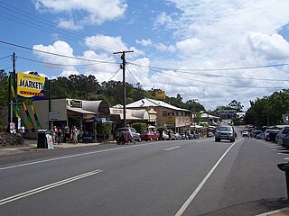
Eumundi is a rural town and locality in the Sunshine Coast Region, Queensland, Australia. In the 2021 census, the locality of Eumundi had a population of 2,504 people.

Montville is a rural town and locality in the Sunshine Coast Region, Queensland, Australia. In the 2016 census, the locality of Montville had a population of 970 people.

<span class="mw-page-title-main">Woombye, Queensland</span> Town in Queensland, Australia

Woombye is a rural town and locality in the Sunshine Coast Region, Queensland, Australia. In the 2021 census, the locality of Woombye had a population of 3,944 people.

<span class="mw-page-title-main">Kin Kin</span> Suburb of Shire of Noosa, Queensland, Australia

Kin Kin is a rural town and locality in the Shire of Noosa, Queensland, Australia. In the 2016 census, the locality of Kin Kin had a population of 764 people. In the 2021 census the population had risen to 844.

<span class="mw-page-title-main">Lake Macdonald, Queensland</span> Suburb of Sunshine Coast, Queensland, Australia

Lake Macdonald is a rural locality in the Shire of Noosa, Queensland, Australia. In the 2016 census Lake Macdonald had a population of 1,363 people.

Diddillibah is a semi-rural locality in the Sunshine Coast Region, Queensland, Australia. In the 2016 census, Diddillibah had a population of 1,403 people.

West Woombye is a rural residential locality in the Sunshine Coast Region, Queensland, Australia. In the 2016 census West Woombye had a population of 1,007 people.

Kiels Mountain is a rural locality in the Sunshine Coast Region, Queensland, Australia. In the 2016 census, Kiels Mountain had a population of 664 people.

<span class="mw-page-title-main">Coochin Creek</span> Suburb of Sunshine Coast, Queensland, Australia

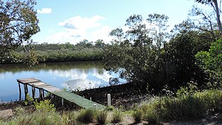
Coochin Creek is a coastal locality in the south of the Sunshine Coast Region, Queensland, Australia. The locality is named for the creek which flows through it.

Landers Shoot is a rural locality in the Sunshine Coast Region, Queensland, Australia. In the 2016 census, Landers Shoot had a population of 252 people.

Hunchy is a rural locality in the Sunshine Coast, Queensland, Australia. In the 2021 census, Hunchy had a population of 592 people.

<span class="mw-page-title-main">Rocksberg</span> Suburb of City of Moreton Bay, Queensland, Australia

Rocksberg is a rural locality in the City of Moreton Bay, Queensland, Australia. In the 2016 census, Rocksberg had a population of 300 people.

<span class="mw-page-title-main">Villeneuve, Queensland</span> Suburb of Somerset Region, Queensland, Australia

Villeneuve is a rural town and locality in the Somerset Region, Queensland, Australia. In the 2021 census, the locality of Villeneuve had a population of 193 people.

<span class="mw-page-title-main">Witta, Queensland</span> Suburb of Sunshine Coast Region, Queensland, Australia

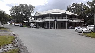
Witta is a rural town and locality in the Sunshine Coast Region, Queensland, Australia. In the 2021 census, the locality of Witta had a population of 1,296 people.

Kidaman Creek is a rural locality in the Sunshine Coast Region, Queensland, Australia. In the 2016 census Kidaman Creek had a population of 130 people.

Kureelpa is a rural locality in the Sunshine Coast Region, Queensland, Australia. In the 2021 census, Kureelpa had a population of 968 people.

Blackall Range road network is a group of roads that provide access to the mountain localities and towns from various lowland places, and enable travel between the mountain communities. The network ensures continuity of access in times of flooding or other natural disasters, and during planned maintenance activities. The area serviced by the network includes the localities and towns, from south to north, of Maleny, Montville and Mapleton. It also includes the rural localities of Bald Knob, Balmoral Ridge, Flaxton, Gheerulla, North Maleny, Obi Obi and Witta. The area hosts a substantial residential community plus many tourism accommodation venues. At the 2021 census, the locality of Maleny had a population of 3,959 people.

References

  1. Australian Bureau of Statistics (28 June 2022). "Flaxton (Suburb and Locality)". Australian Census 2021 QuickStats. Retrieved 28 June 2022.  OOjs UI icon edit-ltr-progressive.svg
  2. 1 2 "Flaxton – locality in Sunshine Coast Region (entry 48636)". Queensland Place Names. Queensland Government . Retrieved 5 November 2019.
  3. 1 2 Australian Bureau of Statistics (28 June 2022). "Flaxton (SAL)". 2021 Census QuickStats. Retrieved 28 February 2023. OOjs UI icon edit-ltr-progressive.svg
  4. 1 2 3 Environmental Protection Agency (Queensland) (2000). Heritage Trails of the Great South East. State of Queensland. p. 133. ISBN   0-7345-1008-X.
  5. "Flaxton". Chronicle And North Coast Advertiser . Vol. XVII, no. 917. Queensland, Australia. 27 May 1921. p. 4. Archived from the original on 10 August 2023. Retrieved 10 August 2023 via National Library of Australia.
  6. Queensland Family History Society (2010), Queensland schools past and present (Version 1.01 ed.), Queensland Family History Society, ISBN   978-1-921171-26-0
  7. "Opening and closing dates of Queensland Schools". Queensland Government . Retrieved 18 April 2019.
  8. "Flaxton: Provisional School". Chronicle And North Coast Advertiser . Vol. XVIII, no. 928. Queensland, Australia. 12 August 1921. p. 5. Archived from the original on 10 August 2023. Retrieved 10 August 2023 via National Library of Australia.
  9. "District Notes". Chronicle And North Coast Advertiser . Vol. XVIII, no. 937. Queensland, Australia. 14 October 1921. p. 7. Archived from the original on 10 August 2023. Retrieved 10 August 2023 via National Library of Australia.
  10. "Parish of Maroochy sheet 2" (Map). Queensland Government. 1955. Retrieved 10 August 2023.
  11. "A walk down memory lane of Coast tourism". Sunshine Coast Daily . 9 July 2017.
  12. Australian Bureau of Statistics (27 June 2017). "Flaxton (SSC)". 2016 Census QuickStats. Retrieved 20 October 2018. OOjs UI icon edit-ltr-progressive.svg
  13. "Queensland Globe". State of Queensland . Retrieved 8 August 2023.
  14. 1 2 3 4 5 "Land for public recreation - Queensland". Queensland Open Data. Queensland Government. 20 November 2020. Archived from the original on 22 November 2020. Retrieved 22 November 2020.

Further reading