
Mooloolaba is a coastal suburb of Maroochydore in the Sunshine Coast Region, Queensland, Australia. It is located 97 kilometres (60 mi) north of the state capital, Brisbane, and is part of the Maroochydore urban centre. In the 2021 census, Mooloolaba had a population of 8,202 people.
Buderim is an urban centre on the Sunshine Coast, Queensland, Australia. It sits on a 180-metre (590 ft) mountain which overlooks the southern Sunshine Coast communities. In the 2016 census, the urban area of Buderim had a population of 29 355.
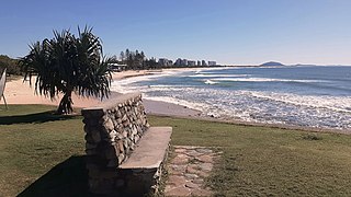
Alexandra Headland is a coastal suburb of Maroochydore in the Sunshine Coast Region, Queensland, Australia. In the 2021 census, Alexandra Headland had a population of 4,235 people.

Bli Bli is a rural town and locality in the Sunshine Coast Region, Queensland, Australia. In the 2021 census, Bli Bli had a population of 10,750 people.

Sippy Downs is a suburb of Buderim in the Sunshine Coast Region, Queensland, Australia.

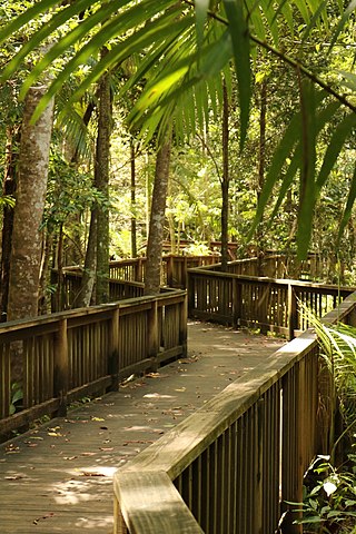
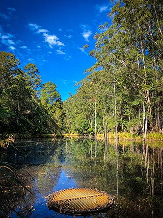
Forest Glen is a rural residential locality in the Sunshine Coast Region, Queensland, Australia. In the 2021 census, Forest Glen had a population of 1,657 people.

Castaways Beach is a coastal suburb in the Shire of Noosa, Queensland, Australia. In the 2016 census, Castaways Beach had a population of 656 people.
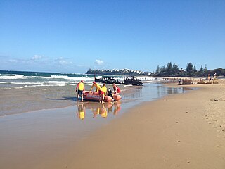
Dicky Beach is both a beach and coastal suburb of Caloundra in the Sunshine Coast Region, Queensland, Australia. In the 2016 census, Dicky Beach had a population of 1,895 people.
Diddillibah is a semi-rural locality in the Sunshine Coast Region, Queensland, Australia. In the 2021 census, Diddillibah had a population of 1,703 people.

Twin Waters is a coastal suburb of Maroochydore in the Sunshine Coast Region, Queensland, Australia. In the 2016 census, Twin Waters had a population of 2,687 people.
Kunda Park is an industrial suburb of Buderim in the Sunshine Coast Region, Queensland, Australia. In the 2021 census, Kunda Park had a population of 22 people.
Kuluin is a suburb of Maroochydore in the Sunshine Coast Region, Queensland, Australia. Kuluin had a population of 2,363 people in the 2016 census and 2,700 in the 2021 census.
Tanawha is a rural locality in the Sunshine Coast Region, Queensland, Australia. The name Tanawha is believed to be a Māori language word referring to a legendary New Zealand monster. For statistical purposes, it is regarded as a subub of Buderim.
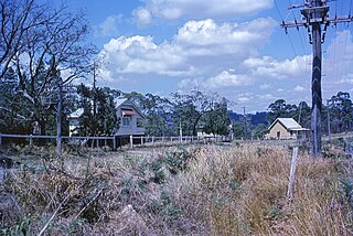
Rosemount is a rural locality in the Sunshine Coast Region, Queensland, Australia. In the 2021 census, Rosemount had a population of 1,851 people.
Chevallum is a rural locality in the Sunshine Coast Region, Queensland, Australia. In the 2016 census, Chevallum had a population of 441 people. In the 2021 census, Chevallum had a population of 467 people.
Kiels Mountain is a rural locality in the Sunshine Coast Region, Queensland, Australia. In the 2021 census, Kiels Mountain had a population of 714 people.

Maroochydore is a coastal suburb of the Sunshine Coast, Queensland, Australia, and is the central suburb and central business district of the Maroochydore urban centre. In the 2016 census, the suburb of Maroochydore had a population of 16,800 people.

Buderim is the central suburb of the town of Buderim in the Sunshine Coast Region, Queensland, Australia. In the 2016 census, the suburb of Buderim had a population of 29,355 people.
Ilkley is a rural locality in the Sunshine Coast Region, Queensland, Australia. In the 2021 census, Ilkley had a population of 812 people.
