Landers Shoot, Queensland

Last updated

Landers Shoot
Queensland
Australia Queensland location map.svg
Red pog.svg
Landers Shoot
Coordinates 26°42′54″S152°55′34″E / 26.715°S 152.9261°E / -26.715; 152.9261 (Landers Shoot (centre of locality))
Population308 (2021 census) [1]
 • Density65.5/km2 (169.7/sq mi)
Established1861
Postcode(s) 4555
Area4.7 km2 (1.8 sq mi)
Time zone AEST (UTC+10:00)
LGA(s) Sunshine Coast Region
State electorate(s) Glass House
Federal division(s) Fisher
Suburbs around Landers Shoot:
Montville Palmwoods Palmwoods
Montville Landers Shoot Eudlo
Montville Eudlo Eudlo

Landers Shoot is a rural locality in the Sunshine Coast Region, Queensland, Australia. [2] In the 2021 census, Landers Shoot had a population of 308 people. [1]

Contents

Geography

Landers Shoot is in the Sunshine Coast hinterland.

History

Edmund Lander leased the area known as the Mooloolah Back Plain from the Queensland Government in 1861. [3] [4] He, along with other pioneers, harvested the timber along the Blackall Range. When the timber was harvested, the bark was stripped, making them slippery from the sap and a sharp point was made on one end of the tree. The tree was then pushed over the eastern side of the cliff down "chutes" (to be collected at the bottom, and transported to the nearest mills). [5] [6] Landers Shoot (a corruption of Lander's Chute) was the base region where the logs arrived at the base of the cliff. [2]

Lander's Shoot State School opened on 17 February 1914 and closed on 31 December 1944. [7] It was at approx 471 Upper Landershute Road ( 26°43′15″S152°55′03″E / 26.7207°S 152.9176°E / -26.7207; 152.9176 (Lander's Shoot State School (former)) ). [8] [9]

Demographics

In the 2016 census, Landers Shoot had a population of 252 people. [10]

In the 2021 census, Landers Shoot had a population of 308 people. [1]

Education

There are no schools in Landers Shoot. The nearest government primary schools are Eudlo State School in neighbouring Eudlo to the south-east and Montville State School in neighbouring Montville to the north-west. The nearest government secondary school is Nambour State College in Nambour to the north. [9]

Facilities

Despite the name, Landers Shute Advanced Water Treatment Plant is a sewage treatment plant in neighbouring Montville, but is adjacent to the locality boundary with the Landers Shute. [11]

Related Research Articles

<span class="mw-page-title-main">Palmwoods, Queensland</span> Town in Queensland, Australia

Palmwoods is a rural town and locality in the Sunshine Coast Region, Queensland, Australia. In the 2021 census, the locality of Palmwoods had a population of 6,357 people.

<span class="mw-page-title-main">Yandina, Queensland</span> Town in Queensland, Australia

Yandina is a rural town and locality in the Sunshine Coast Region, Queensland, Australia. IIn the 2021 census, the locality of Yandina had a population of 3,073 people.

<span class="mw-page-title-main">Mooloolah Valley, Queensland</span> Suburb of Sunshine Coast Region, Queensland, Australia

Mooloolah Valley is a rural locality in the Sunshine Coast Region, Queensland, Australia. In the 2021 census, Mooloolah Valley had a population of 3,629 people.

<span class="mw-page-title-main">Landsborough, Queensland</span> Town in Queensland, Australia

Landsborough is a town and a locality in the Sunshine Coast Region, Queensland, Australia. At the 2021 census, Landsborough had a population of 4,446 people.

Montville is a rural town and locality in the Sunshine Coast Region, Queensland, Australia. In the 2016 census, the locality of Montville had a population of 970 people.

<span class="mw-page-title-main">Woombye, Queensland</span> Town in Queensland, Australia

Woombye is a rural town and locality in the Sunshine Coast Region, Queensland, Australia. In the 2021 census, the locality of Woombye had a population of 3,944 people.

Verrierdale is a rural locality in the Sunshine Coast Region, Queensland, Australia. In the 2021 census, Verrierdale had a population of 809 people.

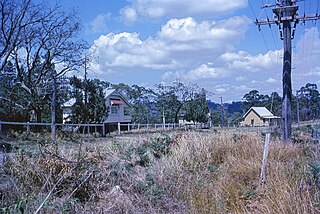
Eudlo is a rural town and locality in the Sunshine Coast Region, Queensland, Australia. In the 2016 census, the locality of Eudlo had a population of 1,117 people.

<span class="mw-page-title-main">Diddillibah, Queensland</span> Suburb of Sunshine Coast Region, Queensland, Australia

Diddillibah is a semi-rural locality in the Sunshine Coast Region, Queensland, Australia. In the 2021 census, Diddillibah had a population of 1,703 people.

<span class="mw-page-title-main">Tanawha, Queensland</span> Suburb of Sunshine Coast, Queensland, Australia

Tanawha is a rural locality in the Sunshine Coast Region, Queensland, Australia. The name Tanawha is believed to be a Māori language word referring to a legendary New Zealand monster. For statistical purposes, it is regarded as a subub of Buderim.

<span class="mw-page-title-main">Eerwah Vale, Queensland</span> Suburb of Sunshine Coast, Queensland, Australia

Eerwah Vale is a locality split between the Sunshine Coast Region and Shire of Noosa, both in Queensland, Australia. In the 2021 census, Eerwah Vale had a population of 671 people.

<span class="mw-page-title-main">Burnside, Queensland</span> Suburb of Nambour, Queensland, Australia

Burnside is a residential locality of the town of Nambour in the Sunshine Coast Region, Queensland, Australia. In the 2021 census, Burnside had a population of 3,104 people.

Coes Creek is a rural locality in the Sunshine Coast Region, Queensland, Australia. In the 2021 census, Coes Creek had a population of 1,515 people.

West Woombye is a rural residential locality in the Sunshine Coast Region, Queensland, Australia. In the 2016 census West Woombye had a population of 1,007 people.

Chevallum is a rural locality in the Sunshine Coast Region, Queensland, Australia. In the 2016 census, Chevallum had a population of 441 people. In the 2021 census, Chevallum had a population of 467 people.

Kiels Mountain is a rural locality in the Sunshine Coast Region, Queensland, Australia. In the 2021 census, Kiels Mountain had a population of 714 people.

Hunchy is a rural locality in the Sunshine Coast, Queensland, Australia. In the 2021 census, Hunchy had a population of 592 people.

<span class="mw-page-title-main">Flaxton, Queensland</span> Suburb of Sunshine Coast Region, Queensland, Australia

Flaxton is a rural locality in the Sunshine Coast Region, Queensland, Australia. In the 2021 census, Flaxton had a population of 992 people.

Bridges is a rural locality in the Sunshine Coast Region, Queensland, Australia. In the 2021 census, Bridges had a population of 295 people.

<span class="mw-page-title-main">Kiamba, Queensland</span> Suburb of Sunshine Coast Region, Queensland, Australia

Kiamba is a rural locality in the Sunshine Coast Region, Queensland, Australia. In the 2021 census, Kiamba had a population of 191 people.

References

  1. 1 2 3 Australian Bureau of Statistics (28 June 2022). "Landers Shoot (SAL)". 2021 Census QuickStats. Retrieved 28 February 2023. OOjs UI icon edit-ltr-progressive.svg
  2. 1 2 "Landers Shoot – locality in Sunshine Coast Region (entry 49432)". Queensland Place Names. Queensland Government . Retrieved 7 March 2022.
  3. "History of the "Rocks"" (PDF). Archived from the original on 6 March 2017. Retrieved 6 March 2017.{{cite web}}: CS1 maint: unfit URL (link)
  4. Slade, Carolyn (2010). Take a Walk Around Palmwoods. Nambour, Qld: Genealogy Sunshine Coast. p. 16. ISBN   9780980353846.
  5. Tutt, Stan (1994). Sunshine Coast Heritage. Maroochydore, Qld: Discovery Press. ISBN   0646143093.
  6. Adams, R.J.L. (2004). Noosa Horizons. Broadwater, Qld: Ultreya. p. 77. ISBN   0975200607.
  7. Queensland Family History Society (2010), Queensland schools past and present (Version 1.01 ed.), Queensland Family History Society, ISBN   978-1-921171-26-0
  8. "Nambour" (Map). Queensland Government. 1942. Archived from the original on 23 June 2022. Retrieved 23 June 2022.
  9. 1 2 "Queensland Globe". State of Queensland . Retrieved 23 June 2022.
  10. Australian Bureau of Statistics (27 June 2017). "Landers Shoot (SSC)". 2016 Census QuickStats. Retrieved 20 October 2018. OOjs UI icon edit-ltr-progressive.svg
  11. "Landmark Areas – Queensland". Queensland Open Data. Queensland Government. 18 November 2020. Archived from the original on 21 November 2020. Retrieved 21 October 2020.