Bells Creek, Queensland

Last updated

Bells Creek
Queensland
Australia Queensland location map.svg
Red pog.svg
Bells Creek
Coordinates 26°49′43″S153°04′41″E / 26.8286°S 153.0780°E / -26.8286; 153.0780 (Bells Creek (centre of locality))
Population343 (2021 census) [1]
 • Density42.3/km2 (109.7/sq mi)
Postcode(s) 4551
Area8.1 km2 (3.1 sq mi)
Time zone AEST (UTC+10:00)
Location
LGA(s) Sunshine Coast Region
County Canning
Parish Bribie
State electorate(s) Caloundra
Federal division(s) Fisher
Suburbs around Bells Creek:
Baringa Baringa Caloundra West
Nirimba Bells Creek Pelican Waters
Banya
Gagalba
Coochin Creek Coochin Creek

Bells Creek is a rural locality in the Sunshine Coast Region, Queensland, Australia. [2] In the 2021 census, Bells Creek had a population of 343 people. [1]

Contents

Geography

Bells Creek is located 8 kilometres (5 mi) west of Caloundra. The Bruce Highway traverses the locality from the south-west to the north-west. Most of the land is freehold and used for farming. The Mooloolah River National Park is in the north-western corner of the locality. The south-western corner of the locality forms part of the Beerwah State Forest. [3]

History

The locality takes its name from the creek, which in turn was named after Mary Alice Bell (later Eglington) who bought Portion 29 south of the creek. She was the governess of the children of explorer and pioneer William Landsborough. The creek had previously been known as Kelaher Creek and by the Indigenous people as Tooringoor. [4]

On 18 August 2017, the north-eastern part of Bells Creek was excised to create the locality of Baringa to accommodate future suburban growth in the Caloundra South Priority Development Area. [5] [6]

On 14 June 2019, the localities of Bells Creek and Meridan Plains were again excised to the localities of Banya, Corbould Park, Gagalba and Nirimba to accommodate future suburban growth in the Caloundra South Priority Development Area. [7] [8] [9] [10] [11] [12] [13]

Demographics

In the 2011 census, Bells Creek had a population of 317 people. [14] The population was 52.1% female and 47.9% male. The median age of the Bells Creek population was 32 years, 5 years below the national median of 37. 79.6% of people living in Bells Creek were born in Australia. The other top responses for country of birth were New Zealand 3.8%, England 3.5%, Scotland 1.9%, Samoa 1.9%, United States of America 1.6%. 89.8% of people spoke only English at home; the next most common languages were 1.9% Arabic, 1.3% Afrikaans. [14]

In the 2016 census, Bells Creek had a population of 94 people. [15]

In the 2021 census, Bells Creek had a population of 343 people. [1]

Education

There are no schools in Bells Creek. The nearest government primary schools are Baringa State School in neighbouring Baringa to the north, Nirimba State Primary School in neighbouring Nirimba to the west, and Landsborough State School in Landsborough to the west. The nearest government secondary schools are Baringa State Secondary College in Baringa and Beerwah State High School in Beerwah to the south-west. [16]

Related Research Articles

<span class="mw-page-title-main">Caloundra</span> Town in Queensland, Australia

Caloundra is a coastal town in the Sunshine Coast Region, Queensland, Australia.

<span class="mw-page-title-main">Glass House Mountains, Queensland</span> Town in Queensland, Australia

Glass House Mountains is a rural hinterland town and locality in the Sunshine Coast Region, Queensland, Australia. In the 2021 census, the locality of Glass House Mountains had a population of 5,601 people.

<span class="mw-page-title-main">Mooloolah Valley, Queensland</span> Suburb of Sunshine Coast Region, Queensland, Australia

Mooloolah Valley is a rural locality in the Sunshine Coast Region, Queensland, Australia. In the 2021 census, Mooloolah Valley had a population of 3,629 people.

<span class="mw-page-title-main">Landsborough, Queensland</span> Town in Queensland, Australia

Landsborough is a town and a locality in the Sunshine Coast Region, Queensland, Australia. In the 2021 census, the locality of Landsborough had a population of 4,446 people.

<span class="mw-page-title-main">Maroochydore railway line</span> Proposed railway line on the Sunshine Coast, Queensland, Australia

The Maroochydore railway line, also known as the Direct Sunshine Coast Rail Line or CAMCOS, is a proposed railway line on the Sunshine Coast, Queensland, Australia.

<span class="mw-page-title-main">Little Mountain, Queensland</span> Suburb of Sunshine Coast, Queensland, Australia

Little Mountain is a suburb of Caloundra in the Sunshine Coast Region, Queensland, Australia. In the 2021 census, Little Mountain had a population of 11,068 people.

Glenview is a rural locality in the Sunshine Coast Region, Queensland, Australia. In the 2021 census, Glenview had a population of 1,396 people.

Meridan Plains is a locality on the north-western edge of the Caloundra urban area in the Sunshine Coast Region, Queensland, Australia. Traditionally a rural area, the locality is attracting residential development from the expansion of Caloundra. In the 2021 census, Meridan Plains had a population of 4,589 people.

<span class="mw-page-title-main">Pelican Waters, Queensland</span> Suburb of Caloundra, Queensland, Australia

Pelican Waters is a suburb of Caloundra in the Sunshine Coast Region, Queensland, Australia. In the 2021 census, Pelican Waters had a population of 7,393 people.

<span class="mw-page-title-main">Coochin Creek</span> Suburb of Sunshine Coast, Queensland, Australia

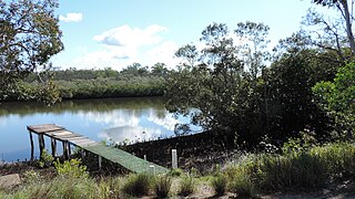
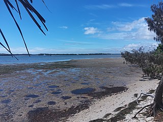
Coochin Creek is a coastal locality in the south of the Sunshine Coast Region, Queensland, Australia. The locality is named for the creek which flows through it.

Bald Knob is a rural locality in the Sunshine Coast Region, Queensland, Australia. In the 2021 census, Bald Knob had a population of 280 people.

<span class="mw-page-title-main">Baringa, Queensland</span> Suburb of Sunshine Coast Region, Queensland, Australia

Baringa is a new suburb in the Sunshine Coast Region, Queensland, Australia. It was established in 2017. In the 2021 census, Baringa had a population of 4,604 people.

Mount Mellum is a rural locality in the Sunshine Coast Region, Queensland, Australia. In the 2021 census, Mount Mellum had a population of 457 people.

Banya is a new rural locality in the Sunshine Coast Region, Queensland, Australia. It is intended to accommodate future suburban growth.

Corbould Park is a locality in the Sunshine Coast Region, Queensland, Australia. In the 2021 census, Corbould Park had "no people or a very low population".

Gagalba is a rural locality in the Sunshine Coast Region, Queensland, Australia.

<span class="mw-page-title-main">Nirimba, Queensland</span> Suburb of Sunshine Coast Region, Queensland, Australia

Nirimba is a developing locality in the Sunshine Coast Region, Queensland, Australia. It was created in 2019. In the 2021 census, Nirimba had a population of 2,229 people.

Glass House Mountains Road is a continuous 30.4-kilometre (18.9 mi) road route in the Moreton Bay and Sunshine Coast local government areas of Queensland, Australia. Part of it is designated as part of State Route 6. It is a state-controlled road, part regional and part district.

Caloundra Road is a continuous 9.3-kilometre (5.8 mi) road route in the Sunshine Coast local government area of Queensland, Australia. Most of it is designated as part of State Route 6. It is a state-controlled district road, part of which is rated as a local road of regional significance (LRRS).

References

  1. 1 2 3 Australian Bureau of Statistics (28 June 2022). "Bells Creek (SAL)". 2021 Census QuickStats. Retrieved 28 February 2023. OOjs UI icon edit-ltr-progressive.svg
  2. "Bells Creek – locality in Sunshine Coast Region (entry 50397)". Queensland Place Names. Queensland Government . Retrieved 7 March 2022.
  3. "Queensland Globe". State of Queensland . Retrieved 17 October 2017.
  4. "William Landsborough". Sunshine Coast Libraries. Archived from the original on 21 May 2022. Retrieved 18 October 2017.
  5. "Baringa – locality in Sunshine Coast Region (entry 50031)". Queensland Place Names. Queensland Government . Retrieved 18 October 2017.
  6. "Recent place name decisions". Queensland Government. Archived from the original on 17 October 2017. Retrieved 18 October 2017.{{cite web}}: CS1 maint: unfit URL (link)
  7. "Recent place name decisions". Queensland Government . 11 October 2019. Archived from the original on 22 October 2019. Retrieved 22 October 2019.
  8. "Proposed locality boundaries: Banya, Bells Creek, Corbould Park, Gagalba, Meridan Plains, Nirimba" (PDF). Queensland Government. 22 February 2019. Archived (PDF) from the original on 28 July 2019. Retrieved 22 October 2019.
  9. "Locality boundaries of Banya, Bells Creek, Corbould Park, Gagalba, Meridan Plains, Nirimba" (PDF). Queensland Government. 14 June 2019. Archived (PDF) from the original on 28 July 2019. Retrieved 22 October 2019.
  10. "Banya – locality in the Sunshine Coast Region (entry 50399)". Queensland Place Names. Queensland Government . Retrieved 22 October 2019.
  11. "Corbould Park – locality in the Sunshine Coast Region (entry 50400)". Queensland Place Names. Queensland Government . Retrieved 22 October 2019.
  12. "Gagalba – locality in the Sunshine Coast Region (entry 50401)". Queensland Place Names. Queensland Government . Retrieved 22 October 2019.
  13. "Nirimba – locality in the Sunshine Coast Region (entry 50402)". Queensland Place Names. Queensland Government . Retrieved 22 October 2019.
  14. 1 2 Australian Bureau of Statistics (31 October 2012). "Bells Creek (State Suburb)". 2011 Census QuickStats. Retrieved 11 June 2011. OOjs UI icon edit-ltr-progressive.svg
  15. Australian Bureau of Statistics (27 June 2017). "Bells Creek (SSC)". 2016 Census QuickStats. Retrieved 20 October 2018. OOjs UI icon edit-ltr-progressive.svg
  16. "Layers: Locality; Schools and school catchments". Queensland Globe. Queensland Government . Retrieved 23 June 2024.