
Mooloolaba is a coastal suburb of Maroochydore in the Sunshine Coast Region, Queensland, Australia. It is located 97 kilometres (60 mi) north of the state capital, Brisbane, and is part of the Maroochydore urban centre.

Nambour is a rural town and locality in the Sunshine Coast Region, Queensland, Australia. In the 2021 census, the locality of Nambour had a population of 12,145 people.

Palmwoods is a rural town and locality in the Sunshine Coast Region, Queensland, Australia. In the 2021 census, the locality of Palmwoods had a population of 6,357 people.

Yandina is a rural town and locality in the Sunshine Coast Region, Queensland, Australia. In the 2021 census, the locality of Yandina had a population of 3,073 people.

Cooroy is a rural town and locality in the Shire of Noosa, Queensland, Australia. In the 2021 census, the locality of Cooroy had a population of 4,801 people.

Glass House Mountains is a rural hinterland town and locality in the Sunshine Coast Region, Queensland, Australia. In the 2021 census, the locality of Glass House Mountains had a population of 5,601 people.
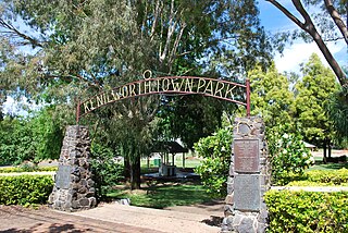
Kenilworth is a rural town and locality in the Sunshine Coast Region, Queensland, Australia. In the 2021 census, the locality of Kenilworth had a population of 604 people.

Mooloolah Valley is a rural locality in the Sunshine Coast Region, Queensland, Australia. In the 2021 census, Mooloolah Valley had a population of 3,629 people.

Landsborough is a town and a locality in the Sunshine Coast Region, Queensland, Australia. In the 2021 census, the locality of Landsborough had a population of 4,446 people.

Mapleton is a rural town and locality in the Sunshine Coast Region, Queensland, Australia. In the 2021 census, the locality of Mapleton had a population of 1,661 people.
Montville is a rural town and locality in the Sunshine Coast Region, Queensland, Australia. In the 2021 census, the locality of Montville had a population of 1,092 people.

Woombye is a rural town and locality in the Sunshine Coast Region, Queensland, Australia. In the 2021 census, the locality of Woombye had a population of 3,944 people.
Eudlo is a rural town and locality in the Sunshine Coast Region, Queensland, Australia. In the 2021 census, the locality of Eudlo had a population of 1,192 people.
Yandina Creek is a rural locality in the Sunshine Coast Region, Queensland, Australia. In the 2021 census, Yandina Creek had a population of 872 people.

Burnside is a residential locality of the town of Nambour in the Sunshine Coast Region, Queensland, Australia. In the 2021 census, Burnside had a population of 3,104 people.
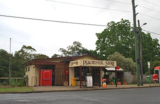
Peachester is a rural town and locality in the Sunshine Coast Region, Queensland, Australia. In the 2021 census, the locality of Peachester had a population of 1,460 people.

Maroochydore is a coastal suburb of the Sunshine Coast, Queensland, Australia, and is the central suburb and central business district of the Maroochydore urban centre. In the 2021 census, the suburb of Maroochydore had a population of 20,629 people.
McIlwraith is a rural locality in the Bundaberg Region, Queensland, Australia. In the 2021 census, McIlwraith had a population of 202 people.
Ilkley is a rural locality in the Sunshine Coast Region, Queensland, Australia. In the 2021 census, Ilkley had a population of 812 people.
Kureelpa is a rural locality in the Sunshine Coast Region, Queensland, Australia. In the 2021 census, Kureelpa had a population of 968 people.


