Kiamba, Queensland

Last updated

Kiamba
Queensland
Wappa Dam, Sunshine Coast Region, Queensland QUT-7244-3.jpg
Wappa Dam splling, 1964
Australia Queensland location map.svg
Red pog.svg
Kiamba
Coordinates 26°34′24″S152°54′34″E / 26.5733°S 152.9094°E / -26.5733; 152.9094 (Kiamba (centre of locality))
Population191 (2021) [1]
 • Density12.32/km2 (31.92/sq mi)
Postcode(s) 4560
Area15.5 km2 (6.0 sq mi)
Time zone AEST (UTC+10:00)
Location
LGA(s) Sunshine Coast Region
State electorate(s) Nicklin
Federal division(s) Fairfax
Suburbs around Kiamba:
Cooloolabin Cooloolabin Cooloolabin
Gheerulla Kiamba Yandina
Kulangoor
Gheerulla Kureelpa Image Flat

Kiamba is a rural locality in the Sunshine Coast Region, Queensland, Australia. [2] In the 2021 census, Kiamba had a population of 191 people. [1]

Contents

Geography

Wappa Falls, 2012 Falls - panoramio (6).jpg
Wappa Falls, 2012

The south branch of the Maroochy River forms much of the southern boundary before flowing to the north-east, where it enters the Wappa Dam ( 26°34′11″S152°55′13″E / 26.5697°S 152.9203°E / -26.5697; 152.9203 (Wappa Dam) ), also in the locality. [3] Rocky Creek enters from the north-west and flows east to join the South Maroochy above the dam. [4]

There are two waterfalls on the south Maroochy River:

History

Wappa Dam under construction, 1962 Wappa Dam under construction, Sunshine Coast Region, Queensland QUT-7245.jpg
Wappa Dam under construction, 1962

The name Kiamba is reportedly derived from an Aboriginal word Geyambin meaning Cockatoo . [2]

Kiamba State School opened on 28 April 1927 and closed on 28 August 1964. [7] It was on the western side of Kiamba Road (approx 26°34′24″S152°54′01″E / 26.57324°S 152.90027°E / -26.57324; 152.90027 (Kiamba State School (former)) ). [8]

In 1930, the residents of Kiamba purchased the Dulong-Kureelpa Public Hall to relocated to Kiamba using volunteer labour on land acquired from Messrs L and C Duhs. [9] The Kiamba Hall was officially opened on 4 October 1930. The building was 40 by 28 feet (12.2 by 8.5 m). The cost of buying the hall and the land was about £112. [10] [11]

Wappa Dam was built in 1963. The dam wall is 138 metres (453 ft) long and is a concrete gravity arch dam with earth abutments. [12]

Demographics

In the 2016 census, Kiamba had a population of 191 people. [13]

In the 2021 census, Kiamba had a population of 191 people. [1]

Education

There are no schools in Kiamba. The nearest government primary schools are Yandina State School in neighbouring Yandina to the east and Nambour State College (Junior School) in Nambour to the south-east. The nearest government secondary school is Nambour State College. [14]

Attractions

Jack Harrison Park (also known as Wappa Park) is on Wappa Park Road on the banks on the Wappa Dam ( 26°34′17″S152°55′21″E / 26.5714°S 152.9225°E / -26.5714; 152.9225 (Jack Harrison Park (Wappa Park)) ). It provides picnic and playground facilities. It provides good views of the dam when it is spilling and the Wappa Falls is a short walk away. [15]

Related Research Articles

<span class="mw-page-title-main">Nambour</span> Suburb of Sunshine Coast, Queensland, Australia

Nambour is a rural town and locality in the Sunshine Coast Region, Queensland, Australia. In the 2016 census, the locality of Nambour had a population of 11,187 people.

<span class="mw-page-title-main">Yandina, Queensland</span> Town in Queensland, Australia

Yandina is a rural town and locality in the Sunshine Coast Region, Queensland, Australia. IIn the 2021 census, the locality of Yandina had a population of 3,073 people.

Montville is a rural town and locality in the Sunshine Coast Region, Queensland, Australia. In the 2016 census, the locality of Montville had a population of 970 people.

<span class="mw-page-title-main">Woombye, Queensland</span> Town in Queensland, Australia

Woombye is a rural town and locality in the Sunshine Coast Region, Queensland, Australia. In the 2021 census, the locality of Woombye had a population of 3,944 people.

Eudlo is a rural town and locality in the Sunshine Coast Region, Queensland, Australia. In the 2016 census, the locality of Eudlo had a population of 1,117 people.

<span class="mw-page-title-main">Eerwah Vale, Queensland</span> Suburb of Sunshine Coast, Queensland, Australia

Eerwah Vale is a locality split between the Sunshine Coast Region and Shire of Noosa, both in Queensland, Australia. In the 2016 census Eerwah Vale had a population of 621 people.

Yandina Creek is a rural locality in the Sunshine Coast Region, Queensland, Australia. In the 2016 census, Yandina Creek had a population of 760 people.

North Arm is a rural town and locality in the Sunshine Coast Region, Queensland, Australia. In the 2021 census, the locality of North Arm had a population of 734 people.

<span class="mw-page-title-main">Maroochy River, Queensland</span> Suburb of Sunshine Coast Region, Queensland, Australia

Maroochy River is a rural hinterland locality in the Sunshine Coast Region, Queensland, Australia. In the 2016 census Maroochy River had a population of 1,531 people.

<span class="mw-page-title-main">Ninderry, Queensland</span> Town in Queensland, Australia

Ninderry is a rural town and locality in the Sunshine Coast Region, Queensland, Australia. In the 2016 census, the locality of Ninderry had a population of 1,087 people.

Valdora is a rural locality in the Sunshine Coast Region, Queensland, Australia. In the 2021 census, Valdora had a population of 776 people.

Kiels Mountain is a rural locality in the Sunshine Coast Region, Queensland, Australia. In the 2016 census, Kiels Mountain had a population of 664 people.

<span class="mw-page-title-main">Wappa Dam</span> Dam in South East Queensland

The Wappa Dam is a mass concrete gravity arch dam with earth-fill abutments and an un-gated spillway across the South Maroochy River that is located in the South East region of Queensland, Australia. The main purpose of the dam is for supply of potable water for the Sunshine Coast region. The impounded reservoir is also called Wappa Dam. The dam and most of the reservoir are within Kiamba with the most northerly part of the reservoir in Cooloolabin, both in the Sunshine Coast Region.

<span class="mw-page-title-main">Maroochy River</span> River in Queensland, Australia

The Maroochy River is a river in South East Queensland, Australia. The river rises from the eastern slopes of the Blackall Range and flows east through Eumundi before entering the sea at Cotton Tree, Maroochydore. Other populated centres in the catchment include Nambour, Eudlo, Yandina and Coolum.

Cooloolabin is a rural locality in the Sunshine Coast Region, Queensland, Australia. In the 2016 census Cooloolabin had a population of 257 people.

<span class="mw-page-title-main">Kulangoor, Queensland</span> Suburb of Sunshine Coast Region, Queensland, Australia

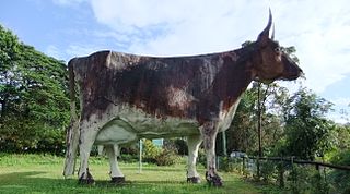
Kulangoor is a locality in the Sunshine Coast Region, Queensland, Australia. It was known as the home of The Big Cow for many years. In the 2021 census, Kulangoor had a population of 455 people.

Kureelpa is a rural locality in the Sunshine Coast Region, Queensland, Australia. In the 2021 census, Kureelpa had a population of 968 people.

Bridges is a rural locality in the Sunshine Coast Region, Queensland, Australia. In the 2016 census Bridges had a population of 276 people.

Yandina–Coolum Road is a continuous 18.5-kilometre (11.5 mi) road route in the Sunshine Coast local government area of Queensland, Australia. The route is signed as State Route 11. It is a state-controlled district road, rated as a local road of regional significance (LRRS).

References

  1. 1 2 3 Australian Bureau of Statistics (28 June 2022). "Kiamba (SAL)". 2021 Census QuickStats. Retrieved 28 February 2023. OOjs UI icon edit-ltr-progressive.svg
  2. 1 2 "Kiamba – locality in Sunshine Coast Region (entry 48698)". Queensland Place Names. Queensland Government . Retrieved 2 October 2023.
  3. "Wappa Dam – reservoir in the Sunshine Coast Region (entry 36485)". Queensland Place Names. Queensland Government . Retrieved 20 March 2024.
  4. Google (20 August 2021). "Kiamba, Queensland" (Map). Google Maps . Google. Retrieved 20 August 2021.
  5. "Kiamba Falls – waterfall in Sunshine Coast Regional (entry 18060)". Queensland Place Names. Queensland Government . Retrieved 2 October 2023.
  6. "Wappa Falls – waterfall in Sunshine Coast Regional (entry 47630)". Queensland Place Names. Queensland Government . Retrieved 2 October 2023.
  7. Queensland Family History Society (2010), Queensland schools past and present (Version 1.01 ed.), Queensland Family History Society, ISBN   978-1-921171-26-0
  8. "Nambour". Queensland Government (Map). 1942. Archived from the original on 21 August 2023. Retrieved 20 March 2024.
  9. "YANDINA". The Brisbane Courier . No. 22, 622. Queensland, Australia. 31 July 1930. p. 10. Retrieved 20 March 2024 via National Library of Australia.
  10. "Advertising". Nambour Chronicle And North Coast Advertiser . Vol. XXVII, no. 1373. Queensland, Australia. 26 September 1930. p. 2. Retrieved 20 March 2024 via National Library of Australia.
  11. "FERTILE AREA". Nambour Chronicle And North Coast Advertiser . Vol. XXVII, no. 1375. Queensland, Australia. 10 October 1930. p. 5. Retrieved 20 March 2024 via National Library of Australia.
  12. "Wappa". Seqwater. Archived from the original on 10 November 2023. Retrieved 19 March 2024.
  13. Australian Bureau of Statistics (27 June 2017). "Kiamba (SSC)". 2016 Census QuickStats. Retrieved 20 October 2018. OOjs UI icon edit-ltr-progressive.svg
  14. "Layers: Locality; Schools and school catchments". Queensland Globe. Queensland Government. Archived from the original on 19 December 2017. Retrieved 19 March 2024.
  15. "Wappa Dam and Falls". Adventure Sunshine Coast. Archived from the original on 16 March 2024. Retrieved 19 March 2024.

Further reading