
Caloundra is a coastal town in the Sunshine Coast Region, Queensland, Australia.

Mooloolah Valley is a rural locality in the Sunshine Coast Region, Queensland, Australia. In the 2021 census, Mooloolah Valley had a population of 3,629 people.

Landsborough is a town and a locality in the Sunshine Coast Region, Queensland, Australia. In the 2021 census, the locality of Landsborough had a population of 4,446 people.
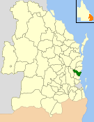
The City of Caloundra was a local government area about 90 kilometres (56 mi) north of Brisbane in the Sunshine Coast region of South East Queensland, Australia. The shire covered an area of 1,093.1 square kilometres (422.0 sq mi); it existed as a local government entity from 1912 until 2008, when it amalgamated with councils further north to form the Sunshine Coast Region.
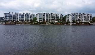
Birtinya is a suburb of Kawana Waters in the Sunshine Coast Region, Queensland, Australia. In the 2021 census, Birtinya had a population of 4,378 people.

Little Mountain is a suburb of Caloundra in the Sunshine Coast Region, Queensland, Australia. In the 2021 census, Little Mountain had a population of 11,068 people.
Glenview is a rural locality in the Sunshine Coast Region, Queensland, Australia. In the 2021 census, Glenview had a population of 1,396 people.

Caloundra is a coastal suburb and the central business district of the town of Caloundra in the Sunshine Coast Region, Queensland, Australia. In the 2021 census, the suburb of Caloundra had a population of 3,932 people.
Battery Hill is a suburb of Caloundra in the Sunshine Coast Region, Queensland, Australia. In the 2021 census, Battery Hill had a population of 2,596 people.
Bells Creek is a rural locality in the Sunshine Coast Region, Queensland, Australia. In the 2021 census, Bells Creek had a population of 343 people.
Caloundra West is a mixed-use suburb of Caloundra in the Sunshine Coast Region, Queensland, Australia. In the 2021 census, Caloundra West had a population of 7,270 people.
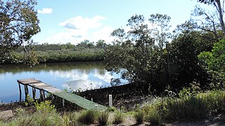
Coochin Creek is a coastal locality in the south of the Sunshine Coast Region, Queensland, Australia. The locality is named for the creek which flows through it.
Ilkley is a rural locality in the Sunshine Coast Region, Queensland, Australia. In the 2021 census, Ilkley had a population of 812 people.
Banya is a new rural locality in the Sunshine Coast Region, Queensland, Australia. It is intended to accommodate future suburban growth.
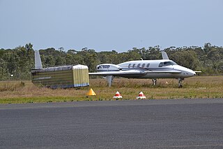
Corbould Park is a locality in the Sunshine Coast Region, Queensland, Australia. In the 2021 census, Corbould Park had "no people or a very low population".
Gagalba is a rural locality in the Sunshine Coast Region, Queensland, Australia.

Nirimba is a developing locality in the Sunshine Coast Region, Queensland, Australia. It was created in 2019. In the 2021 census, Nirimba had a population of 2,229 people.
Glass House Mountains Road is a continuous 30.4-kilometre (18.9 mi) road route in the Moreton Bay and Sunshine Coast local government areas of Queensland, Australia. Part of it is designated as part of State Route 6. It is a state-controlled road, part regional and part district.
Caloundra Road is a continuous 9.3-kilometre (5.8 mi) road route in the Sunshine Coast local government area of Queensland, Australia. Most of it is designated as part of State Route 6. It is a state-controlled district road, part of which is rated as a local road of regional significance (LRRS).


