Shelly Beach, Queensland (Sunshine Coast)

Last updated

Shelly Beach
Caloundra,  Queensland
Albert Street in Shelley Beach, Queensland.jpg
Albert Street, 2021
Australia Queensland location map.svg
Red pog.svg
Shelly Beach
Coordinates 26°47′47″S153°08′45″E / 26.7963°S 153.1458°E / -26.7963; 153.1458 (Shelly Beach (centre of suburb))
Population925 (2021 census) [1]
 • Density1,850/km2 (4,800/sq mi)
Postcode(s) 4551 [2]
Area0.5 km2 (0.2 sq mi)
Time zone AEST (UTC+10:00)
Location
LGA(s) Sunshine Coast Region
County Canning
Parish Bribie
State electorate(s) Caloundra
Federal division(s) Fisher
Suburbs around Shelly Beach:
Moffat Beach Moffat Beach Coral Sea
Moffat Beach Shelly Beach Coral Sea
Kings Beach Kings Beach Coral Sea

Shelly Beach is a coastal suburb of Caloundra in the Sunshine Coast Region, Queensland, Australia. [3] In the 2021 census, Shelly Beach had a population of 925 people. [1]

Contents

Geography

Foot bridge at Shelly Beach connecting to neighbouring Moffat Beach Bridge Across Waterway - panoramio.jpg
Foot bridge at Shelly Beach connecting to neighbouring Moffat Beach

The suburb presumably takes its name from the beach known as Shelly Beach ( 26°47′47″S153°08′54″E / 26.7964°S 153.1484°E / -26.7964; 153.1484 (Shelly Beach (beach)) ) along the suburb's coastline. [4] [5]

History

Our Lady of the Rosary Catholic School opened on 29 January 1980 by the Sisters of St Joseph, but is now under lay leadership. [6] [7]

Demographics

In the 2016 census, Shelly Beach had a population of 854 people. [8]

In the 2021 census, Shelly Beach had a population of 925 people. [1]

Education

Our Lady of the Rosary School is a Catholic primary (Prep-6) school for boys and girls at Alfred Street ( 26°47′50″S153°08′37″E / 26.7972°S 153.1437°E / -26.7972; 153.1437 (Our Lady of the Rosary School) ). [9] [10] In 2018, the school had an enrolment of 334 students with 23 teachers (20 full-time equivalent) and 15 non-teaching staff (10 full-time equivalent). [11]

There are no government schools in Shelly Beach. The nearest government primary and secondary schools are Caloundra State School and Caloundra State High School, both in Caloundra CBD to the west. [12]

Related Research Articles

<span class="mw-page-title-main">Peregian Beach</span> Town in Queensland, Australia

Peregian Beach is a beach and small coastal town on the Sunshine Coast, Queensland, Australia. It is a suburb split between two local government areas with the eastern coastal in the Shire of Noosa and the western hinterland part in the Sunshine Coast Region. In the 2021 census, the suburb of Peregian Beach had a population of 4,972 people.

<span class="mw-page-title-main">Noosa Heads, Queensland</span> Town in Queensland, Australia

Noosa Heads is a coastal town and suburb in the Shire of Noosa, Queensland, Australia. In the 2021 census, the suburb of Noosa Heads had a population of 5,120 people. It is a popular holiday destination.

<span class="mw-page-title-main">Caloundra</span> Town in Queensland, Australia

Caloundra is a coastal town in the Sunshine Coast Region, Queensland, Australia.

<span class="mw-page-title-main">Coolum Beach, Queensland</span> Town in Queensland, Australia

Coolum Beach is a beachside town and coastal suburb in the Sunshine Coast Region, Queensland, Australia.In the 2021 census, the suburb of Coolum Beach had a population of 9,152 people.

<span class="mw-page-title-main">Sunshine Beach, Queensland</span> Town in Queensland, Australia

Sunshine Beach is a coastal town and suburb in the Shire of Noosa, Queensland, Australia. In the 2021 census, the suburb of Sunshine Beach had a population of 2,480 people.

<span class="mw-page-title-main">Castaways Beach, Queensland</span> Suburb of Noosa, Queensland, Australia

Castaways Beach is a coastal suburb in the Shire of Noosa, Queensland, Australia. It is located 7 kilometres (4 mi) south of Noosa Heads. In the 2021 census, Castaways Beach had a population of 683 people.

Marcus Beach is a coastal suburb in the Shire of Noosa, Queensland, Australia. In the 2021 census, Marcus Beach had a population of 839 people.

<span class="mw-page-title-main">Dicky Beach, Queensland</span> Suburb of Caloundra, Queensland, Australia

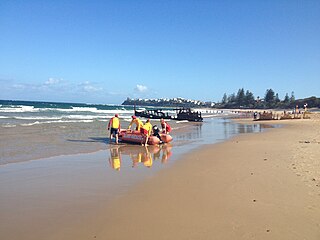
Dicky Beach is both a beach and coastal suburb of Caloundra in the Sunshine Coast Region, Queensland, Australia. In the 2021 census, Dicky Beach had a population of 1,921 people.

<span class="mw-page-title-main">Mount Coolum, Queensland</span> Suburb of Sunshine Coast, Queensland, Australia

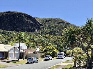
Mount Coolum is a coastal suburb in the Sunshine Coast Region, Queensland, Australia. In the 2021 census, Mount Coolum had a population of 4,545 people.

<span class="mw-page-title-main">Twin Waters, Queensland</span> Suburb of Maroochydore, Queensland, Australia

Twin Waters is a coastal suburb of Maroochydore in the Sunshine Coast Region, Queensland, Australia. In the 2021 census, Twin Waters had a population of 2,966 people.

<span class="mw-page-title-main">Yaroomba, Queensland</span> Suburb of Sunshine Coast, Queensland, Australia

Yaroomba is a coastal suburb in the Sunshine Coast Region, Queensland, Australia. In the 2021 census, Yaroomba had a population of 2,043 people.

<span class="mw-page-title-main">Point Arkwright, Queensland</span> Suburb of Sunshine Coast, Queensland, Australia

Point Arkwright is a coastal suburb in the Sunshine Coast Region, Queensland, Australia. In the 2021 census, Point Arkwright had a population of 309 people.

Aroona is a suburb of Caloundra in the Sunshine Coast Region, Queensland, Australia. In the 2021 census, Aroona had a population of 3,466 people.

<span class="mw-page-title-main">Golden Beach, Queensland</span> Suburb of Caloundra, Queensland, Australia

Golden Beach is a coastal suburb of Caloundra in the Sunshine Coast Region, Queensland, Australia. It is located within the Caloundra urban centre directly southwest of the Caloundra CBD. In the 2021 census, Golden Beach had a population of 5,646 people.

Glenview is a rural locality in the Sunshine Coast Region, Queensland, Australia. In the 2021 census, Glenview had a population of 1,396 people.

<span class="mw-page-title-main">Caloundra (suburb)</span> Suburb of Sunshine Coast, Queensland, Australia

Caloundra is a coastal suburb and the central business district of the town of Caloundra in the Sunshine Coast Region, Queensland, Australia. In the 2021 census, the suburb of Caloundra had a population of 3,932 people.

Battery Hill is a suburb of Caloundra in the Sunshine Coast Region, Queensland, Australia. In the 2021 census, Battery Hill had a population of 2,596 people.

<span class="mw-page-title-main">Caloundra West, Queensland</span> Suburb of Caloundra, Queensland, Australia

Caloundra West is a mixed-use suburb of Caloundra in the Sunshine Coast Region, Queensland, Australia. In the 2021 census, Caloundra West had a population of 7,270 people.

<span class="mw-page-title-main">Pelican Waters, Queensland</span> Suburb of Caloundra, Queensland, Australia

Pelican Waters is a suburb of Caloundra in the Sunshine Coast Region, Queensland, Australia. In the 2021 census, Pelican Waters had a population of 7,393 people.
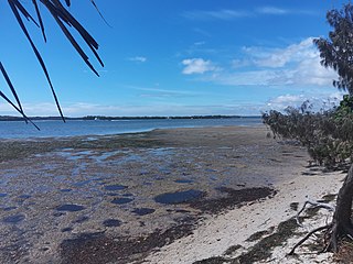
<span class="mw-page-title-main">Currumbin Waters, Queensland</span> Suburb of Gold Coast City, Queensland, Australia

Currumbin Waters is a suburb in the City of Gold Coast, Queensland, Australia. It borders New South Wales. In the 2021 census, Currumbin Waters had a population of 9,797 people.

References

  1. 1 2 3 Australian Bureau of Statistics (28 June 2022). "Shelly Beach (SAL)". 2021 Census QuickStats. Retrieved 28 February 2023. OOjs UI icon edit-ltr-progressive.svg
  2. "Shelly Beach Postcode (QLD)". Archived from the original on 3 August 2013. Retrieved 17 January 2013.
  3. "Shelly Beach – suburb in Sunshine Coast Region (entry 48866)". Queensland Place Names. Queensland Government . Retrieved 14 February 2022.
  4. "Mountain ranges beaches and sea passages – Queensland". Queensland Open Data. Queensland Government. 12 November 2020. Archived from the original on 25 November 2020. Retrieved 25 November 2020.
  5. "Shelly Beach – beach in the Sunshine Coast Region (entry 30693)". Queensland Place Names. Queensland Government . Retrieved 28 February 2022.
  6. Queensland Family History Society (2010), Queensland schools past and present (Version 1.01 ed.), Queensland Family History Society, ISBN   978-1-921171-26-0
  7. "Principal's welcome". Our Lady of the Rosary School. Archived from the original on 14 June 2021. Retrieved 28 February 2022.
  8. Australian Bureau of Statistics (27 June 2017). "Shelly Beach (SSC)". 2016 Census QuickStats. Retrieved 20 October 2018. OOjs UI icon edit-ltr-progressive.svg
  9. "State and non-state school details". Queensland Government. 9 July 2018. Archived from the original on 21 November 2018. Retrieved 21 November 2018.
  10. "Our Lady of the Rosary School". Our Lady of the Rosary School. Archived from the original on 31 December 2021. Retrieved 28 February 2022.
  11. "ACARA School Profile 2018". Australian Curriculum, Assessment and Reporting Authority. Archived from the original on 27 August 2020. Retrieved 28 January 2020.
  12. "Queensland Globe". State of Queensland . Retrieved 28 February 2022.