
The Bruce Highway is a major highway in Queensland, Australia. Commencing in the state capital, Brisbane, it passes through areas close to the eastern coast on its way to Cairns in Far North Queensland. The route is part of the Australian National Highway and also part of Highway 1, the longest highway route in Australia. Its length is approximately 1,679 kilometres (1,043 mi); it is entirely sealed with bitumen. The highway is named after a popular former Queensland and federal politician, Harry Bruce. Bruce was the state Minister for Works in the mid-1930s when the highway was named after him. The highway once passed through Brisbane, but was truncated at Bald Hills when the Gateway Motorway became National Highway 1 upon its opening in December 1986.

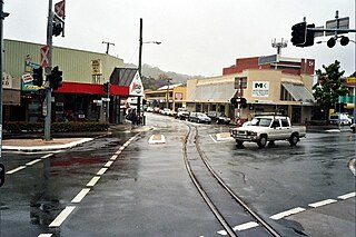
Nambour is a rural town and locality in the Sunshine Coast Region, Queensland, Australia. In the 2021 census, the locality of Nambour had a population of 12,145 people.

Yandina is a rural town and locality in the Sunshine Coast Region, Queensland, Australia. In the 2021 census, the locality of Yandina had a population of 3,073 people.

Maroochydore is a coastal town in the Sunshine Coast Region, Queensland, Australia. In the 2021 census, the urban area of Maroochydore had a population of 63,673 people.

Bli Bli is a rural town and locality in the Sunshine Coast Region, Queensland, Australia. In the 2021 census, the locality of Bli Bli had a population of 10,138 people.

Mapleton is a rural town and locality in the Sunshine Coast Region, Queensland, Australia. In the 2021 census, the locality of Mapleton had a population of 1,661 people.

Woombye is a rural town and locality in the Sunshine Coast Region, Queensland, Australia. In the 2021 census, the locality of Woombye had a population of 3,944 people.
Eudlo is a rural town and locality in the Sunshine Coast Region, Queensland, Australia. In the 2021 census, the locality of Eudlo had a population of 1,192 people.
Diddillibah is a semi-rural locality in the Sunshine Coast Region, Queensland, Australia. In the 2021 census, Diddillibah had a population of 1,703 people.
Valdora is a rural locality in the Sunshine Coast Region, Queensland, Australia. In the 2021 census, Valdora had a population of 776 people.
West Woombye is a rural residential locality in the Sunshine Coast Region, Queensland, Australia. In the 2021 census, West Woombye had a population of 1,083 people.
Chevallum is a rural locality in the Sunshine Coast Region, Queensland, Australia. In the 2016 census, Chevallum had a population of 441 people. In the 2021 census, Chevallum had a population of 467 people.
Kiels Mountain is a rural locality in the Sunshine Coast Region, Queensland, Australia. In the 2021 census, Kiels Mountain had a population of 714 people.
Landers Shoot is a rural locality in the Sunshine Coast Region, Queensland, Australia. In the 2021 census, Landers Shoot had a population of 308 people.
Hunchy is a rural locality in the Sunshine Coast, Queensland, Australia. In the 2021 census, Hunchy had a population of 592 people.
Kurwongbah is a rural locality in the City of Moreton Bay, Queensland, Australia. In the 2021 census, Kurwongbah had a population of 1,552 people.
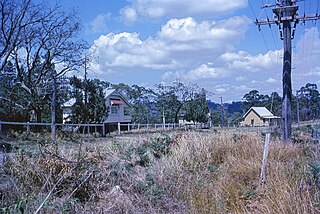
Moreton Central Sugar Mill Cane Tramway is a heritage-listed tramway at Mill Street, Currie Street, and Howard Street, in Nambour, Sunshine Coast Region, Queensland, Australia. It was built c. 1897. It was added to the Queensland Heritage Register on 7 February 2005.

Kiamba is a rural locality in the Sunshine Coast Region, Queensland, Australia. In the 2021 census, Kiamba had a population of 191 people.
Nambour–Bli Bli Road is a continuous 8.1-kilometre (5.0 mi) road route in the Sunshine Coast local government area of Queensland, Australia. It is signed as State Route 10. It is a state-controlled district road, rated as a local road of regional significance (LRRS).
