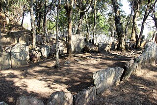
Lunglei, formerly known as Lungleh, is the second-largest town in Mizoram, northeastern India, situated in the south-central part of the state. The town served as the capital of British South Lushai Hills from 1889 to 1898. It is situated 729 metres above sea level and is situated on a ridge surrounded by hills. Lunglei has an estimated population of 80,000 residents as of 2023.
Bairabi is a census town in Kolasib district in the state of Mizoram, India.

Lengpui Airport is a domestic airport serving Aizawl, the capital of Mizoram, India. Located in Lengpui within the Mamit district, the airport lies approximately 32 km north of Aizawl. It offers flights connecting to Delhi, Kolkata, Guwahati, Imphal and Silchar. Notably, Lengpui Airport is the first in India to be constructed by a State Government. The airport is also known as Aizawl Airport or Aizawl–Lengpui Airport, reflecting its role in serving Aizawl.

Mamit district is one of the eleven districts of Mizoram state in India.

Serchhip district is one of the eleven districts of Mizoram state in India. The district occupies an area of 1421.60 km2. Serchhip town is the administrative headquarters of the district. This district came into existence on 15 September 1998, being carved out of the larger Aizawl District. Because of the way it was created it includes part of East Lungdar Tehsil and part of Thingsulthliah Tehsil.
Zote is a village in Champhai block of Champhai District, Mizoram state, India.

Mizo Zirlai Pawl is a Mizo multinational student organization and apex students body in Mizoram state. Established on 27 October 1935 in Shillong by Mizo earlier educated students. Originally as the Lushai Students Association (LSA), which was later replaced with the "Mizo Zirlai Pawl" on 1 September 1946. As Mizoram State government notified MZP raising day 27 October was observed as "Zirlaite Ni" from 2008 in Mizoram. It was registered as SR No. 35 of 1969–70 under Indian Societies Registration Act. Its general headquarters is in the state capital of Mizoram, Aizawl. And it has 12 headquarters inside and outside of Mizoram state, such as Churachandpur, Behliangchhip, and in Mizoram state - Serchhip, Biate, Champhai, Darlawn, Kolasib, Mamit, Zawlnuam, Saitual, Lunglei and Khawzawl. It has 50 Sub-Headquarters and many branches.

Education in Mizoram consists of a diverse array of formal education systems ranging from elementary to university, from training institution to technical courses. The Government of India imposes mandatory education at least up to the basic level. For this public schools are made free of fees, and provided with free textbooks and school lunch.
Mizoram is a land of rolling hills, valleys, rivers, and lakes in Northeast India. As many as 21 major hill ranges or peaks of different heights run through the length and breadth of the state, with plains scattered here and there. The average height of the hills to the west of the state is about 1,000 metres. These gradually rise to 1,300 metres to the east. Some areas, however, have higher ranges which go up to a height of over 2,000 metres.
The Mizoram College Teachers' Association (MCTA) is a governmental, non-political and non-profit organisation for college teachers under the Government of Mizoram, India. It was established by a conference of college teachers on 7 September 1979 at Aizawl, which became its headquarters. The organisation is recognised by the Government of Mizoram, and consists of 21 government colleges and 1 grant-in-aid college.

Mizoram is a state in the northeast of India. Mizoram is considered by many as a beautiful place due to its landscape and pleasant climate. There have been many attempts to increase revenue through tourism but many potential tourists find the lack of amenities to be a hurdle. However, the State continues to promote itself and many projects have been initiated. The tourism ministry continues to maintain or upgrade its tourist lodges throughout the state. Foreign tourists are required to obtain an 'inner line permit' under the special permit before visiting. The permit can be obtained from Indian missions abroad for a limited number of days or direct from Mizoram Government authorities within India. The state is rich in bird diversity, which has the potentiality to make it a major birding destination. Mizoram is a stronghold for Mrs. Hume's pheasant. There is also a rare record of the wild water buffalo from the state. There are several past records of the Sumatran rhinoceros from Mizoram, then Lushai Hills. The small population of wild elephants can be seen in Ngengpui and Dampa Sanctuaries.
Place names in India are usually in Indian languages. Other languages include Portuguese, Dutch, English and Arabic.
Bairabi railway station serves Bairabi city in Kolasib district, Mizoram. Its code is BHRB. The station consists of 3 platforms. Bairabi is one of the railhead of Mizoram and connected with a broad-gauge line. The 84.25 km broad-gauge railway line from Katakhal Junction to Bairabi, was completed on 21 March 2016.
Sports in Mizoram plays an important part of the culture of Mizoram and it plays a key role in development of the state. Football, Basketball and Volleyball are the more popular sports in the Indian state of Mizoram
The Mizoram Co-operative Apex Bank or Mizoram Apex Bank is an Indian co-operative banking company headquartered in Aizawl. It was incorporated in 1982 as an urban cooperative bank.

Aizawl, formerly known as Aijal, is the capital city and the most populous city of Mizoram, India. It is also the third largest city in northeast India. It is situated atop a series of ridges, with an average elevation of around 1,132 metres above sea level. In 2024, the city has an estimated population of 415,000 people.
Hnahthial district is one of the eleven districts of Mizoram state in India. The creation of Hnahthial District was first notified on 12 September 2008 but until 2020, it remained non-functional despite a number of promises made by top political leaders and an all-out effort by Hnahthial District Function Demand Committee to let the state government make it functional. Hnahthial district was made functional only 12 years later on 3 June 2019 with the creation of the office of the Deputy Commissioner.
Islam is Mizoram's fourth largest religion. With 14,832 followers, it constituted 1.35% of the population in 2011. The Aijal Mosque, established in 1909, is the only mosque in Aizawl and the oldest mosque in Mizoram.


