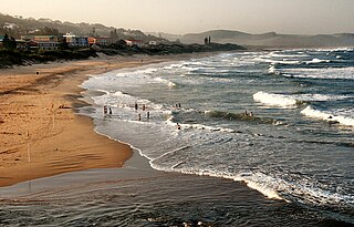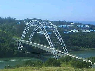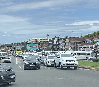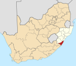
Margate is a coastal resort town in the KwaZulu-Natal province, about 20 kilometres south-west of Port Shepstone and 127 kilometres south-west of Durban. The river which flows into the sea at Margate is called "Nkhongweni" (place of entreaty) as the original inhabitants of the area were reputed to be so mean resulting in travellers begging for hospitality.

Port Shepstone is a large town situated on the mouth of the Mzimkhulu River, the largest river on the KwaZulu-Natal South Coast of South Africa. It is located halfway between Hibberdene and Margate and is positioned 120 km south of Durban. It serves as the administrative, educational, industrial and commercial centre for southern Natal.

Scottburgh is a coastal resort town located along the south coast of KwaZulu-Natal, South Africa. It situated south of the mouth of the Mpambanyoni River (confuser of birds).

Port Edward is a small resort town situated on the south coast of KwaZulu-Natal in South Africa and lies on the border between KwaZulu-Natal and the Eastern Cape. It is situated on the R61 road between Port Shepstone and Lusikisiki.
Harding is a town situated in the Mzimkulwana River valley, Ugu District Municipality of KwaZulu-Natal, South Africa
Hibberdene is a small coastal town on the KwaZulu-Natal South Coast in South Africa, approximately 23 km north-east of Port Shepstone and 90 km south-west of Durban and halfway between coastal towns of Scottburgh and Margate.

Ramsgate is a village on the south coast of KwaZulu-Natal in South Africa, just southwest of Margate. Ramsgate is located on the mouth of a river known by the Zulu name Bilanhlolo for the bubbles caused by strong currents making it look like the water is boiling. In 1922, there was only one person living there, Paul Buck, a painter and violin maker and he called the place Blue Lagoon.
Umtentweni, also officially known as eMthenteni, is a small coastal resort on the South Coast of KwaZulu-Natal, South Africa, between the Mzimkulu River (the great home of all rivers) and the Mtentweni River. It forms part of the coastal town of Port Shepstone in the Ray Nkonyeni Local Municipality, KwaZulu-Natal, South Africa. It is a relatively clean and quiet residential resort; it has become an attractive destination for people aiming to get away from city life. Most of the village is filled with complexes, flats, bed and breakfasts and suburban-style houses. Twenty years ago the whole of Umtentweni consisted of a lot of greenery and wildlife. All this has changed due to the growing popularity of this small resort and the constant clearing for new housing.

The R61 is a long provincial route in South Africa that connects Beaufort West with Port Shepstone via Graaff-Reinet, Komani, Mthatha and Port Edward.

The R102 is a Regional Route in South Africa. It is the route designation for all old sections of the N2, thus it is a discontinuous road that resumes in areas where a new N2 has been constructed.

The N2 is a national route in South Africa that runs from Cape Town through George, Gqeberha, East London, Mthatha, Port Shepstone and Durban to Ermelo. It is the main highway along the Indian Ocean coast of the country. Its current length of 2,255 kilometres (1,401 mi) makes it the longest numbered route in South Africa.

The Ugu District Municipality is one of the 11 districts of the KwaZulu-Natal province of South Africa. Ugu is isiZulu for "coast". It governs the KZN South Coast and its seat is Port Shepstone. The majority of its 722,484 inhabitants spoke isiZulu as of 2011. The district code is DC21.
Marburg is a settlement in the Ugu District Municipality in the KwaZulu-Natal province of South Africa, situated approximately 112 kilometres south-west of the city of Durban. Marburg was a Norwegian settlement given the name Marburg for a nearby German mission. The Norwegian founders played a significant role in the development of Marburg and Port Shepstone, which it forms part of today. The British colonial government gave the settlers a free voyage to South Africa and also houses and 100 acres of land. Marburg was the only successful Scandinavian settlement in South Africa.
Izingolweni or eZinqoleni is a town in Ugu District Municipality in the KwaZulu-Natal province of South Africa. It was founded in the 1870s as a police and administration post. The name comes from the Zulu language word for "place with very shallow holes." Izingolweni also consists of a school called Izingolweni Primary which is rumored that it was built by the community. This very school is the center of excellence in the place. It is very exceptional and produces very fine learners each year.

Shelly Beach is a coastal resort town on the South Coast of the KwaZulu-Natal province of South Africa, located approximately halfway between Margate and Port Shepstone.

The KwaZulu-Natal South Coast is a region along the southern stretch of coastline of KwaZulu-Natal, South Africa, south of the coastal city of Durban.
Boboyi, or Bhobhoyi, is a peri-urban settlement in KwaZulu-Natal, South Africa. It is located 8 kilometres west of Port Shepstone and is named after the Boboyi River which runs through the area.
Oslo Beach is a small coastal village located along the South Coast of KwaZulu-Natal, South Africa and forms part of the coastal town of Port Shepstone.
Murchison is a peri-urban settlement in the Ugu District Municipality in KwaZulu-Natal, South Africa.

Izotsha is a small rural settlement on the South Coast of the KwaZulu-Natal province of South Africa, just inland from Shelly Beach and approximately 7 kilometres south-west of Port Shepstone. The name ‘Izotsha’ translates to 'it will burn’ in the Zulu language.


