Panuke Lake

Last updated
Panuke Lake
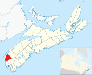
Location West Hants, Nova Scotia
Coordinates 44°47′33.9″N64°6′46.9″W / 44.792750°N 64.113028°W / 44.792750; -64.113028 Coordinates: 44°47′33.9″N64°6′46.9″W / 44.792750°N 64.113028°W / 44.792750; -64.113028
Basin  countriesCanada

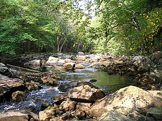
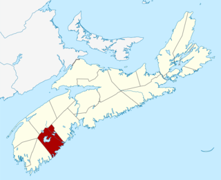
Panuke Lake is a lake of West Hants, in Nova Scotia, Canada.
Nova Scotia Province of Canada

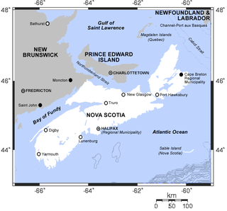
Nova Scotia is one of Canada's three Maritime Provinces, and one of the four provinces that form Atlantic Canada. Its provincial capital is Halifax. Nova Scotia is the second-smallest of Canada's ten provinces, with an area of 55,284 square kilometres (21,300 sq mi), including Cape Breton and another 3,800 coastal islands. As of 2016, the population was 923,598. Nova Scotia is Canada's second-most-densely populated province, after Prince Edward Island, with 17.4 inhabitants per square kilometre (45/sq mi).

Canada Country in North America

Canada is a country in the northern part of North America. Its ten provinces and three territories extend from the Atlantic to the Pacific and northward into the Arctic Ocean, covering 9.98 million square kilometres, making it the world's second-largest country by total area. Canada's southern border with the United States, stretching some 8,891 kilometres (5,525 mi), is the world's longest bi-national land border. Its capital is Ottawa, and its three largest metropolitan areas are Toronto, Montreal, and Vancouver. As a whole, Canada is sparsely populated, the majority of its land area being dominated by forest and tundra. Consequently, its population is highly urbanized, with over 80 percent of its inhabitants concentrated in large and medium-sized cities, with 70% of citizens residing within 100 kilometres (62 mi) of the southern border. Canada's climate varies widely across its vast area, ranging from arctic weather in the north, to hot summers in the southern regions, with four distinct seasons.
See also

There is a hydro-electric dam at the north end of the lake.

Related Research Articles

Guysborough County, Nova Scotia County in Nova Scotia, Canada

Guysborough County is a county in the Canadian province of Nova Scotia.

Queens County, Nova Scotia County in Nova Scotia, Canada

Queens County is a county in the Canadian province of Nova Scotia.

Kejimkujik National Park National park in Canada

Kejimkujik National Park is a National Park of Canada, covering 404 km2 (156 sq mi) in the southwest of Nova Scotia peninsula. It consists of two separate land areas: an inland part, which is coincident with the Kejimkujik National Historic Site of Canada, and the Kejimujik National Park Seaside on the Atlantic coast.

Municipality of the District of Clare District municipality in Nova Scotia, Canada

Clare, officially named the Municipality of the District of Clare, is a district municipality in western Nova Scotia, Canada. Statistics Canada classifies the district municipality as a municipal district.

Dalem Lake Provincial Park provincial park in Nova Scotia

Dalem Lake Provincial Park is a provincial park located in the Canadian province of Nova Scotia on Boularderie Island.

Cole Harbour-Eastern Passage

Cole Harbour—Eastern Passage is a provincial electoral district in Nova Scotia, Canada, that elects one member of the Nova Scotia House of Assembly.

Victoria-The Lakes provincial electoral district in Nova Scotia, Canada

Victoria—The Lakes is a provincial electoral district in Nova Scotia, Canada, that elects one member of the Nova Scotia House of Assembly.

Lake Echo, Nova Scotia Community in Nova Scotia, Canada

Lake Echo is an unincorporated suburban community that is part of the Halifax Regional Municipality in Nova Scotia, Canada; approximately 15 kilometres east of Dartmouth.

Route 328 is a short collector road in the Canadian province of Nova Scotia.

Municipality of the District of Yarmouth District municipality in Nova Scotia, Canada

Yarmouth, officially named the Municipality of the District of Yarmouth, is a district municipality in Yarmouth County, Nova Scotia, Canada. Statistics Canada classifies the district municipality as a municipal district.

Route 318 is a collector road in the Canadian province of Nova Scotia.

Scouting and Guiding in Nova Scotia

Scouting in Nova Scotia has a long history, from the 1900s to the present day, serving thousands of youth in programs that suit the environment in which they live.

Cape Breton The Lakes was a provincial electoral district in Nova Scotia, Canada, that elected one member of the Nova Scotia House of Assembly.

Liscomb Game Sanctuary

Liscomb Game Sanctuary is a conservation area that straddles the border of Halifax Regional Municipality and Guysborough County in the Canadian province of Nova Scotia. Nova Scotia Route 374 runs north-south through the sanctuary. Within the sanctuary are two nature reserves and parts of two wilderness areas.

Black Lake (Nova Scotia) various lakes in Nova Scotia, Canada

There are various Black Lakes in Nova Scotia, Canada. They vary widely in size, depth and usability. Many counties, such as Cumberland, Halifax, Inverness, and Pictou Counties have more than one Black Lake so named, while other counties mentioned in this article have only one named Black Lake.

Kidston Island Lighthouse lighthouse in Nova Scotia, Canada

The Kidston Island Lighthouse is a lighthouse on Kidston Island, located in the Bras d'Or lakes, in Baddeck, Nova Scotia. The original lighthouse on Kidston Island was built in 1875. The present lighthouse was built in 1912 and the two stood side-by-side for some time. The lighthouse can only be accessed by boat; a ferry operates during the summer months.

Clayton Park West (electoral district)

Clayton Park West is a provincial electoral district in Nova Scotia, Canada, that elects one member of the Nova Scotia House of Assembly.

Outline of Nova Scotia Overview of and topical guide to Nova Scotia

The following outline is provided as an overview of and topical guide to Nova Scotia:

References