Paxville, South Carolina

Last updated

Paxville, South Carolina
Paxville SC.jpg
SCMap-doton-Paxville.PNG
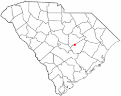
Location of Paxville, South Carolina
Coordinates: 33°44′11″N80°21′27″W / 33.73639°N 80.35750°W / 33.73639; -80.35750
Country United States
State South Carolina
County Clarendon
Area
[1]
  Total1.05 sq mi (2.72 km2)
  Land1.05 sq mi (2.72 km2)
  Water0.00 sq mi (0.00 km2)
Elevation
184 ft (56 m)
Population
 (2020) [2]
  Total232
  Density220.74/sq mi (85.27/km2)
Time zone UTC-5 (Eastern (EST))
  Summer (DST) UTC-4 (EDT)
ZIP code
29102
Area code(s) 803, 839
FIPS code 45-55060 [3]
GNIS feature ID1250042 [4]

Paxville is a town in Clarendon County, South Carolina, United States. The population was 185 at the 2010 census, [5] down from 248 in 2000. The town was named after Joseph Pack.

Contents

Joseph Pack and his wife, Louisa Alexandria Pack, arrived in America from England in the year 1770. He became one of the most extensive land holders in the Carolina Low Country, having acquired more than 10,000 acres (4,000 ha) of land. He helped found the town of Packsville (later renamed Paxville in 1902). Paxville is believed to be the oldest town in Clarendon County.

Some of the land grants given to Joseph Pack were from King George III of the United Kingdom, while others were from the state of South Carolina. Some of the land grants in Paxville may have been given to Joseph as a result of his Revolutionary War service. There is a marker honoring Joseph Pack's service with the South Carolina Militia during the Revolutionary War.

Joseph and Louisa raised a family of six boys and six girls. Joseph Pack died in 1827 and his wife Louisa followed in 1832. Joseph Pack is buried in the Paxville Cemetery. [6]

Geography

Paxville is located in western Clarendon County at 33°44′11″N80°21′27″W / 33.736431°N 80.357497°W / 33.736431; -80.357497 . [7] U.S. Route 15 passes through the town, leading north 14 miles (23 km) to Sumter and south 9 miles (14 km) to Summerton. South Carolina Highway 261 crosses US 15 in the center of town and leads west 6 miles (10 km) to Pinewood and east 9 miles (14 km) to Manning, the county seat.

According to the United States Census Bureau, the town has a total area of 1.0 square mile (2.7 km2), all land. [5]

Demographics

Historical population
CensusPop.Note
1910 175
1920 1855.7%
1930 170−8.1%
1940 19414.1%
1950 2087.2%
1960 2163.8%
1970 26120.8%
1980 244−6.5%
1990 218−10.7%
2000 24813.8%
2010 185−25.4%
2020 23225.4%
U.S. Decennial Census [8] [2]

As of the census [3] of 2000, there were 248 people, 100 households, and 73 families residing in the town. The population density was 236.8 inhabitants per square mile (91.4/km2). There were 110 housing units at an average density of 105.0 per square mile (40.5/km2). The racial makeup of the town was 64.92% White, 33.87% African American, 0.40% from other races, and 0.81% from two or more races.

There were 100 households, out of which 32.0% had children under the age of 18 living with them, 53.0% were married couples living together, 19.0% had a female householder with no husband present, and 27.0% were non-families. 26.0% of all households were made up of individuals, and 14.0% had someone living alone who was 65 years of age or older. The average household size was 2.48 and the average family size was 2.93.

In the town, the population was spread out, with 24.2% under the age of 18, 6.5% from 18 to 24, 27.4% from 25 to 44, 25.4% from 45 to 64, and 16.5% who were 65 years of age or older. The median age was 40 years. For every 100 females, there were 90.8 males. For every 100 females age 18 and over, there were 82.5 males.

The median income for a household in the town was $28,438, and the median income for a family was $37,500. Males had a median income of $26,094 versus $22,917 for females. The per capita income for the town was $16,390. About 9.4% of families and 20.4% of the population were below the poverty line, including 34.3% of those under the age of eighteen and 22.4% of those 65 or over.

Related Research Articles

<span class="mw-page-title-main">Lee County, South Carolina</span> County in South Carolina, United States

Lee County is a county located in the U.S. state of South Carolina. As of the 2020 census, its population was 16,531, making it the fifth-least populous county in South Carolina. Its county seat is Bishopville.

<span class="mw-page-title-main">Clarendon County, South Carolina</span> County in South Carolina, United States

Clarendon County is a county located below the fall line in the Coastal Plain region of U.S. state of South Carolina. As of the 2020 census, its population was 31,144. Its county seat is Manning.

<span class="mw-page-title-main">Chadbourn, North Carolina</span> Town in North Carolina, United States of America

Chadbourn is a town in Columbus County, North Carolina, United States. The population was 1,856 at the 2010 census.

<span class="mw-page-title-main">Elko, South Carolina</span> Town in South Carolina, United States

Elko is a town in Barnwell County, South Carolina, United States. According to the 2010 census the population was 193.

<span class="mw-page-title-main">Manning, South Carolina</span> City in South Carolina, United States

Manning is a city in and the county seat of Clarendon County, South Carolina, United States. The population was 3,245 as of the 2010 census, with an estimated population in 2018 of 3,941. It was named after former South Carolina governor John Laurence Manning.

<span class="mw-page-title-main">Summerton, South Carolina</span> Town in South Carolina, United States

Summerton is a town in Clarendon County, South Carolina, United States. Per the 2020 census, the population was 814.

<span class="mw-page-title-main">Turbeville, South Carolina</span> Town in South Carolina, United States

Turbeville is a town in Clarendon County, South Carolina, United States. The population was 766 at the 2010 census, up from 602 in 2000.

<span class="mw-page-title-main">Pelion, South Carolina</span> Town in South Carolina, United States

Pelion is a town in Lexington County, South Carolina, United States. The population was 674 at the 2010 census. It is part of the Columbia, South Carolina Metropolitan Statistical Area.

<span class="mw-page-title-main">Santee, South Carolina</span> Town in South Carolina, United States

Santee is a town in Orangeburg County along the Santee River Valley in central South Carolina, United States. It has become a resort town of note located centrally north-south along the Atlantic Seaboard of South Carolina. The region has been rural, with a primarily agricultural economy typical of Orangeburg County, but is now known primarily for its several golf courses in proximity to Lake Marion, Santee State Park and other Lake Marion attractions. Interstate 95 connects its attractions easily with tourists traveling by automobile. I-95 crosses a narrow arm of the lake into the town lands, along a causeway. Lake Marion is a man-made hydroelectric reservoir, which at 110,000 acres is one of the fifty largest lakes in the country.

<span class="mw-page-title-main">Cherryvale, South Carolina</span> CDP in South Carolina, United States

Cherryvale is a census-designated place (CDP) in Sumter County, South Carolina, United States. The population was 2,461 at the 2000 census. It is included in the Sumter, South Carolina Metropolitan Statistical Area.

Dalzell is a census-designated place (CDP) in Sumter County, South Carolina, United States. The population was 3,175 at the 2020 census. It is included in the Sumter, South Carolina Metropolitan Statistical Area.

<span class="mw-page-title-main">East Sumter, South Carolina</span> CDP in South Carolina, United States

East Sumter is a census-designated place (CDP) in Sumter County, South Carolina, United States. The population was 1,220 at the 2000 census. It is included in the Sumter, South Carolina Metropolitan Statistical Area.

Lakewood is a census-designated place (CDP) in Sumter County, South Carolina, United States. The population was 2,603 at the 2000 census. It is included in the Sumter, South Carolina Metropolitan Statistical Area.

<span class="mw-page-title-main">Mulberry, South Carolina</span> CDP in South Carolina, United States

Mulberry is a census-designated place (CDP) in Sumter County, South Carolina, United States. The population was 841 at the 2000 census. It is included in the Sumter, South Carolina Metropolitan Statistical Area.

<span class="mw-page-title-main">Oakland, South Carolina</span> CDP in South Carolina, United States

Oakland is a census-designated place (CDP) in Sumter County, South Carolina, United States. The population was 1,272 at the 2000 census. It is included in the Sumter, South Carolina Metropolitan Statistical Area. Part of the area of the census-designated place is located within the Stateburg Historic District

<span class="mw-page-title-main">Pinewood, South Carolina</span> Town in South Carolina, United States

Pinewood is a town located on South Carolina Highway 261 at the southern entrance to the High Hills of Santee in Sumter County, South Carolina, United States. The population was 538 at the 2010 census. It is included in the Sumter, South Carolina Metropolitan Statistical Area.

<span class="mw-page-title-main">Rembert, South Carolina</span> Town in South Carolina, United States

Rembert is a town in Sumter County, South Carolina, United States. The population was 306 at the 2010 census, a decline from 406 in 2000. It is included in the Sumter, South Carolina Metropolitan Statistical Area.

Shiloh is a census-designated place (CDP) in Sumter County, South Carolina, United States. The population was 259 at the 2000 census. It is included in the Sumter, South Carolina Metropolitan Statistical Area.

Stateburg is a census-designated place (CDP) in the High Hills of Santee in Sumter County, South Carolina, United States. The population was 1,380 at the 2010 census. It is included in the Sumter, South Carolina Metropolitan Statistical Area. Stateburg is located within the larger Stateburg Historic District.

Wedgefield is a census-designated place (CDP) in Sumter County, South Carolina, United States. The population was 1,544 at the 2000 census.

References

  1. "ArcGIS REST Services Directory". United States Census Bureau. Retrieved October 15, 2022.
  2. 1 2 "Census Population API". United States Census Bureau. Retrieved October 15, 2022.
  3. 1 2 "U.S. Census website". United States Census Bureau . Retrieved January 31, 2008.
  4. "US Board on Geographic Names". United States Geological Survey. October 25, 2007. Retrieved January 31, 2008.
  5. 1 2 "Geographic Identifiers: 2010 Census Summary File 1 (G001): Paxville town, South Carolina". U.S. Census Bureau, American Factfinder. Archived from the original on February 13, 2020. Retrieved July 1, 2015.
  6. "Joseph PACK, Sr. B. Abt 1748 England d. 10 Dec 1827 Packsville, Sumter District, South Carolina: Singleton and Related Families".
  7. "US Gazetteer files: 2010, 2000, and 1990". United States Census Bureau. February 12, 2011. Retrieved April 23, 2011.
  8. "Census of Population and Housing". Census.gov. Retrieved June 4, 2015.