Payne Gap, Kentucky | |
|---|---|
 | |
 Payne Gap  Payne Gap | |
| Coordinates: 37°09′19″N82°39′34″W / 37.15528°N 82.65944°W | |
| Country | United States |
| State | Kentucky |
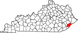
| County | Letcher |
| Area | |
• Total | 2.31 sq mi (5.97 km2) |
| • Land | 2.31 sq mi (5.97 km2) |
| • Water | 0 sq mi (0.00 km2) |
| Elevation | 1,762 ft (537 m) |
| Population (2020) | |
• Total | 347 |
| • Density | 150.6/sq mi (58.16/km2) |
| Time zone | UTC-5 (Eastern (EST)) |
| • Summer (DST) | UTC-4 (EDT) |
| Area code | 606 |
| GNIS feature ID | 500292 [2] |
Payne Gap is an unincorporated community and census-designated place in Letcher County, Kentucky, United States. As of the 2020 census, Payne Gap had a population of 347. [3] U.S. Route 119 passes through the community.