Payne Gap, Kentucky

Last updated

Payne Gap, Kentucky
USA Kentucky location map.svg
Red pog.svg
Payne Gap
Usa edcp location map.svg
Red pog.svg
Payne Gap
Coordinates: 37°09′19″N82°39′34″W / 37.15528°N 82.65944°W / 37.15528; -82.65944
Country United States
State Kentucky
County Letcher
Area
[1]
  Total2.30 sq mi (5.97 km2)
  Land2.30 sq mi (5.97 km2)
  Water0.00 sq mi (0.00 km2)
Elevation
1,762 ft (537 m)
Population
 (2020)
  Total347
  Density150.67/sq mi (58.16/km2)
Time zone UTC-5 (Eastern (EST))
  Summer (DST) UTC-4 (EDT)
Area code 606
GNIS feature ID500292 [2]

Payne Gap is an unincorporated community and census-designated place in Letcher County, Kentucky, United States. Its population was 329 as of the 2010 census. [3] U.S. Route 119 passes through the community.

Contents

Geography

According to the U.S. Census Bureau, the community has an area of 2.306 square miles (5.97 km2); 2.305 square miles (5.97 km2) of its area is land, and 0.001 square miles (0.0026 km2) is water. [3]

Demographics

As of the 2020 census, there were 347 people, 173 housing units, and 276 families in the CDP. The racial makeup was 96.5% White, 0.6% Asian, and 2.9% from two or more races. A total of 0.6% of the population had Hispanic or Latino origin. [4]

The ancestry was 30.8% American, 13.0% English, 9.5% Irish, 6.4% German, 2.3% French, and 2.3% Scottish. [4]

The median age was 38.2 years old. A total of 5.6% of the population were 65 or older, with 3.1% between the ages of 65 and 74, and 2.4% between the ages of 75 and 84. A total of 29.0% of the population were under 18, with 17.9% between the ages of 5 and 14, and 11.1% between the ages of 15 and 17. [4]

The median household income was $29,375. 47.0% of the population were in poverty. [4]

Historical population
CensusPop.Note
2020 347
U.S. Decennial Census [5]

Related Research Articles

<span class="mw-page-title-main">LaCenter, Kentucky</span> City in Kentucky, United States

LaCenter, formerly and often informally written as La Center, is a home rule-class city in Ballard County, Kentucky, in the United States. The population was 1,009 at the 2010 census, making it the most populous community in the county. It is part of the Paducah micropolitan area.

<span class="mw-page-title-main">Owingsville, Kentucky</span> City in Kentucky, United States

Owingsville is a home rule-class city in Bath County, Kentucky, in the United States. The population was 1,530 during the year 2010 U.S. Census. It is the county seat and is located roughly at the county's center, at the junction of US 60 and Kentucky 36. It is part of the Mount Sterling micropolitan area.

<span class="mw-page-title-main">Martin, Kentucky</span> City in Kentucky, United States

Martin is a home rule-class city in Floyd County, Kentucky, in the United States. The population was 634 as of the 2010 census.
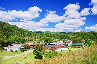
<span class="mw-page-title-main">Loyall, Kentucky</span> City in Kentucky, United States

Loyall is a home rule-class city in Harlan County, Kentucky, in the United States. The population was 1,461 as of the 2010 census, up from 766 at the time of the 2000 census.

<span class="mw-page-title-main">South Wallins, Kentucky</span> Census-designated place in Kentucky, United States

South Wallins is an unincorporated community and census-designated place (CDP) in Harlan County, Kentucky, United States. The population was 859 at the 2010 census, down from 996 at the 2000 census.
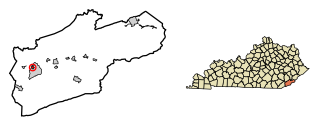
<span class="mw-page-title-main">Wallins Creek, Kentucky</span> Census-designated place in Kentucky, United States

Wallins Creek is an unincorporated community and census-designated place (CDP) in Harlan County, Kentucky, United States. The population was 156 at the 2010 census, when it was still a city, having dropped from 257 at the 2000 census.

<span class="mw-page-title-main">Mortons Gap, Kentucky</span> City in Kentucky, United States

Mortons Gap is a home rule-class city in Hopkins County, Kentucky, in the United States. The population was 728 at the 2020 census, down from 863 at the 2010 census.
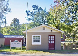
<span class="mw-page-title-main">St. Charles, Kentucky</span> City in Kentucky, United States

St. Charles is a home rule-class city in Hopkins County, Kentucky, United States. The population was 277 at the 2010 U.S. Census.
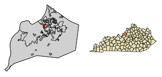
<span class="mw-page-title-main">Bellewood, Kentucky</span> City in Kentucky, United States

Bellewood is a home rule-class city in Jefferson County, Kentucky, United States. The city was formally incorporated by the state assembly in 1950. The population was 321 at the 2010 census.

<span class="mw-page-title-main">Coldstream, Kentucky</span> City in Kentucky, United States

Coldstream is a home rule-class city in Jefferson County, Kentucky, United States. The population was 1,100 at the 2010 census, up from 956 at the 2000 census.
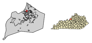
<span class="mw-page-title-main">Glenview Hills, Kentucky</span> City in Kentucky, United States

Glenview Hills is a home rule-class city in Jefferson County, Kentucky, United States. The population was 319 at the 2010 census.

<span class="mw-page-title-main">Glenview Manor, Kentucky</span> City in Kentucky, United States

Glenview Manor is a home rule-class city in Jefferson County, Kentucky, United States. The population was 191 at the 2010 census.

<span class="mw-page-title-main">Wellington, Kentucky</span> City in Kentucky, United States

Wellington is a home rule-class city in metro Louisville, Jefferson County, Kentucky, United States. It is considered to be part of the Upper Highlands section of Louisville. It was incorporated in 1946. The population was 565 at the 2010 census.

<span class="mw-page-title-main">Fleming-Neon, Kentucky</span> City in Kentucky, United States

Fleming-Neon also known as Neon, is a home rule-class city in Letcher County, Kentucky, in the United States. The population was 770 at the 2010 census, down from 840 at the 2000 census.

<span class="mw-page-title-main">Pine Knot, Kentucky</span> Census-designated place in Kentucky, United States

Pine Knot is an unincorporated community and census-designated place (CDP) in McCreary County, Kentucky, United States. The population was 1,380 at the 2020 census, down from 1,621 in 2010.

<span class="mw-page-title-main">New Haven, Kentucky</span> City in Kentucky, United States

New Haven is a home rule-class city in Nelson County, Kentucky, United States. The population was 855 at the 2010 census.

<span class="mw-page-title-main">Payne, Ohio</span> Village in Ohio, United States

Payne is a village in Paulding County, Ohio, United States. The population was 1,192 at the 2020 census.

<span class="mw-page-title-main">Shade Gap, Pennsylvania</span> Borough in Pennsylvania, United States

Shade Gap is a borough in Huntingdon County, Pennsylvania, United States. The population was 105 at the 2010 census.

<span class="mw-page-title-main">Keokee, Virginia</span> Census-designated place in Virginia, United States

Keokee is an unincorporated community and census-designated place (CDP) in Lee County, Virginia, United States. The population was 416 at the 2010 census.

<span class="mw-page-title-main">Union Gap, Washington</span> City in Washington, United States

Union Gap is a city in Yakima County, Washington, United States. As of the 2020 census, the city population was 6,568. Union Gap has become the retail hub for the entire Yakima Valley as a result of Valley Mall and other thriving businesses being located here. Part of the city is part of the Yakama Nation.

References

  1. "2020 U.S. Gazetteer Files". United States Census Bureau. Retrieved March 18, 2022.
  2. "Payne Gap". Geographic Names Information System . United States Geological Survey, United States Department of the Interior.
  3. 1 2 "2010 Census Gazetteer Files - Places: Kentucky". U.S. Census Bureau . Retrieved April 2, 2017.
  4. 1 2 3 4 "Explore Census Data". data.census.gov. Retrieved June 20, 2023.
  5. "Census of Population and Housing". Census.gov. Retrieved June 4, 2016.