Plaza de Mexico (Manila)

Last updated
Plaza de Mexico
Public square

09659jfStatue of Adolfo Lopez Mateos Intramuros Manilafvf 14.jpg

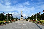
The statue of Adolfo López Mateos at Plaza de Mexico
Location: Magallanes Drive, Intramuros
Manila, Philippines
Coordinates: 14°35′39″N120°58′28″E / 14.59417°N 120.97444°E / 14.59417; 120.97444 Coordinates: 14°35′39″N120°58′28″E / 14.59417°N 120.97444°E / 14.59417; 120.97444

Plaza de Mexico, also known simply as Plaza Mexico, is a historic riverside square in Manila, Philippines, located at the west end of Magallanes Drive and Riverside Drive in Intramuros bordering the Pasig River in the north. It is surrounded by the Aduana Building on the south, the Bureau of Immigration Building on the east and the ruins of the Bastión de Maestranza and Puerta de Almacenes on the west. The Pasig River Ferry has a station also named Plaza Mexico located northeast of the square behind the Immigration building. The square was named Plaza de Mexico in 1964 to commemorate the 4th centenary of the expedition of Miguel López de Legazpi and Andres de Urdaneta from New Spain (Mexico) and the historic Manila-Acapulco galleon trade relations between the two nations that lasted 250 years.

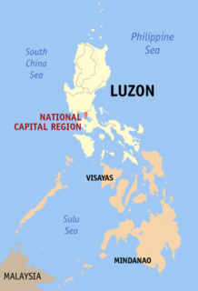
Manila Capital / Highly Urbanized City in National Capital Region, Philippines

Manila, officially the City of Manila, is the capital of the Philippines. It is the most densely populated city proper in the world. It was the first chartered city by virtue of the Philippine Commission Act 183 on July 31, 1901 and gained autonomy with the passage of Republic Act No. 409 or the "Revised Charter of the City of Manila" on June 18, 1949. Manila, alongside Mexico and Madrid are considered the world's original set of Global Cities due to Manila's commercial networks being the first to traverse the Pacific Ocean, thus connecting Spanish Asia with the Spanish Americas, marking the first time in world history when an uninterrupted chain of trade routes circled the planet. Manila has been damaged by and rebuilt from wars more times than the famed city of Troy and it is also the second most natural disaster afflicted capital city in the world next to Tokyo yet it is simultaneously among the most populous and most wealthy cities in Southeast Asia.

Philippines Republic in Southeast Asia

The Philippines, officially the Republic of the Philippines, is an archipelagic country in Southeast Asia. Situated in the western Pacific Ocean, it consists of about 7,641 islands that are categorized broadly under three main geographical divisions from north to south: Luzon, Visayas, and Mindanao. The capital city of the Philippines is Manila and the most populous city is Quezon City, both part of Metro Manila. Bounded by the South China Sea on the west, the Philippine Sea on the east and the Celebes Sea on the southwest, the Philippines shares maritime borders with Taiwan to the north, Vietnam to the west, Palau to the east, and Malaysia and Indonesia to the south.

Intramuros Place in National Capital Region, Philippines

Intramuros is the 0.67 square kilometres (0.26 sq mi) historic walled area within the modern city of Manila, the capital of the Philippines. It is administered by the Intramuros Administration (IA), which was created through the Presidential Decree No. 1616 signed on April 10, 1979. IA is tasked to rebuild, redevelop, administer and preserve the remaining pre-war buildings, structures and fortifications of Intramuros.

Contents

Located on this square is the monument to the IV Centenary of the Mexico–Philippines Maritime Expedition donated by the Mexican Secretary of The Navy Shipyards during the celebrations of the Year of Mexican-Philippine Friendship in 1964. On the other side of the square is a statue of Adolfo López Mateos, the President of Mexico who visited the city in 1962. [1]

The Astilleros de la Secretaría de Marina, are also known as ASTIMAR. The yards are dependent on the Mexican General Directorate of Naval Construction of the Mexican Navy, which carries out various types of naval construction and repairs in the Mexican territory.

Adolfo López Mateos President of Mexico

Adolfo López Mateos was a Mexican politician who became a member of the Institutional Revolutionary Party (PRI), after earlier opposing its precursor in 1929. He was elected President of Mexico, serving from 1958 to 1964.
President of Mexico Head of state of the country of Mexico

The President of Mexico, officially known as the President of the United Mexican States, is the head of state and government of Mexico. Under the Constitution, the president is also the Supreme Commander of the Mexican armed forces. The current President is Andrés Manuel López Obrador, who took office on December 1, 2018.

History

Until 1904, the area of Plaza de Mexico contained the walls of the Baluarte de Santo Domingo which enclosed the Aduana Building and the old Santo Domingo Church. In that year the American colonial government, seeing the need to develop and expand the Pasig River docks, decided to tear down its walls and open up this side of Intramuros. The Magallanes Monument, originally erected in 1848 in the center of the esplanade called Paseo de Magallanes to honor the Portuguese navigator who discovered the Philippines, was transferred to this site fronting the Aduana Building. The monument was completely destroyed during World War II. [2]

Ferdinand Magellan Portuguese explorer in the service of Spain

Ferdinand Magellan was a Portuguese explorer who organised the Spanish expedition to the East Indies from 1519 to 1522, resulting in the first circumnavigation of the Earth, completed by Juan Sebastián Elcano.

World War II 1939–1945 global war

World War II, also known as the Second World War, was a global war that lasted from 1939 to 1945. The vast majority of the world's countries—including all the great powers—eventually formed two opposing military alliances: the Allies and the Axis. A state of total war emerged, directly involving more than 100 million people from over 30 countries. The major participants threw their entire economic, industrial, and scientific capabilities behind the war effort, blurring the distinction between civilian and military resources. World War II was the deadliest conflict in human history, marked by 50 to 85 million fatalities, most of whom were civilians in the Soviet Union and China. It included massacres, the genocide of the Holocaust, strategic bombing, premeditated death from starvation and disease, and the only use of nuclear weapons in war.

From 1962 to 1964, a series of cultural exchanges between the Philippines and Mexico was held to celebrate the Year of Mexican-Philippine Friendship. This resulted in the creation of several landmarks in the city dedicated to Mexico and the Philippines' long historical and cultural ties to the Latin American country. They include Plaza de Mexico and its monuments, the statue of the Mexican hero of liberation Miguel Hidalgo on Bonifacio Drive, and the renaming of Taft Avenue Extension in Pasay to Mexico Road. [3] [4]

Bonifacio Drive is a road running for 1.6 kilometers in a north-south direction between Intramuros and Port Area in Manila, Philippines.

Taft Avenue major street in Metro Manila, Philippines

Taft Avenue is a major road in the south of Metro Manila. It passes through three cities in the metropolis: Manila, Pasay and Parañaque. The road was named after the former Governor-General of the Philippines and U.S President, William Howard Taft. The Philippines was a former commonwealth territory of the United States in the first half of the twentieth century. It is a component of National Route 170 (N170), a secondary road in the Philippine highway network and anchors R-2 of the Manila arterial road network.

Pasay Highly Urbanized City in National Capital Region, Philippines

Pasay, officially the City of Pasay,, or simply known as Pasay City, is a 1st class highly urbanized city in Metro Manila, Philippines. According to the 2015 census, it has a population of 416,522 people.

See also

Related Research Articles

Miguel López de Legazpi Spanish navigator and colonial governor

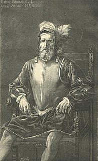
Miguel López de Legazpi, also known as El Adelantado and El Viejo, was a Spanish navigator and governor who established the first Spanish settlement in the East Indies when his expedition crossed the Pacific Ocean from the Viceroyalty of New Spain in modern-day Mexico, arrived in Cebu of the Philippine Islands, 1565. He was the first Governor-General of the Spanish East Indies which included the Philippines and other Pacific archipelagos, namely Guam and the Marianas Islands. After obtaining peace with various indigenous nations and kingdoms, he made Cebu the capital of the Spanish East Indies in 1565 and later transferred to Manila in 1571. The capital city of the province of Albay bears his name.

Juan de Salcedo was a Spanish conquistador. He was born in Mexico in 1549 and he was the grandson of Miguel López de Legazpi and brother of Felipe de Salcedo. Salcedo was one of the soldiers who accompanied the Spanish colonization of the Philippines in 1565. He joined the Spanish military in 1564 for their exploration of the East Indies and the Pacific, at the age of 15. In 1567, Salcedo led an army of about 300 Spanish and Mexican soldiers and 600 Visayan (Filipino) allies along with Martín de Goiti for their conquest of Islamic Manila. There they fought a number of battles against the Muslim leaders, mainly against Tarik Sulayman. The Spanish officers, Mexican recruits and Filipino warriors coalesced in 1570 and 1571 to attack the Islamised areas of Luzon, for control of lands and settlements.

Pan-Philippine Highway highway in the Philippines traversing most of the country

The Pan-Philippine Highway, also known as the Maharlika Highway is a 3,517-kilometer (2,185 mi) network of roads, bridges, and ferry services that connect the islands of Luzon, Samar, Leyte, and Mindanao in the Philippines, serving as the country's principal transport backbone. It is the longest highway in the Philippines that forms the country's north–south backbone component of the National Route 1 (N1) of the Philippine highway network. The entire highway is designated as Asian Highway 26 (AH26) of the Asian Highway Network.

Mexican settlement in the Philippines

Mexican settlement in the Philippines comprises a multilingual Filipino ethnic group composed of Philippine citizens with Mexican ancestry. The immigration of Mexicans to the Philippines dates back to the Spanish period. In the Philippines there are a Couple of Million Mexicans currently residing. The Mexican community has been established in those islands many years ago. Migration from Mexico has been important since the Spanish period and when the Philippines was trading with this country during the Viceroyalty of New Spain, Mexican mestizos mixed with the inhabitants of the islands, similar to the amount of Spain and the United States, numbering up many names of Spanish origin. Mexican Filipinos are ethnically diverse. They can be Mexicans of European descent, Indigenous peoples of Mexico, mixed-race, or members of any other group.

Mexico–Philippines relations Diplomatic relations between the United Mexican States and the Republic of the Philippines

Mexico and the Philippines share a common history dating from when both countries were conquered by the Spanish Empire. There were 200,000 Mexicans with Filipino descent residing in Mexico as of year 2000, mostly in the states of Colima, Guerrero, and Michoacán.

Plaza de Roma

Plaza de Roma, also known as Plaza Roma, is one of two major public squares in Intramuros, Manila. It is bounded by Andres Soriano Avenue to the north, Cabildo Street to the east, Santo Tomas Street to the south, and General Antonio Luna Street to the west. The plaza is considered to be the center of Intramuros.

Plaza Moriones public square in Tondo, Manila, Philippines

Plaza Moriones is a major public square in Tondo, Manila. Unlike other squares in Manila, the plaza is in the shape of a linear park occupying the central median of Moriones Street, starting at the intersection of Moriones and Juan Luna Streets, and ending at the intersection with Santa Maria Street, bisected by Nicolas Zamora Street in the center. It is named after Governor-General Domingo Moriones y Muralla, responsible for the construction of Manila's sewerage system during his tenure from 1877 to 1881.

Aduana Building

The Aduana Building, also known as the Intendencia, was a Spanish colonial structure in Manila, Philippines that housed several government offices through the years. It is located in front of the BPI Intramuros at Plaza España, Soriano (Aduana) Ave. corner Muralla St. in Intramuros.

Ayuntamiento de Manila

The Ayuntamiento de Manila is a building located at the corner of Andrés Soriano Avenue and Cabildo Street, fronting Plaza de Roma in Intramuros, Manila, Philippines. Also known as the Casas Consistoriales as well as nicknamed as Marble Palace, the Ayuntamiento was the seat of the Manila City Council, which consisted of two alcaldes, eight oidores (judges), a clerk, and a chief constable. Destroyed in World War II and reconstructed thereafter, the building now houses the offices of the Bureau of the Treasury.

Anda Circle road junction in the Phillipines

Anda Circle, also known as Rotonda Anda, is a roundabout located at the boundary of Intramuros and Port Area in central Manila, Philippines. It is an interchange system at the junction of Bonifacio Drive and Andres Soriano Avenue and serves as a prominent gateway to the Walled City. Inside the circle are two levels of octagonal enclosures which forms the perimeter of the monument erected in honor of Simón de Anda y Salazar. Anda was appointed as Governor General of the Philippines from 1770 to October 30, 1776.

Colegio de Santa Rosa

Colegio de Santa Rosa is a tertiary school in Manila, Philippines. It was established on August 30, 1750 as the Beaterio y Casa de Segunda Enseñanza by Mother Paula de la Santissima Trinidad to educate the indias, or native Filipinas. It acquired its present name on 1774 and is known for several other names including Colegio de Madre Paula and Beaterio y Casa de Enseñanza.

Liwasang Bonifacio public square in Ermita, Manila

The Liwasang Bonifacio, also known by its former name, Plaza Lawton, is a city square and transport hub in front of the Manila Central Post Office in the Ermita district of Manila, Philippines. It lies at the south end of Jones Bridge, MacArthur Bridge and Quezon Bridge that link the northern districts of Binondo, Santa Cruz and Quiapo to the central district of Ermita. The plaza straddles the dividing line between Ermita and Intramuros and is the starting point of Padre Burgos Avenue which connects to Taft Avenue and Roxas Boulevard in Rizal Park.

Plaza de España (Manila)

Plaza de España, also known simply as Plaza España, is a diminutive open space in Intramuros, Manila, Philippines formed by the intersection of Andres Soriano Avenue, Solana Street and Muralla Street. It is a triangular "square" which features a monument to King Philip II of Spain after whom the Philippines was named. The square is one of 47 parks and plazas in the City of Manila maintained by the city's Park Development Office in partnership with the Intramuros Administration. It is surrounded by the Aduana Building, the BPI Intramuros building which replaced the old Santo Domingo Church destroyed during World War II, and the Banco Filipino condominium building built on a portion of the old Ayuntamiento de Manila.

Outline of Metro Manila Overview of and topical guide to Metro Manila

The following outline is provided as an overview of and topical guide to Metro Manila:

Index of Metro Manila-related articles

The following is an alphabetical list of articles related to the Philippine capital region of Metro Manila.

The Binondo–Intramuros Bridge is an under construction bridge in Manila, Philippines that spans the Pasig River. Once completed, it will connect San Fernando Street in Binondo to Solana Street and Riverside Drive in Intramuros. The bridge will have four lanes and will exhibit a steel bowstring arch design with inclined arches. It will have a length of 737 meters (2,418 ft).

References

  1. "Manual de Organización de la Embajada de México en Filipinas" (PDF). Secretariat of Foreign Affairs (Mexico) . Retrieved 18 June 2015.
  2. "Moving memorials". Manila Bulletin . Retrieved 18 June 2015.
  3. "Globalization in the Philippines 400 years ago". Philippine Daily Inquirer. Archived from the original on 5 October 2009. Retrieved 18 June 2015.
  4. "Proclamation No. 320, s. 1964". Official Gazette of the Republic of the Philippines. Retrieved 18 June 2015.