Pluto, West Virginia

Last updated

Pluto
Pluto, West Virginia Postmark.jpg
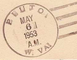
Postmark from Pluto, West Virginia
USA West Virginia location map.svg
Red pog.svg
Pluto
Location within the state of West Virginia
Usa edcp location map.svg
Red pog.svg
Pluto
Pluto (the United States)
Coordinates: 37°42′37″N80°59′32″W / 37.71028°N 80.99222°W / 37.71028; -80.99222
Country United States
State West Virginia
County Raleigh
Elevation
846 ft (258 m)
Time zone UTC-5 (Eastern (EST))
  Summer (DST) UTC-4 (EDT)
GNIS ID 1549878 [1]

Pluto is an unincorporated community in Raleigh County, West Virginia. The elevation is 2,589 feet. [2]

History

The community was named after Pluto from Greek mythology. [3]

A community landmark is the Pluto Missionary Baptist Church, [4] known as the Old Log Church. According to a 1971 column by Shirley Donnelly, the church was established in 1893 on land donated by Jim Meador. The logs from Meador’s property were sawed and hewn by Jesse Harris. The pulpit in the new church was crafted by Gus Samples, local carpenter and joiner.

References

  1. U.S. Geological Survey Geographic Names Information System: Pluto, West Virginia
  2. "Pluto Populated Place Profile / Raleigh County, West Virginia Data". westvirginia.hometownlocator.com. Retrieved August 30, 2009.
  3. Kenny, Hamill (1945). West Virginia Place Names: Their Origin and Meaning, Including the Nomenclature of the Streams and Mountains. Piedmont, WV: The Place Name Press. p. 494.
  4. U.S. Geological Survey Geographic Names Information System: Pluto Baptist Church