
Fredericton is the capital city of the Canadian province of New Brunswick. The city is situated in the west-central portion of the province along the Saint John River, also known by its Indigenous name of Wolastoq, which flows west to east as it bisects the city. The river is the dominant natural feature of the area. One of the main urban centres in New Brunswick, the city had a population of 63,116 and a metropolitan population of 108,610 in the 2021 Canadian Census. It is the third-largest city in the province after Moncton and Saint John.

New Brunswick is one of the thirteen provinces and territories of Canada. It is one of the three Maritime provinces and one of the four Atlantic provinces. It is the only province with both English and French as its official languages.

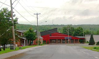
Campbellton is a city in Restigouche County, New Brunswick, Canada.

St. Stephen is a Canadian town in Charlotte County, New Brunswick, situated on the east bank of the St. Croix River around the intersection of New Brunswick Route 170 and the southern terminus of New Brunswick Route 3. The St. Croix River marks a section of the Canada–United States border, forming a natural border between Calais, Maine and St. Stephen. U.S. Route 1 parallels the St. Croix river for a few miles, and is accessed from St. Stephen by three cross-border bridges.
Centreville is a community in Carleton County, New Brunswick, Canada. It held village status prior to 2023.

Gagetown is a community in Queens County, New Brunswick, Canada. It held village status prior to 2023. It is on the west bank of the Saint John River and is the county's shire town.

Perth-Andover is a community in Victoria County, New Brunswick, Canada. It held village status prior to 2023.

The Saint John River is a 673-kilometre-long (418 mi) river that flows from Northern Maine into Canada, and runs south along the western side of New Brunswick, emptying into the Atlantic Ocean in the Bay of Fundy. Eastern Canada's longest river, its drainage basin is one of the largest on the east coast at about 55,000 square kilometres (21,000 sq mi).
The Meduxnekeag River is a tributary of the Saint John River. It is about 35 miles (56 km) long. The North Branch Meduxnekeag River rises from the outlet of a small pond in Maine and runs to its confluence with the Meduxnekeag in Wakefield, New Brunswick. The South Branch Meduxnekeag River rises from the outflow of Johnson Pond in Linneus, and runs to its confluence with the Meduxnekeag River two miles upstream from Houlton, Maine. The Meduxnekeag joins the Saint John in Woodstock, New Brunswick.

The Listuguj Mi'gmaq First Nation is a Mi'gmaq First Nations band government with a registered population (2022) of 4,248 members, most of whom are of Mi'kmaq ancestry. The name Listuguj, is the origin for the name of the Restigouche River, as well as other nearby places also carrying the name Restigouche. Listuguj is also used as a name for one of the Míkmaq orthographies. Its southern border is adjacent to Pointe-à-la-Croix, Quebec.
Eel River Crossing is a community in Restigouche County, New Brunswick, Canada. It held village status prior to 2023.

Grand Bay-Westfield is a town on the west bank of the Saint John River immediately north of the boundary between Kings County and Saint John County of New Brunswick, Canada.
Port Elgin is a Canadian community in Westmorland County, New Brunswick. It is located near the Nova Scotia border at the mouth of the Gaspereaux River where it empties into the Northumberland Strait's Baie Verte.

Saint-Léonard is a community in Madawaska County, New Brunswick, Canada. It held town status prior to 2023.

Cocagne is a Canadian community, formerly part of an eponymous local service district (LSD) and later incorporated rural community, in Kent County, New Brunswick.

The history of New Brunswick covers the period from the arrival of the Paleo-Indians thousands of years ago to the present day. Prior to European colonization, the lands encompassing present-day New Brunswick were inhabited for millennia by the several First Nations groups, most notably the Maliseet, Mi'kmaq, and the Passamaquoddy.
The Tobique River is a river in northwestern New Brunswick, Canada. The river rises from Nictau Lake in Mount Carleton Provincial Park and flows for 148 kilometres to its confluence with the Saint John River near Perth-Andover.

Gesgapegiag is one of two First Nations reserves on the south shore of the Gaspésie, most of whom are of Mi'kmaq ancestry. Most of the members reside on the federal Indian reserve that was set aside by the legislature of Lower Canada in 1853, for the exclusive use of the majority of Mi'kmaq in this region. The remaining Mi'kmaq live off-reserve in the eastern United States and across Canada, but stay connected to the community through modern communications and travel to. All community members, regardless of residence, participate in democratic elections held every two years to elect one Chief and eight Councillors in accordance with Canada's Indian Act Election Regulations. The community is also allied to other Mi'kmaq communities in the Gaspé region of Quebec and in northern New Brunswick. Together, their elected Chiefs advance ancestral claims to self-government and to the traditional territory called Gespe'gewa'gi ('Kespékewáki), the last land.
Route 780 is a 29-kilometre (18 mi) long mostly west–east secondary highway in the southwestern portion of New Brunswick, Canada.

Lepreau is a civil parish in Charlotte County, New Brunswick, Canada, west of Saint John.

