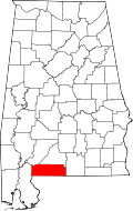
Pollard, Alabama

Last updated

Pollard, Alabama
Escambia County Alabama Incorporated and Unincorporated areas Pollard Highlighted 0161536.svg
Location of Pollard in Escambia County, Alabama.
Coordinates: 31°1′38″N87°10′20″W / 31.02722°N 87.17222°W / 31.02722; -87.17222
Country United States
State Alabama
County Escambia
Area
[1]
  Total1.11 sq mi (2.89 km2)
  Land1.11 sq mi (2.88 km2)
  Water0.00 sq mi (0.01 km2)
Elevation
62 ft (19 m)
Population
 (2020)
  Total128
  Density115.11/sq mi (44.45/km2)
Time zone UTC-6 (Central (CST))
  Summer (DST) UTC-5 (CDT)
ZIP code
36441
Area code 251
FIPS code 01-61536
GNIS feature ID0125105

Pollard is a town in Escambia County, Alabama, United States. It was the first established county seat of Escambia County, from its creation in 1868 until 1883, when it lost that distinction to Brewton. At the 2020 census, the population was 128.

Contents

Geography

Pollard is located in south-central Escambia County at 31°1′38″N87°10′20″W / 31.02722°N 87.17222°W / 31.02722; -87.17222 (31.027340, -87.172342). [2] It is 1.5 miles (2.4 km) south and east of U.S. Routes 31 and 29, 6 miles (10 km) east of Flomaton, and 9 miles (14 km) southwest of Brewton.

According to the U.S. Census Bureau, the town has a total area of 1.1 square miles (2.9 km2), all land. [3]

Demographics

Historical population
CensusPop.Note
1880 347
1890 38912.1%
1900 267−31.4%
1910 599124.3%
1920 6315.3%
1930 304−51.8%
1940 33911.5%
1950 271−20.1%
1960 210−22.5%
1970 86−59.0%
1980 14467.4%
1990 100−30.6%
2000 12020.0%
2010 13714.2%
2020 128−6.6%
U.S. Decennial Census [4]

As of the census [5] of 2000, there were 120 people, 48 households, and 33 families residing in the town. The population density was 107.6 inhabitants per square mile (41.5/km2). There were 64 housing units at an average density of 57.4 per square mile (22.2/km2). The racial makeup of the town was 51.67% White, 41.67% Black or African American, 1.67% Native American, 0.83% from other races, and 4.17% from two or more races. 1.67% of the population were Hispanic or Latino of any race.

There were 48 households, out of which 31.3% had children under the age of 18 living with them, 50.0% were married couples living together, 14.6% had a female householder with no husband present, and 29.2% were non-families. 29.2% of all households were made up of individuals, and 12.5% had someone living alone who was 65 years of age or older. The average household size was 2.50 and the average family size was 3.09.

In the town, the population was spread out, with 27.5% under the age of 18, 6.7% from 18 to 24, 22.5% from 25 to 44, 23.3% from 45 to 64, and 20.0% who were 65 years of age or older. The median age was 41 years. For every 100 females, there were 106.9 males. For every 100 females age 18 and over, there were 93.3 males.

The median income for a household in the town was $26,875, and the median income for a family was $28,750. Males had a median income of $41,250 versus $17,813 for females. The per capita income for the town was $11,410. There were 22.6% of families and 26.6% of the population living below the poverty line, including 36.4% of under eighteens and 30.4% of those over 64.

Education

Escambia County Public School System is the local school district. [6]

Related Research Articles

<span class="mw-page-title-main">Santa Rosa County, Florida</span> County in Florida, United States

Santa Rosa County is a county located in the northwestern portion of the U.S. state of Florida. As of 2020, the population is 188,000. The county seat is Milton, which lies in the geographic center of the county. Other major communities within Santa Rosa County are Navarre, Pace, and Gulf Breeze. Navarre is the most populated community with a population of approximately 45,000 residents. Santa Rosa County is included in the Pensacola Metropolitan Statistical Area, which also includes Escambia County.

<span class="mw-page-title-main">Escambia County, Alabama</span> County in Alabama, United States

Escambia County is a county located in the south central portion of the U.S. state of Alabama. As of the 2020 census, the population was 36,757. Its county seat is Brewton.

<span class="mw-page-title-main">Brewton, Alabama</span> City in and county seat of Escambia County, Alabama

Brewton is a city in and the county seat of Escambia County, Alabama, United States. As of the 2020 census, the population was 5,276. Brewton is located in south central Alabama, just north of the Florida Panhandle.

<span class="mw-page-title-main">East Brewton, Alabama</span> City in Alabama, United States

East Brewton is a city in Escambia County, Alabama, United States. It was incorporated in October 1918. At the 2020 census, the population was 2,293. The community grew around Fort Crawford, a fort built to protect early settlers of the area.

<span class="mw-page-title-main">Flomaton, Alabama</span> Town in Alabama, United States

Flomaton is a town in Escambia County, Alabama, United States. At the 2010 census the town's population was 1,440. It is located next to the Alabama / Florida state line.

<span class="mw-page-title-main">Riverview, Alabama</span> Town in Alabama, United States

Riverview is a town in Escambia County, Alabama, United States. At the 2010 census the population was 184, up from 99 at the 2000 census.

<span class="mw-page-title-main">Union, Alabama</span> Town in Alabama, United States

Union is a town in rural Greene County, Alabama, United States. Per the 2020 census, the population was 180. According to the 1980 U.S. Census, it was incorporated in the 1970s.

<span class="mw-page-title-main">Bellview, Florida</span> Census-designated place in Florida, United States

Bellview is a census-designated place (CDP) in Escambia County, Florida. It is considered to be a community within Pensacola. The population was 23,355 at the 2010 census. It is part of the Pensacola–Ferry Pass–Brent Metropolitan Statistical Area.

<span class="mw-page-title-main">Century, Florida</span> Town in Florida, United States

Century is a town in Escambia County, Florida, United States. Per the 2020 census, the population was 1,713. It is part of the Pensacola–Ferry Pass–Brent Metropolitan Statistical Area.

<span class="mw-page-title-main">Ferry Pass, Florida</span> Census-designated place in Florida, United States

Ferry Pass is a census-designated place (CDP) in Escambia County, Florida. It is a community in Pensacola, and is located north of Pensacola City Limits. As of the 2010 United States Census, the population was 28,921. The University of West Florida, located in Ferry Pass, is the only university located in the Pensacola Metropolitan Area.

<span class="mw-page-title-main">Myrtle Grove, Florida</span> Census-designated place in Florida, United States

Myrtle Grove is a census-designated place (CDP) in Escambia County, Florida, United States. The population was 15,870 at the 2010 census. It is part of the Pensacola–Ferry Pass–Brent Metropolitan Statistical Area.

<span class="mw-page-title-main">Warrington, Florida</span> CDP in Florida, United States

Warrington is a census-designated place (CDP) in Escambia County, Florida, United States. Warrington is located between downtown Pensacola and the state line with Alabama; it is 6 miles (10 km) away from both.

<span class="mw-page-title-main">Jay, Florida</span> Town in the state of Florida, United States

Jay is a town in Santa Rosa County, Florida, United States. The Town of Jay is part of the Pensacola–Ferry Pass–Brent Metropolitan Statistical Area, and located on the Florida Panhandle in North Florida. The population was 524 at the 2020 census.

<span class="mw-page-title-main">Sandborn, Indiana</span> Town in Indiana, United States

Sandborn is a town in Vigo Township, Knox County, Indiana, United States. The population was 359 at the 2020 census. It is the home of the annual Black Creek Festival.

<span class="mw-page-title-main">Ozark, Missouri</span> City in Missouri, United States

Ozark is a city in and the county seat of Christian County, Missouri. Its population was 21,284 as of the 2020 census. Ozark is also the third largest city in the Springfield, Missouri Metropolitan Area, and is centered along a business loop of U.S. Route 65, where it intersects with Missouri Route 14.

<span class="mw-page-title-main">Marklesburg, Pennsylvania</span> Borough in Pennsylvania, United States

Marklesburg is a borough in Huntingdon County, Pennsylvania, United States. The population was 204 at the 2010 census.

<span class="mw-page-title-main">Erin, Tennessee</span> City in Tennessee, United States

Erin is a city in and the county seat of Houston County, Tennessee. The population was 1,224 at the time of the 2020 census and 1,324 at the time of the 2010 census.

<span class="mw-page-title-main">Blum, Texas</span> Town in Texas, United States

Blum is a town in Hill County, Texas, United States. The population was 383 at the 2020 census.

<span class="mw-page-title-main">Matoaka, West Virginia</span> Census-designated place in West Virginia, United States

Matoaka is a census-designated place in Mercer County, West Virginia, United States. The population was 173 at the 2020 census. It is part of the Bluefield, WV-VA micropolitan area which has a population of 100,093. This town is named for Chief Powhatan's daughter Matoaka who was better known by her nickname "Pocahontas". Matoaka became an unincorporated town when it voted to dissolve its charter in May 2018.

<span class="mw-page-title-main">Lafayette, Walworth County, Wisconsin</span> Town in Wisconsin, United States

Lafayette is a town in Walworth County, Wisconsin, United States. The population was 2,039 at the 2020 census. The unincorporated community of Bowers is located in the town. The unincorporated community of Abells Corners is also located partially in the town

References

  1. "2020 U.S. Gazetteer Files". United States Census Bureau. Retrieved October 29, 2021.
  2. "US Gazetteer files: 2010, 2000, and 1990". United States Census Bureau. February 12, 2011. Retrieved April 23, 2011.
  3. "Geographic Identifiers: 2010 Demographic Profile Data (G001): Pollard town, Alabama". American Factfinder. U.S. Census Bureau. Archived from the original on February 13, 2020. Retrieved January 21, 2016.
  4. "U.S. Decennial Census". Census.gov. Retrieved June 6, 2013.
  5. "U.S. Census website". United States Census Bureau . Retrieved January 31, 2008.
  6. "2020 CENSUS - SCHOOL DISTRICT REFERENCE MAP: Escambia County, AL" (PDF). U.S. Census Bureau . Retrieved August 1, 2022. - Text list

31°01′38″N87°10′20″W / 31.02734°N 87.172342°W / 31.02734; -87.172342