Primero, Ponce, Puerto Rico

Last updated

Primero
Edificio Ponce Darlington, Barrio Primero, Ponce, Puerto Rico (DSC05036).jpg
Ponce Darlington Building, (Barrio Primero, Ponce, Puerto Rico) Ponce's first multi-story building, built in 1962, [2] and former home of WRIK-TV.
Primero, Ponce, Puerto Rico.svg
Location of barrio Primero within the municipality of Ponce shown in red
Caribbean location map.svg
Red pog.svg
Primero
Location of Puerto Rico
Coordinates: 18°00′29″N66°37′10″W / 18.007938°N 66.619476°W / 18.007938; -66.619476 [3]
Commonwealth Flag of Puerto Rico.svg  Puerto Rico
Municipality Bandera de Ponce, Puerto Rico.svg Ponce
Area
[3]
  Total0.26 sq mi (0.7 km2)
  Land0.26 sq mi (0.7 km2)
  Water0 sq mi (0 km2)
Elevation
[4]
33 ft (10 m)
Population
 (2010)
  Total3,175
  Density12,211.5/sq mi (4,714.9/km2)
 Source: 2010 Census
Time zone UTC−4 (AST)

Primero (Barrio Primero) is one of the 31 barrios of the municipality of Ponce, Puerto Rico. Together with Segundo, Tercero, Cuarto, Quinto, and Sexto, Primero is one of the municipality's original six core urban barrios. It was founded in 1878. [5]

Contents

Location

Primero is an urban barrio located in the southern section of the municipality, within the Ponce city limits, and southwest of the traditional center of the city, Plaza Las Delicias.

Boundaries

Barrio Primero is bounded on the North by Villa Street, on the South by Ferrocarril and Dr. Ferran Streets, on the West by PR-2R (Carretera Pámpanos / Calle Coto Canas), and on the East by Eugenio Maria de Hostos Avenue and Marina Street. [6]

In terms of barrio-to-barrio boundaries, Primero is bounded in the North by Barrio Segundo, in the South by Canas Urbano, in the West by Barrio Canas Urbano, and in the East by Barrio Cuarto. The communities of Ponce de Leon, Los Maestros, Mariani, and Pedro J. Rosaly are located in Barrio Primero.

The Ponce City Hall, the oldest colonial building in the city, is located in Barrio Primero. Ponce City Hall.JPG
The Ponce City Hall, the oldest colonial building in the city, is located in Barrio Primero.

Features and demographics

Primero has 0.25 square miles (650,000 m2) of land area and no water area. [7] In 2000, the population of Primero was 3,550. The population density in Primero was 13,997 persons per square mile. [8] [7]

In 2010, the population of Primero was 3,175 persons, and it had a density of 12,211.5 persons per square mile. [9]

Historical population
CensusPop.Note
1900 1,592
1910 2,38549.8%
1920 2,65811.4%
1930 3,70339.3%
1940 4,84630.9%
1950 6,27929.6%
1960 5,768−8.1%
1970 5,289−8.3%
1980 4,093−22.6%
1990 3,905−4.6%
2000 3,550−9.1%
2010 3,175−10.6%
U.S. Decennial Census
1899 (shown as 1900) [10] 1910-1930 [11]
1930-1950 [12] 1960 [13] 1980-2000 [14] 2010 [15]

Notable landmarks

Primero is home to Ponce City Hall on its northeastern end. The Dora Colón Clavell Urban Park, is also found in Barrio Primero. The historic, NRHP-listed, Rosaly-Batiz House, Residencia Zaldo de Nebot on 27 Marina Street, and the Missionary Society of the Methodist Episcopal Church on 132 Villa Street, are also in Barrio Primero.

See also

Related Research Articles

<span class="mw-page-title-main">Playa, Ponce, Puerto Rico</span> Barrio of Puerto Rico

Barrio Playa, also known as Playa de Ponce, Ponce Playa, or La Playa, is one of the thirty-one barrios that comprise the municipality of Ponce, Puerto Rico. Along with Bucaná, Canas, Vayas, and Capitanejo, Playa is one of the municipality's five coastal barrios. Barrio Playa also incorporates several islands, the largest of which is Caja de Muertos. It was founded in 1831.

<span class="mw-page-title-main">Anón</span> Barrio of Ponce, Puerto Rico

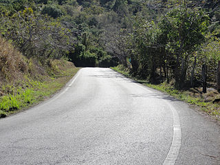
Anón is one of the 31 barrios in the municipality of Ponce, Puerto Rico. Along with Marueño, Coto Laurel, Guaraguao, Quebrada Limon, Real, and San Patricio, and the coastal barrios of Canas and Capitanejo, Anón is one of the municipality's nine bordering barrios. Anón borders the municipalities of Jayuya and Juana Diaz. The name of this barrio is of native Indian origin. It was founded in 1878. Barrio Anón is one of three Ponce barrios located on the Cordillera Central mountain range.

<span class="mw-page-title-main">Canas, Ponce, Puerto Rico</span> Barrio of Puerto Rico

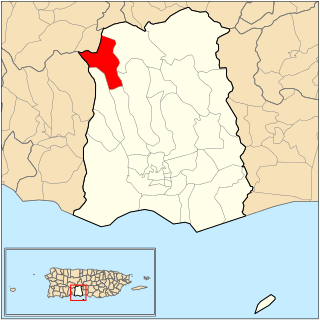
Canas is one of the 31 barrios in the municipality of Ponce, Puerto Rico. Along with Anón, Coto Laurel, Guaraguao, Quebrada Limón, Real, San Patricio, and Marueño, and the coastal barrio of Capitanejo, Canas is one of the municipality's nine bordering barrios. It borders the municipality of Peñuelas. Along with Playa, Bucana, Vayas and Capitanejo, Canas is also one of Ponce's five coastal barrios. It was founded in 1831.

<span class="mw-page-title-main">Magueyes, Ponce, Puerto Rico</span> Barrio of Puerto Rico

Magueyes is one of the 31 barrios of the municipality of Ponce, Puerto Rico. Together with Cerrillos, Machuelo Arriba, Maragüez, Montes Llanos, Portugués, Sabanetas, and Tibes, Magueyes is one of the municipality's eight interior barrios. The name of this barrio is of native Indian origin. It was created in 1831.

<span class="mw-page-title-main">Coto Laurel</span> Barrio of Ponce, Puerto Rico

Coto Laurel is one of the 31 barrios of the municipality of Ponce, Puerto Rico. Along with Anón, Marueño, Guaraguao, Quebrada Limon, Real, and San Patricio, and the coastal barrios of Canas and Capitanejo, Coto Laurel is one of the municipality's nine bordering barrios. It borders the municipality of Juana Diaz. It was founded in 1831.

<span class="mw-page-title-main">Guaraguao</span> Barrio of Ponce, Puerto Rico

Guaraguao is one of the 31 barrios in the municipality of Ponce, Puerto Rico. Along with Anón, Coto Laurel, Marueño, Quebrada Limón, Real, and San Patricio, and the coastal barrios of Canas and Capitanejo, Guaraguao is one of the municipality's nine bordering barrios. It borders the municipalities of Adjuntas and Peñuelas. The name of this barrio is of native Taino Indian origin. It was created in 1878. Barrio Guaraguao is one of three Ponce barrios located on the Cordillera Central mountain range.

<span class="mw-page-title-main">Vayas</span> Barrio of Ponce, Puerto Rico

Vayas is one of the 31 barrios of the municipality of Ponce, Puerto Rico. Along with Playa, Bucana, Canas and Capitanejo, Vayas is also one of Ponce's five coastal barrios. Together with Capitanejo, Vayas is also one of two rural coastal barrios in the municipality. It was organized in 1831, at which time it was divided into Vayas Norte and Vayas Sur; in 1878 the two were subsequently merged into today's Vayas.

<span class="mw-page-title-main">Bucaná</span> Barrio of Ponce, Puerto Rico

Bucaná is one of the 31 barrios of the municipality of Ponce, Puerto Rico. Together with Canas, Playa, Vayas, and Capitanejo, Bucaná is one of the municipality's five coastal barrios. The name of this barrio is of native Indian origin. It was founded in 1831.

<span class="mw-page-title-main">Capitanejo, Ponce, Puerto Rico</span> Barrio of Puerto Rico

Capitanejo is one of the 31 barrios of the municipality of Ponce, Puerto Rico. Along with Anón, Coto Laurel, Guaraguao, Quebrada Limón, Real, San Patricio, and Marueño, and the coastal barrio of Canas, Capitanejo is one of the municipality's nine bordering barrios. It borders the municipality of Juana Diaz. Along with Playa, Bucana, Vayas and Canas, Capitanejo is also one of Ponce's five coastal barrios. Together with Vayas, Capitanejo is also one of two rural coastal barrios in the municipality. It was founded in 1822.

<span class="mw-page-title-main">Marueño</span> Barrio of Ponce, Puerto Rico

Marueño is one of the 31 barrios of the municipality of Ponce, Puerto Rico. Along with Anón, Coto Laurel, Guaraguao, Quebrada Limón, Real, and San Patricio, and the coastal barrios of Canas and Capitanejo, Marueño is one of the municipality's nine bordering barrios. Marueño borders the municipality of Peñuelas. The name of this barrio is of native Indian origin. It was created in 1831.

<span class="mw-page-title-main">Quebrada Limón</span> Barrio of Ponce, Puerto Rico

Quebrada Limón is one of the 31 barrios of the municipality of Ponce, Puerto Rico. Along with Anón, Coto Laurel, Guaraguao, Marueño, Real, and San Patricio, and the coastal barrios of Canas and Capitanejo, Quebrada Limón is one of the municipality's nine bordering barrios. It borders the municipality of Peñuelas. It was founded in 1878.

<span class="mw-page-title-main">Real, Ponce, Puerto Rico</span> Barrio of Puerto Rico

Real is one of the 31 barrios of the municipality of Ponce, Puerto Rico. Along with Anón, Coto Laurel, Guaraguao, Quebrada Limón, Marueño, and San Patricio, and the coastal barrios of Canas and Capitanejo, Real is one of the municipality's nine bordering barrios. It borders the municipality of Juana Diaz. It was founded in 1878.

<span class="mw-page-title-main">Machuelo Abajo</span> Barrio of Ponce, Puerto Rico

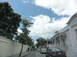
Machuelo Abajo is one of the 31 barrios of the municipality of Ponce, Puerto Rico. Along with Canas Urbano, Magueyes Urbano, Portugués Urbano, and San Antón, Machuelo Abajo is one of the municipality's five originally rural barrios that are now also part of the urban zone of the city of Ponce. It was founded in 1818.

<span class="mw-page-title-main">Tercero, Ponce, Puerto Rico</span> Barrio of Puerto Rico

Tercero is one of the 31 barrios of the municipality of Ponce, Puerto Rico. Together with Primero, Segundo, Cuarto, Quinto, and Sexto, Tercero is one of the municipality's six core urban barrios. It was organized in 1878.

<span class="mw-page-title-main">Cuarto, Ponce, Puerto Rico</span> Barrio of Puerto Rico

Cuarto is one of the 31 barrios of the municipality of Ponce, Puerto Rico. Together with Primero, Segundo, Tercero, Quinto, and Sexto, Cuarto is one of the municipality's six core urban barrios. It was created in 1878.

<span class="mw-page-title-main">Segundo, Ponce, Puerto Rico</span> Barrio of Puerto Rico

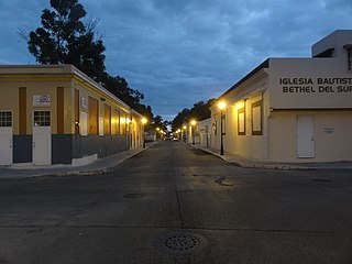
Segundo is one of the 31 barrios of the municipality of Ponce, Puerto Rico. Along with Primero, Tercero, Cuarto, Quinto, and Sexto, Segundo is one of the municipality's six core urban barrios. It was organized in 1878. Barrio Segundo has 3 subbarrios: Baldority de Castro, Clausells, and Reparada.

<span class="mw-page-title-main">Quinto, Ponce, Puerto Rico</span> Barrio of Puerto Rico

Quinto is one of the 31 barrios of the municipality of Ponce, Puerto Rico. Together with Primero, Segundo, Tercero, Cuarto, and Sexto, Quinto is one of the municipality's six original urban barrios. It was organized in 1878.

<span class="mw-page-title-main">Sexto, Ponce, Puerto Rico</span> Barrio of Puerto Rico

Sexto is one of the 31 barrios of the municipality of Ponce, Puerto Rico. Along with Primero, Segundo, Tercero, Cuarto, and Quinto, Sexto is one of the municipality's six core urban barrios. Barrio Sexto used to be called Barrio Cantera. It was organized in 1878.

<span class="mw-page-title-main">Canas Urbano</span> Barrio of Ponce, Puerto Rico

Canas Urbano is one of the 31 barrio of the municipality of Ponce, Puerto Rico. Along with Machuelo Abajo, Magueyes Urbano, Portugués Urbano, and San Antón, Canas Urbano is one of the municipality's five originally rural barrios that are now also part of the urban zone of the city of Ponce. The name of this barrio is of native indigenous origin. It was created in 1953.

<span class="mw-page-title-main">San Patricio, Ponce, Puerto Rico</span> Barrio of Puerto Rico

San Patricio is one of the 31 barrios of the municipality of Ponce, Puerto Rico. It is one of the municipality's nine bordering barrios, along with Anón, Coto Laurel, Guaraguao, Quebrada Limón, Real, and Marueño, and the coastal barrios of Canas and Capitanejo. Its northern edge borders the municipalities of Utuado and Jayuya. It was founded in 1878. Barrio San Patricio is one of three Ponce barrios located on the Cordillera Central mountain range.

References

  1. Carmelo Rosario Natal. "Ponce en Su Historia Moderna: 1945-2002." Gobierno Municipal de Ponce. First Edition. 2003. Page 55.
  2. Carmelo Rosario Natal. "Ponce en Su Historia Moderna: 1945-2002." Gobierno Municipal de Ponce. First Edition. 2003. Page 55.
  3. 1 2 "US Gazetteer 2019". US Census. US Government.
  4. U.S. Geological Survey Geographic Names Information System: Primero barrio
  5. Barrios de Ponce. Archived 30 September 2015 at the Wayback Machine Antepasados Esclavos.(From: Pedro Tomás de Córdoba. Memorias geográficas, históricas, económicas y estadísticas de la Isla de Puerto Rico.) Retrieved 28 November 2014.
  6. General Purpose Population Data, Census 2000. Unidad de Sistemas de Información Geográfica, Área de Tecnología de Información Gubernamental, Oficina de Gerencia y Presupuesto. Gobierno de Puerto Rico. Archived 2010-08-12 at the Wayback Machine Retrieved 17 February 2010.
  7. 1 2 U.S. Census Bureau. Census 2000. Ponce and Its Barrios. (Ponce Municipio, Puerto Rico -- County Subdivision and Place. GCT-PH1. Population, Housing Units, Area, and Density: 2000. Data Set: Census 2000 Summary File 1 (SF 1) 100-Percent Data) Archived 12 February 2020 at archive.today Retrieved 24 April 2010.
  8. City Melt Retrieved 17 February 2010.
  9. Puerto Rico:2010:population and housing unit counts.pdf (PDF). U.S. Dept. of Commerce, Economics and Statistics Administration, U.S. Census Bureau. 2010.
  10. "Report of the Census of Porto Rico 1899". War Department Office Director Census of Porto Rico. Archived from the original on 16 July 2017. Retrieved 21 September 2017.
  11. "Table 3-Population of Municipalities: 1930 1920 and 1910" (PDF). United States Census Bureau. Archived (PDF) from the original on 17 August 2017. Retrieved 21 September 2017.
  12. "Table 4-Area and Population of Municipalities Urban and Rural: 1930 to 1950" (PDF). United States Census Bureau. Archived (PDF) from the original on 30 August 2015. Retrieved 21 September 2014.
  13. Census of Population, 1960: Number of Inhabitants, General Population Characteristics, General Social and Economic Characteristics, and Detailed Characteristics. Characteristics of the population. U.S. Bureau of the Census. 1963. pp. 97–101. Retrieved 10 June 2023.
  14. "Table 2 Population and Housing Units: 1960 to 2000" (PDF). United States Census Bureau. Archived (PDF) from the original on 24 July 2017. Retrieved 21 September 2017.
  15. Puerto Rico: 2010 Population and Housing Unit Counts.pdf (PDF). U.S. Dept. of Commerce Economics and Statistics Administration U.S. Census Bureau. 2010. Archived (PDF) from the original on 20 February 2017. Retrieved 2 August 2019.