
The Woodland Trust is the largest woodland conservation charity in the United Kingdom and is concerned with the creation, protection, and restoration of native woodland heritage. It has planted over 50 million trees since 1972.

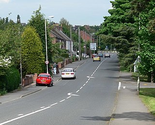
Ashby-de-la-Zouch, sometimes spelt Ashby de la Zouch and shortened locally to Ashby, is a market town and civil parish in the North West Leicestershire district of Leicestershire, England. The town is near to the Derbyshire and Staffordshire borders. Its 2001 census population of 11,410 rose to 12,370 in 2011. The castle in the town was an important fort in the 15th–17th centuries. In the 19th century the town's main industries were ribbon manufacture, coal mining, and brickmaking.
Moira is a former mining village about 2.5 miles (4 km) southwest of Ashby-de-la-Zouch in North West Leicestershire, England. The village is about 3 miles (5 km) south of Swadlincote and is close to the boundary with Derbyshire. The population is included in the civil parish of Ashby Woulds.

The Ashby-de-la-Zouch Canal is a 31-mile (50 km) long canal in England which connected the mining district around Moira, just outside the town of Ashby-de-la-Zouch in Leicestershire, with the Coventry Canal at Bedworth in Warwickshire. It was opened in 1804, and a number of tramways were constructed at its northern end, to service collieries. The canal was taken over by the Midland Railway in 1846, but remained profitable until the 1890s, after which it steadily declined. Around 9 miles (14 km) passed through the Leicestershire coal field, and was heavily affected by subsidence, with the result that this section from Moira, southwards to Snarestone, was progressively closed in 1944, 1957 and 1966, leaving 22 miles (35 km) of navigable canal.

The National Forest is an environmental project in central England run by The National Forest Company. From the 1990s, 200 square miles (520 km2) of north Leicestershire, south Derbyshire and southeast Staffordshire have been planted in an attempt to blend ancient woodland with newly planted areas to create a new national forest. It stretches from the western outskirts of Leicester in the east to Burton upon Trent in the west, and is planned to link the ancient forests of Needwood and Charnwood.

North West Leicestershire is a local government district in Leicestershire, England. The population of the Local Authority at the 2011 census was 93,348. Its main towns are Ashby-de-la-Zouch and Coalville.

Measham is a large village in the North West Leicestershire district in Leicestershire, England, near the Derbyshire, Staffordshire and Warwickshire boundaries. It lies off the A42, 4½ miles south of Ashby de la Zouch, in the National Forest. Historically it was in an exclave of Derbyshire absorbed into Leicestershire in 1897. The name is thought to mean "homestead on the River Mease".

Willesley is a place near Ashby-de-la-Zouch. Originally in Derbyshire, it is now in north-west Leicestershire. In the 19th century it had a population of about 60 and Willesley Hall was the home of the Abney and later the Abney-Hastings family. Willesley is so small that it would be a hamlet except that it has a church.
May Hill is a prominent English hill between Gloucester and Ross-on-Wye. Its summit, on the western edge of Gloucestershire and its northern slopes in Herefordshire, is distinguishable by a clump of trees on its summit, which forms an official Site of Special Scientific Interest. It is reached by three public footpaths, two as parts of the Gloucestershire Way and Wysis Way.

North West Leicestershire is a constituency represented in the House of Commons of the UK Parliament since 2010 by Andrew Bridgen, a Conservative.
Leighfield is a civil parish in the county of Rutland in the East Midlands of England. There is no settlement centre in the parish, only a few isolated properties. In the 2001 census it had a population of 10, which was the fourth smallest of Rutland's parish populations. At the 2011 census the population remained less than 100 and was included in the civil parish of Ridlington. It shares its name with Leighfield Forest, a much larger area from Braunston-in-Rutland to Stockerston and from Skeffington to Ridlington, a triangle of land roughly 4 miles (6.4 km) in each direction.

Heather is a village west of Ibstock in North West Leicestershire, England. The population of the civil parish was 949 at the 2001 census reducing to 920 at the 2011 census. In the Domesday Book of 1086, its name is recorded as Hadre, meaning "the heathland".
Ravenstone is a small rural cluster village with a population of 2149, situated just off the A511 road between Coalville and Ashby-de-la-Zouch, in North West Leicestershire, and within the National Forest, England. From the 2011 census the population was included in the civil parish of Ravenstone with Snibston.

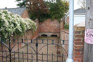
Snibston is an area east of Ravenstone, north west Leicestershire, in the English Midlands. Originally rural, part of Snibston was transformed into a coal mining village by the opening of coal mines by the Snibston Colliery Company in the early 1830s. This industrial part of Snibston was subsequently subsumed into the developing town of Coalville, though small rural areas of Snibston survive within the civil parishes of Ravenstone with Snibston and Hugglescote and Donington le Heath. In the part of Snibston within the latter civil parish stands the 13th-century church of St Mary, noted as the smallest church still in use for regular worship in England. The main Snibston Colliery was sunk in 1831, and after its closure the Snibston Country Park with the Snibston Discovery Museum was built on part of the colliery site. Part of the park is Snibston Grange Local Nature Reserve. The population is included in the civil parish of Ravenstone with Snibston.

Coleorton is a village and civil parish in North West Leicestershire, England. It is situated on the A512 road approximately 2 miles (3.2 km) east of Ashby de la Zouch. Nearby villages include Newbold, to the north, Thringstone to the east, and Swannington to the south-east.

Normanton le Heath is a village and civil parish situated between the parishes of Packington, Ravenstone and Heather in North West Leicestershire, England. The population of the civil parish was 131 at the 2001 census, rising to 165 at the 2011 census. It should not be confused with another Normanton in the county which is near Bottesford.

Sence Valley Forest Park is located between Ibstock and Heather in North West Leicestershire, and within the National Forest, England.

Sheet Hedges Wood is in the parish of Newtown Linford, and lies some 1-mile (1.6 km) north of Groby, in Leicestershire, UK. The site is made up of two areas of woodland and a meadow field, all with public access, extending 29 acres (120,000 m2). The woodland block is adjacent to the road includes a car park and access trails.

Ockwells Park is a park, part of which is a local nature reserve, in Cox Green, Berkshire, England. The nature reserve is owned by the Royal Borough of Windsor and Maidenhead.


