Quillacollo is a province in the Cochabamba Department, Bolivia. It is known for its festival in August where people from all over Bolivia come and pay homage to the Virgin of Urqupiña. Quillacollo is said to be one of the fastest-growing cities in Bolivia.

Quillacollo Municipality is the first municipal section of the Quillacollo Province in the Cochabamba Department, Bolivia. Its capital is Quillacollo. At the time of census 2001 the municipality had 104,206 inhabitants.
Jatun Q'asa is a mountain in the Tunari mountain range of the Bolivian Andes, about 5,025 m (16,486 ft) high. It is situated north-west of Cochabamba in the Cochabamba Department, Quillacollo Province, in the west of the Quillacollo Municipality.
Puma Apachita is a mountain in the Tunari mountain range of the Bolivian Andes, about 4,920 m (16,142 ft) high. It is situated in the Cochabamba Department, Quillacollo Province, Quillacollo Municipality, northwest of Cochabamba. Puma Apachita lies southeast of Jatun Q'asa.
Sura Kallanka is a mountain in the Andes of Peru, about 5,000 metres (16,404 ft) high. It is situated in the Apurímac Region, Antabamba Province, Oropesa District. It lies southeast of Kimsaqucha, Mallmanya and Hatun Q'asa. North of Sura Kallanka there is a lake named Suraqucha (Soracocha).
“‘Huch'uy Puka Q'asa’” is a mountain in the Andes of Peru, about 4,400 metres (14,436 ft) high. It is situated in the Ayacucho Region, Cangallo Province, Totos District, northeast of Totos. Huch'uy Puka Q'asa lies south of Chawpi Urqu. The lake north of it is named Llulluchaqucha (Llullucha Ccocha).

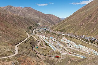
Chuqi Chukchu is a 5,154-metre-high (16,909 ft) mountain in the Cordillera Central in the Andes of Peru. It is situated in the Lima Region, Huarochiri Province, Chicla District. Chuqi Chukchu lies near the Antikuna mountain pass, northwest of Wayrakancha and northeast of Quñuq P'ukru. The mining village of Q'asa P'allqa (Casapalca) lies at its feet.
Wamanilla or Misayuq Pata is an archaeological site in the Ayacucho Region in Peru. It was declared a National Cultural Heritage by Resolución Viceministerial Nº 459-2011-VMPCIC-MC of April 20, 2011. It is situated in the Huanca Sancos Province, Sacsamarca District, and in the Víctor Fajardo Province, Huancaraylla District.
Hatun Q'asa is a mountain in the Wansu mountain range in the Andes of Peru, about 4,800 metres (15,748 ft) high. It is situated in the Arequipa Region, Condesuyos Province, Cayarani District. Hatun Q'asa lies at the Q'illumayu valley.
Mandorcasa is a mountain in the northwest of the Vilcabamba mountain range in the Andes of Peru, about 4,800 metres (15,748 ft) high. It is situated in the Cusco Region, La Convención Province, Vilcabamba District. Mandorcasa lies west of Choquetacarpo.
Waqutuyuq is a mountain in the Chunta mountain range in the Andes of Peru, about 4,800 metres (15,748 ft) high. It is located in the Huancavelica Region, Huancavelica Province, Huancavelica District, north of Antarasu. Waqutuyuq lies at a valley named Qarwa Q'asa. The waters of its intermittent stream flow to Kachimayu in the north.
T'iyuyuq is a 5,015-metre-high (16,453 ft) mountain in Bolivia. It is located in the Potosí Department, Sud Lípez Province, San Pablo de Lípez Municipality. It lies southeast of Lípez and east of Suni K'ira.
Qiñwa Q'asa is a mountain in the Bolivian Andes which reaches a height of approximately 3,760 m (12,340 ft). It is located in the Cochabamba Department, Quillacollo Province, Sipe Sipe Municipality. Qiñwa Q'asa lies northwest of Q'ara Apachita, east of the village of Janq'u Jaqhi.
Yuraq Q'asa is a mountain in the Bolivian Andes which reaches a height of approximately 3,980 m (13,060 ft). It is located in the Cochabamba Department, Quillacollo Province, Sipe Sipe Municipality.
Kuntur Wachana is a 3,396-metre-high (11,142 ft) mountain in the Bolivian Andes. It is located in the Cochabamba Department, Capinota Province, Sicaya Municipality.
Uqi Salli Punta is a 4,840-metre-high (15,880 ft) mountain in the Bolivian Andes. It is located in the Cochabamba Department, on the border of the Chapare Province, Villa Tunari Municipality, and the Quillacollo Province, Quillacollo Municipality.
Silla Q'asa is a mountain in the Bolivian Andes which reaches a height of approximately 4,480 m (14,700 ft). It is located in the Cochabamba Department, Ayopaya Province, Morochata Municipality. It lies southeast and east of the lakes named Q'umir Qucha, Yana Qucha, Parinani and Wallatani.
Q'illu Suchusqa is a mountain in the Bolivian Andes which reaches a height of approximately 4,480 m (14,700 ft). It is located in the Cochabamba Department, Quillacollo Province, Quillacollo Municipality. Q'illu Suchusqa lies southwest of Wila Qullu Punta.
Kimsa Tinkuy is a mountain in the Bolivian Andes which reaches a height of approximately 4,720 m (15,490 ft). It is located in the Cochabamba Department, Quillacollo Province, Quillacollo Municipality. Kimsa Tinkuy lies northwest to west of Awila Wachana Punta and southeast of Quna Quna Q'asa.
Mulli Urqu is a 2,906-metre-high (9,534 ft) mountain in the Bolivian Andes. It is located in the Chuquisaca Department, Oropeza Province, Yotala Municipality. Mulli Urqu lies west of the Kachi Mayu which is a left tributary of the Pillku Mayu.


