Reading, Kansas

Last updated

Reading, Kansas
Reading Bank & Post Office.JPG
Downtown Reading (2009) (prior to tornado)
Lyon County Kansas Incorporated and Unincorporated areas Reading Highlighted.svg
Location within Lyon County and Kansas
Map of Lyon Co, Ks, USA.png
Coordinates: 38°31′09″N95°57′27″W / 38.51917°N 95.95750°W / 38.51917; -95.95750 [1]
Country United States
State Kansas
County Lyon
Founded1870
Platted 1870
Incorporated 1890 [2]
Named for Reading, Pennsylvania
Government
[2]
  Type Mayor–Council
Area
[3]
  Total0.21 sq mi (0.55 km2)
  Land0.21 sq mi (0.55 km2)
  Water0.00 sq mi (0.00 km2)
Elevation
[1]
1,093 ft (333 m)
Population
 (2020) [4]
  Total181
  Density860/sq mi (330/km2)
Time zone UTC-6 (CST)
  Summer (DST) UTC-5 (CDT)
ZIP code
66868
Area code 620
FIPS code 20-58600
GNIS ID 2396331 [1]
Website readingks.com

Reading is a city in Lyon County, Kansas, United States. [1] As of the 2020 census, the population of the city was 181. [4]

Contents

History

For millennia, the land that is currently Kansas was inhabited by Native Americans. In 1803, the United States secured most of modern Kansas as part of the Louisiana Purchase. In 1854, Congress organized the Kansas Territory and in 1861, Kansas became the 34th state.

In 1863, by Act of Congress and similarly by an act of the State of Kansas, the Atchison, Topeka and Santa Fe Railway was granted 3,000,000 acres of Kansas land on the condition that it would build a continuous line to the western border of Kansas by March 1, 1873. On Oct. 30, 1868, construction began at Topeka. By Sept. 14, 1870, the first Santa Fe train reached Emporia, fifteen miles past the present site of Reading. [5] James Fagan, agent for the railroad lands, and T. J. Peter and M. S. Sargent, who represented the railroad interest, organized a town company, with James Fagan as president. The land was owned by McMann & Co., of Reading, Pennsylvania. The town was platted on sixty acres of Section 3, Township 18, Range 13, and called it Reading, after Reading, Pennsylvania. In summer 1870, the town site was surveyed. [6]

The first post office in Reading was established in August 1870. [7] Reading was incorporated as a city in September 1890. [8]

2011 tornado

EF3 tornado that struck Reading on May 21, 2011 May 21, 2011 Reading, Kansas tornado.jpg
EF3 tornado that struck Reading on May 21, 2011

On May 21, 2011 around 9:15PM, an EF3 tornado hit Reading. It was three blocks wide and stayed on the ground for about four miles. The tornado destroyed at least 56 of 110 homes and 14 of 21 businesses. The post office and fire station suffered major damage. One person died and two were hospitalized. Early damage estimates topped $2.2 million. [9] [10] [11]

In just over a year, the community rebuilt itself with some help of the Federal Emergency Management Agency. [12] Most of the town has been rebuilt as of 2023.

Geography

Reading is located at 38°31′09″N95°57′33″W / 38.519102°N 95.959091°W / 38.519102; -95.959091 (38.519102, -95.959091) [13] at the eastern edge of Lyon County. It is fifteen miles northeast of Emporia and fourteen miles southwest of Osage City along Highway 170. According to the United States Census Bureau, the city has a total area of 0.20 square miles (0.52 km2), all of it land. [14]

Climate

The climate in this area is characterized by hot, humid summers and generally mild to cool winters. According to the Köppen Climate Classification system, Reading has a humid subtropical climate, abbreviated "Cfa" on climate maps. [15]

Demographics

Historical population
CensusPop.Note
1880 120
1900 304
1910 289−4.9%
1920 35823.9%
1930 341−4.7%
1940 302−11.4%
1950 289−4.3%
1960 249−13.8%
1970 247−0.8%
1980 244−1.2%
1990 2648.2%
2000 247−6.4%
2010 231−6.5%
2020 181−21.6%
U.S. Decennial Census
Reading Community Center, Reading Cafe, Grain Elevator (replaced after tornado). Reading Kansas community center and grain elevator.jpg
Reading Community Center, Reading Café, Grain Elevator (replaced after tornado).
1870s Reading Jailhouse next to Reading Water Tower. The old jail in Reading Kansas, Oct. 2012.jpg
1870s Reading Jailhouse next to Reading Water Tower.

Reading is part of the Emporia Micropolitan Statistical Area.

2020 census

The 2020 United States census counted 181 people, 80 households, and 57 families in Reading. [16] [17] The population density was 849.8 per square mile (328.1/km2). There were 80 housing units at an average density of 375.6 per square mile (145.0/km2). [17] [18] The racial makeup was 95.58% (173) white or European American (95.58% non-Hispanic white), 0.0% (0) black or African-American, 0.0% (0) Native American or Alaska Native, 0.0% (0) Asian, 0.0% (0) Pacific Islander or Native Hawaiian, 1.66% (3) from other races, and 2.76% (5) from two or more races. [19] Hispanic or Latino of any race was 1.1% (2) of the population. [20]

Of the 80 households, 36.2% had children under the age of 18; 47.5% were married couples living together; 26.2% had a female householder with no spouse or partner present. 23.8% of households consisted of individuals and 7.5% had someone living alone who was 65 years of age or older. [17] The average household size was 2.4 and the average family size was 2.7. [21] The percent of those with a bachelor’s degree or higher was estimated to be 6.6% of the population. [22]

26.5% of the population was under the age of 18, 10.5% from 18 to 24, 20.4% from 25 to 44, 28.2% from 45 to 64, and 14.4% who were 65 years of age or older. The median age was 42.3 years. For every 100 females, there were 110.5 males. [17] For every 100 females ages 18 and older, there were 104.6 males. [17]

The 2016-2020 5-year American Community Survey estimates show that the median household income was $46,250 (with a margin of error of +/- $24,821) and the median family income was $54,375 (+/- $18,273). [23] Males had a median income of $31,528 (+/- $10,170) versus $20,139 (+/- $2,746) for females. The median income for those above 16 years old was $25,000 (+/- $6,708). [24] Approximately, 9.8% of families and 20.8% of the population were below the poverty line, including 53.6% of those under the age of 18 and 2.6% of those ages 65 or over. [25] [26]

2010 census

As of the census [27] of 2010, there were 231 people, 86 households, and 62 families residing in the city. The population density was 1,155.0 inhabitants per square mile (445.9/km2). There were 103 housing units at an average density of 515.0 per square mile (198.8/km2). The racial makeup of the city was 100.0% White. Hispanic or Latino of any race were 3.9% of the population.

There were 86 households, of which 46.5% had children under the age of 18 living with them, 52.3% were married couples living together, 12.8% had a female householder with no husband present, 7.0% had a male householder with no wife present, and 27.9% were non-families. 24.4% of all households were made up of individuals, and 8.2% had someone living alone who was 65 years of age or older. The average household size was 2.69 and the average family size was 3.15.

The median age in the city was 32.9 years. 33.8% of residents were under the age of 18; 5.1% were between the ages of 18 and 24; 27.2% were from 25 to 44; 26.4% were from 45 to 64; and 7.4% were 65 years of age or older. The gender makeup of the city was 53.7% male and 46.3% female.

2000 census

As of the census [28] of 2000, there were 247 people, 92 households, and 63 families residing in the city. The population density was 1,185.3 inhabitants per square mile (457.6/km2). There were 108 housing units at an average density of 518.3 per square mile (200.1/km2). The racial makeup of the city was 97.98% White, 0.40% African American, and 1.62% from two or more races. Hispanic or Latino of any race were 1.62% of the population.

There were 92 households, out of which 39.1% had children under the age of 18 living with them, 53.3% were married couples living together, 7.6% had a female householder with no husband present, and 31.5% were non-families. 26.1% of all households were made up of individuals, and 9.8% had someone living alone who was 65 years of age or older. The average household size was 2.68 and the average family size was 3.29.

In the city, the population was spread out, with 33.2% under the age of 18, 6.5% from 18 to 24, 34.4% from 25 to 44, 16.6% from 45 to 64, and 9.3% who were 65 years of age or older. The median age was 32 years. For every 100 females, there were 96.0 males. For every 100 females age 18 and over, there were 108.9 males.

The median income for a household in the city was $25,000, and the median income for a family was $29,500. Males had a median income of $18,750 versus $25,536 for females. The per capita income for the city was $11,673. About 15.6% of families and 13.3% of the population were below the poverty line, including 14.4% of those under the age of eighteen and none of those 65 or over.

Government

The Reading government consists of a mayor and five council members. The council meets the first Thursday of each month at 7PM. [2]

Education

The community is served by North Lyon County USD 251 public school district, and its headquarters are located in Americus. The Northern Heights High School is located east of Allen, and its mascot is the Wildcats. The NLC Elementary School and NLC Early Learning Center (preschool) are located in Americus.

The city previously had a school located at 424 First Street. Reading High School was closed through school unification in 1980. The Reading High School mascot was "The Reading Lions". The Reading Elementary School closed at the end of the 2017-2018 academic year. As of March 21, 2019 the school district had not made a decision as to the disposition of the school building in Reading. [29]

Notable people

See also

Related Research Articles

<span class="mw-page-title-main">Hardtner, Kansas</span> City in Kiowa County, Kansas

Hardtner is a city in Barber County, Kansas, United States. As of the 2020 census, the population of the city was 167. It is located 1 mile north of the Kansas / Oklahoma state border.

<span class="mw-page-title-main">Chapman, Kansas</span> City in Dickinson County, Kansas

Chapman is a city in Dickinson County, Kansas, United States. As of the 2020 census, the population of the city was 1,377.

<span class="mw-page-title-main">Manchester, Kansas</span> City in Dickinson County, Kansas

Manchester is a city in Dickinson County, Kansas, United States. As of the 2020 census, the population of the city was 47.

<span class="mw-page-title-main">Hill City, Kansas</span> City in Graham County, Kansas

Hill City is a city and county seat of Graham County, Kansas, United States. As of the 2020 census, the population of the city was 1,403.

<span class="mw-page-title-main">Eureka, Kansas</span> City in Greenwood County, Kansas

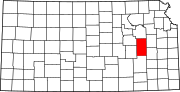
Eureka is a city in and the county seat of Greenwood County, Kansas, United States. As of the 2020 census, the population of the city was 2,332.

<span class="mw-page-title-main">Madison, Kansas</span> City in Greenwood County, Kansas

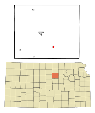
Madison is a city in Greenwood County, Kansas, United States, along the Verdigris River. As of the 2020 census, the population of the city was 689.

<span class="mw-page-title-main">Attica, Kansas</span> City in Harper County, Kansas

Attica is a city in Harper County, Kansas, United States. As of the 2020 census, the population of the city was 516. The town was named after the historical region of Attica, in Greece.

<span class="mw-page-title-main">Jetmore, Kansas</span> City in Hodgeman County, Kansas

Jetmore is a city in and the county seat of Hodgeman County, Kansas, United States. As of the 2020 census, the population of the city was 770.

<span class="mw-page-title-main">Pleasanton, Kansas</span> City in Kansas, United States

Pleasanton is a city in Linn County, Kansas, United States. As of the 2020 census, the population of the city was 1,208.

<span class="mw-page-title-main">Admire, Kansas</span> City in Lyon County, Kansas

Admire is a city in Lyon County, Kansas, United States. As of the 2020 census, the population of the city was 130.

<span class="mw-page-title-main">Americus, Kansas</span> City in Lyon County, Kansas

Americus is a city in Lyon County, Kansas, United States. As of the 2020 census, the population of the city was 776. It is located northwest of the city of Emporia. Americus is often a waypoint in some Unbound Gravel bike races.

<span class="mw-page-title-main">Emporia, Kansas</span> City in Lyon County, Kansas, United States

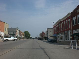
Emporia is a city in and the county seat of Lyon County, Kansas, United States. As of the 2020 census, the population of the city was 24,139. Emporia lies between Topeka and Wichita at the intersection of U.S. Route 50 with Interstates 335 and 35 on the Kansas Turnpike. Emporia is also a college town, home to Emporia State University and Flint Hills Technical College. It is home of two annual sporting events: Unbound Gravel and Dynamic Discs Open.

<span class="mw-page-title-main">Hartford, Kansas</span> City in Lyon County, Kansas

Hartford is a city in Lyon County, Kansas, United States. As of the 2020 census, the population of the city was 355.

<span class="mw-page-title-main">Florence, Kansas</span> City in Marion County, Kansas

Florence is a city in Marion County, Kansas, United States. As of the 2020 census, the population of the city was 394. The city was named after the daughter of the third Governor of Kansas Samuel J. Crawford. It is located at the intersection of U.S. Route 50 and U.S. Route 77 highways.

<span class="mw-page-title-main">Bern, Kansas</span> City in Nemaha County, Kansas

Bern is a city in Nemaha County, Kansas, United States. As of the 2020 census, the population of the city was 161.

<span class="mw-page-title-main">Bennington, Kansas</span> City in Ottawa County, Kansas

Bennington is a city in Ottawa County, Kansas, United States. As of the 2020 census, the population of the city was 622.

<span class="mw-page-title-main">Auburn, Kansas</span> City in Shawnee County, Kansas

Auburn is a city in Shawnee County, Kansas, United States. As of the 2020 census, the population of the city was 1,273.

<span class="mw-page-title-main">Harveyville, Kansas</span> City in Wabaunsee County, Kansas

Harveyville is a city in Wabaunsee County, Kansas, United States. As of the 2020 census, the population of the city was 178. It is located 8.5 miles (13.7 km) northwest of the city of Burlingame.

<span class="mw-page-title-main">Paxico, Kansas</span> City in Wabaunsee County, Kansas

Paxico is a city in Wabaunsee County, Kansas, United States. As of the 2020 census, the population of the city was 210.

<span class="mw-page-title-main">Greenleaf, Kansas</span> City in Washington County, Kansas

Greenleaf is a city in Washington County, Kansas, United States. As of the 2020 census, the population of the city was 350.

References

  1. 1 2 3 4 U.S. Geological Survey Geographic Names Information System: Reading, Kansas
  2. 1 2 3 "City of Reading". The League of Kansas Municipalities. May 24, 2019.
  3. "2019 U.S. Gazetteer Files". United States Census Bureau. Retrieved July 24, 2020.
  4. 1 2 "Profile of Reading, Kansas in 2020". United States Census Bureau. Archived from the original on May 3, 2022. Retrieved May 3, 2022.
  5. Joseph W. Snell; Don W. Wilson (Summer 1968). "The Birth of The Atchison, Topeka and Santa Fe Railroad". The Kansas Historical Quarterly. 34 (2): 113–142. Archived from the original on April 18, 2005.
  6. Cutler, William G. (1883). "Lyon County, Part 18: Reading". In Bunce, Bonnie (ed.). History of the State of Kansas. Chicago: A. T. Andreas.
  7. "Kansas Post Offices, 1828-1961". Kansas Historical Society . Retrieved June 10, 2014.
  8. French, Laura M. (2009). History of Emporia and Lyon County, Kansas. Heritage Books. p. 136. ISBN   978-0788403460.
  9. "EF3 tornado kills one, causes extensive damage in Lyon County town". The Wichita Eagle . May 22, 2011. Retrieved August 5, 2015.
  10. Cooper, Brad (May 22, 2011). "Reading, Kan. reels after devastating storm". The Kansas City Star .
  11. Carpenter, Tim (May 23, 2011). "Kansas officials inspect damage in Reading". The Topeka Capital-Journal . Retrieved August 5, 2015.
  12. Fisher, Maria Sudekum (June 12, 2011). "Reading, Kan., doesn't qualify for some FEMA aid". Columbia Missourian . Associated Press . Retrieved August 5, 2015.
  13. "US Gazetteer files: 2010, 2000, and 1990". United States Census Bureau. February 12, 2011. Retrieved April 23, 2011.
  14. "US Gazetteer files 2010". United States Census Bureau. Archived from the original on January 25, 2012. Retrieved July 6, 2012.
  15. "Climate Summary for Reading, Kansas". Weatherbase. Retrieved August 5, 2015.
  16. "US Census Bureau, Table P16: HOUSEHOLD TYPE". data.census.gov. Retrieved January 3, 2024.
  17. 1 2 3 4 5 "US Census Bureau, Table DP1: PROFILE OF GENERAL POPULATION AND HOUSING CHARACTERISTICS". data.census.gov. Retrieved January 3, 2024.
  18. Bureau, US Census. "Gazetteer Files". Census.gov. Retrieved December 30, 2023.
  19. "US Census Bureau, Table P1: RACE". data.census.gov. Retrieved January 3, 2024.
  20. "US Census Bureau, Table P2: HISPANIC OR LATINO, AND NOT HISPANIC OR LATINO BY RACE". data.census.gov. Retrieved January 3, 2024.
  21. "US Census Bureau, Table S1101: HOUSEHOLDS AND FAMILIES". data.census.gov. Retrieved January 3, 2024.
  22. "US Census Bureau, Table S1501: EDUCATIONAL ATTAINMENT". data.census.gov. Retrieved January 3, 2024.
  23. "US Census Bureau, Table S1903: MEDIAN INCOME IN THE PAST 12 MONTHS (IN 2020 INFLATION-ADJUSTED DOLLARS)". data.census.gov. Retrieved January 3, 2024.
  24. "US Census Bureau, Table S2001: EARNINGS IN THE PAST 12 MONTHS (IN 2020 INFLATION-ADJUSTED DOLLARS)". data.census.gov. Retrieved January 3, 2024.
  25. "US Census Bureau, Table S1701: POVERTY STATUS IN THE PAST 12 MONTHS". data.census.gov. Retrieved January 3, 2024.
  26. "US Census Bureau, Table S1702: POVERTY STATUS IN THE PAST 12 MONTHS OF FAMILIES". data.census.gov. Retrieved January 3, 2024.
  27. "U.S. Census website". United States Census Bureau. Retrieved July 6, 2012.
  28. "U.S. Census website". United States Census Bureau. Retrieved January 31, 2008.
  29. "Decision on Reading Elementary sale tabled".

Further reading

City
Historical
May 2011 Tornado
Maps