Rennert, North Carolina

Last updated

Rennert, North Carolina
Open Arms Assembly of God.jpg
Open Arms Assembly of God in Rennert
USA North Carolina location map.svg
Red pog.svg
Rennert, North Carolina
Location within the state of North Carolina
Coordinates: 34°48′51″N79°04′45″W / 34.81417°N 79.07917°W / 34.81417; -79.07917
Country United States
State North Carolina
County Robeson
Government
  MayorElizabeth Locklear
Area
[1]
  Total1.10 sq mi (2.86 km2)
  Land1.10 sq mi (2.86 km2)
  Water0.00 sq mi (0.00 km2)
Elevation
[2]
184 ft (56 m)
Population
 (2020)
  Total275
  Density249.32/sq mi (96.29/km2)
Time zone UTC-5 (Eastern (EST))
  Summer (DST) UTC-4 (EDT)
FIPS code 37-55940 [3]
GNIS feature ID2407198 [2]

Rennert is a town in Robeson County, North Carolina, United States. The population was 383 at the 2010 census.

Contents

History

The community was originally named Alpin's Grove after James McAlpin, a Scottish man who settled in the area after serving in the British army during the American Revolutionary War and became a schoolteacher. After the Atlantic Coast Line Railroad was laid through the community, it was renamed Rennert, the name of a hotel in New York City. [4] It was incorporated in 1895 but had its incorporation repealed in 1947. [5] Its incorporation was restored in 1977. [6]

Geography

According to the United States Census Bureau, the town has a total area of 0.8 square miles (2.1 km2), all land.

Demographics

Historical population
CensusPop.Note
1900 133
1910 17934.6%
1920 29263.1%
1930 212−27.4%
1980 178
1990 21721.9%
2000 28330.4%
2010 38335.3%
2020 275−28.2%
U.S. Decennial Census [7]

As of the census [3] of 2000, there were 283 people, 88 households, and 62 families residing in the town. The population density was 356.6 inhabitants per square mile (137.7/km2). There were 99 housing units at an average density of 124.7 per square mile (48.1/km2). The racial makeup of the town was 36.40% Native American, 30.04% African American, 24.73% White, 0.35% Asian, 7.77% from other races, and 0.71% from two or more races. Hispanic or Latino of any race were 21.20% of the population.

There were 88 households, out of which 33.0% had children under the age of 18 living with them, 43.2% were married couples living together, 20.5% had a female householder with no husband present, and 29.5% were non-families. 21.6% of all households were made up of individuals, and 13.6% had someone living alone who was 65 years of age or older. The average household size was 3.22 and the average family size was 3.73.

In the town, the population was spread out, with 32.9% under the age of 18, 14.1% from 18 to 24, 24.7% from 25 to 44, 18.4% from 45 to 64, and 9.9% who were 65 years of age or older. The median age was 27 years. For every 100 females, there were 76.9 males. For every 100 females age 18 and over, there were 88.1 males.

The median income for a household in the town was $26,250, and the median income for a family was $28,500. Males had a median income of $18,542 versus $17,656 for females. The per capita income for the town was $5,833. About 13.6% of families and 18.4% of the population were below the poverty line, including 14.3% of those under the age of eighteen and 51.9% of those 65 or over.

Notable person

Related Research Articles

<span class="mw-page-title-main">Mount Pleasant, North Carolina</span> Town in North Carolina, United States

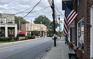
Mount Pleasant is a town located in eastern Cabarrus County, North Carolina, United States. As of the 2010 census, the town population was 1,652. The town center is located at the crossroads of Mount Pleasant Road and North Carolina Highway 73. NC Highway 49 skirts the town to the north on its way from Charlotte to Asheboro.

<span class="mw-page-title-main">Earl, North Carolina</span> Town in North Carolina, United States

Earl is a town in Cleveland County, North Carolina, United States. The population was 260 at the 2010 census.

<span class="mw-page-title-main">Fallston, North Carolina</span> Hamlet in North Carolina, United States

Fallston is a hamlet in Cleveland County, North Carolina, United States. The population was 607 at the 2010 census.

<span class="mw-page-title-main">Mooresboro, North Carolina</span> Town in North Carolina, United States

Mooresboro is a town in Cleveland County, North Carolina, United States. The population was 311 at the 2010 census.
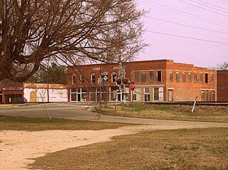
<span class="mw-page-title-main">Chadbourn, North Carolina</span> Town in North Carolina, United States of America

Chadbourn is a town in Columbus County, North Carolina, United States. The population was 1,856 at the 2010 census.

<span class="mw-page-title-main">Walkertown, North Carolina</span> Town in North Carolina, United States

Walkertown is a town in Forsyth County, North Carolina, United States and a rural area outside of Winston-Salem. It is part of the Piedmont Triad. The population was 5,695 at the 2020 census.

<span class="mw-page-title-main">High Shoals, North Carolina</span> City in North Carolina, United States

High Shoals is a city in Gaston County, North Carolina, United States, named for the high rocky shoal across the Catawba River. The population was 696 at the 2010 census.

Elrod is a census-designated place (CDP) in Robeson County, North Carolina, United States. The population was 441 at the 2000 census.

<span class="mw-page-title-main">Lumber Bridge, North Carolina</span> Town in North Carolina, United States

Lumber Bridge is a town in Robeson County, North Carolina, United States. The population was 94 at the 2010 census.

<span class="mw-page-title-main">Lumberton, North Carolina</span> City in North Carolina, United States

Lumberton is a city in Robeson County, North Carolina, United States. As of 2020, its population was 19,025. It is the seat of Robeson County's government.

Marietta is a town located in Robeson County, North Carolina, United States. As of the 2010 census, the town had a total population of 175.

<span class="mw-page-title-main">McDonald, North Carolina</span> Town in North Carolina, United States

McDonald is a town in Robeson County, North Carolina, United States. The population was 113 at the 2010 census.

Orrum is a town in Robeson County, North Carolina, United States. The population was 91 at the 2010 census.

<span class="mw-page-title-main">Parkton, North Carolina</span> Town in North Carolina, United States

Parkton is a town in Robeson County, North Carolina, Lumberton metro area, United States. The town was so named because it was a place where farmers tied up their horses while waiting for the train. As of the 2010 census, the town population was 436.

<span class="mw-page-title-main">Pembroke, North Carolina</span> Town in North Carolina, United States

Pembroke is a town in Robeson County, North Carolina, United States. It is about 90 miles inland and northwest from the Atlantic Coast. The population was 2,973, at the 2010 census. The town is the seat of the state-recognized Lumbee tribe of North Carolina, as well as the home of The University of North Carolina at Pembroke.

<span class="mw-page-title-main">Proctorville, North Carolina</span> Town in North Carolina, United States

Proctorville is a town in Robeson County, North Carolina, United States. The population was 117 at the 2010 census.

<span class="mw-page-title-main">Raynham, North Carolina</span> Town in North Carolina, United States

Raynham is a town in Robeson County, North Carolina, United States. The population was 72 at the 2010 census.

<span class="mw-page-title-main">Rowland, North Carolina</span> Town in North Carolina, United States

Rowland is a town in Rowland Township, Robeson County, North Carolina, United States. The population was 1,037 at the 2010 census.

<span class="mw-page-title-main">St. Pauls, North Carolina</span> Town in North Carolina, United States

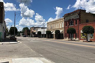
St. Pauls is a town in Robeson County, North Carolina, United States. The population was 2,035 at the 2010 census.

<span class="mw-page-title-main">Enochville, North Carolina</span> CDP in North Carolina, United States

Enochville is a census-designated place (CDP) in Rowan County, North Carolina, United States. The population was 2,851 at the 2000 census.

References

  1. "ArcGIS REST Services Directory". United States Census Bureau. Retrieved September 20, 2022.
  2. 1 2 U.S. Geological Survey Geographic Names Information System: Rennert, North Carolina
  3. 1 2 "U.S. Census website". United States Census Bureau . Retrieved January 31, 2008.
  4. "Origins of Names of Robeson Towns". The Robesonian. February 26, 1951. p. 13.
  5. Powell 1976, p. 409.
  6. Geryard, Harry (June 19, 1977). "Many Rennert Residents Have Second Thoughts As Town Incorporation Sparks Pro-Con Controversy". The Robesonian. p. 1.
  7. "Census of Population and Housing". Census.gov. Retrieved June 4, 2015.

Works cited