Riverside-Albert

Last updated

Riverside-Albert
RiversideAlbertStation 2011.jpg
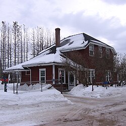
Former train station in Riverside-Albert
Canada New Brunswick location map 2.svg
Red pog.svg
Riverside-Albert
Location of Riverside-Albert, New Brunswick
Coordinates: 45°45′5.1″N64°43′3.6″W / 45.751417°N 64.717667°W / 45.751417; -64.717667
CountryCanada
Province New Brunswick
County Albert County
Parish Hopewell Parish
Municipality Fundy Albert
Incorporated1966
Amalgamated2023
Government
  Type Village council
Area
[1]
  Land3.39 km2 (1.31 sq mi)
Population
 (2021) [1]
  Total348
  Density102.8/km2 (266/sq mi)
  Change (2016–21)
Decrease2.svg 0.6%
Electoral districts
   Federal Fundy Royal
   Provincial Albert
Time zone UTC-4 (Atlantic (AST))
  Summer (DST) UTC-3 (Atlantic (ADT))
Canadian Postal code
E4H
Area code(s) 506, 428
Telephone Exchange882
HighwayNB 114.svg Route 114
NB 915.svg Route 915
Website http://www.riverside-albert.ca

Riverside-Albert is a disincorporated village in Fundy Albert, New Brunswick, Canada. [2] [3] It resides in the geographic parish of Hopewell in Albert County.

Contents

Riverside-Albert is located on the north of Shepody River on upland above the marsh. The community of Harvey Parish is located across the river. It is approximately halfway between two major tourist destinations: Fundy National Park and the Hopewell Rocks.

Post office called Albert from 1875; Riverside from 1875 to 1932; Riverside from 1932.

The Trans Canada Trail passes through Riverside-Albert. [4]

History

Following the French period, Acadian settlers remained under English rule and continued developing the community of Shepody, which included the Riverside-Albert area. In the aftermath of the Acadian Expulsion in 1755, Nova Scotia Governor Lawrence invited applications for township grants. This begat Hopewell Township of Cumberland County on the location of Shepody. Hopewell's slow beginning grew pace during the rapid growth of the lumbering and ship building industries along the Bay, and Hopewell's communities benefited from the easy access to it at Hopewell's riversides.

Riverside and Albert both appear as communities on the cadastral land grant map of the area. [5]

Albert was originally called Hopewell Corner but the inhabitants resolved to rename it Albert in 1881 due to there being four communities named Hopewell within 12 miles of each other. In 1898 Albert was the terminus of the Salisbury and Harvey Railway, with a population of 500. [6]

Riverside, originally River Side, was a station on the Salisbury and Hillsborough Railway, with a population of 300 in 1871. The post office was renamed Riverside in 1932. [7]

The local improvement district of Riverside-Albert was incorporated on 29 December 1947. [8] The local improvement district became a village in 1966 under the new Municipalities Act. [9] [10]

On 1 January 2023, the village of Riverside-Albert amalgamated with the villages of Alma and Hillsborough and parts of eight local service districts to form the new village of Fundy Albert. [11] [3] The community's name remains in official use. [12]

Demographics

In the 2021 Census of Population conducted by Statistics Canada, Riverside-Albert had a population of 348 living in 142 of its 154 total private dwellings, a change of

Notable people

Notable residents have included Abner Reid McClelan and Roscoe Fillmore.

See also

Related Research Articles

<span class="mw-page-title-main">Bay of Fundy</span> Bay on the east coast of North America

The Bay of Fundy is a bay between the Canadian provinces of New Brunswick and Nova Scotia, with a small portion touching the U.S. state of Maine. It is an arm of the Gulf of Maine. Its tidal range is the highest in the world. The name is probably a corruption of the French word fendu, meaning 'split'.

<span class="mw-page-title-main">Petitcodiac River</span> River in south-eastern New Brunswick, Canada

The Petitcodiac River is a river located in south-eastern New Brunswick, Canada. Local tourist businesses often refer to it as the "chocolate river" due to its distinctive brown mud floor and brown waters. Stretching across a meander length of 79 kilometres, the river traverses Westmorland, Albert, and Kings counties, draining a watershed area of about 2,071 square kilometres (800 sq mi). The watershed features valleys, ridges, and rolling hills, and is home to a diverse population of terrestrial and aquatic species. Ten named tributaries join the river in its course toward its mouth in Shepody Bay. Prior to the construction of a causeway in 1968, the Petitcodiac River had one of the world's largest tidal bores, which ranged from 1 to 2 metres (3.3–6.6 ft) in height and moved at speeds of 5 to 13 kilometres per hour (3.1–8.1 mph). With the opening of the causeway gates in April 2010, the river is flushing itself of ocean silts, and the bore is returning to its former size.

<span class="mw-page-title-main">Dorchester, New Brunswick</span> Place in New Brunswick, Canada

Dorchester is a community in Westmorland County, New Brunswick, Canada. The community became part of the new town of Tantramar in the 2023 New Brunswick local governance reform. Originally incorporated as a town in 1911, it was converted to a village in 1966. By 1825 it had been named for Guy Carleton, 1st Baron Dorchester, an 18th-century Governor-General of the old Province of Quebec, but prior to that was called Botsford.

<span class="mw-page-title-main">Hillsborough, New Brunswick</span> Place in New Brunswick, Canada

Hillsborough is a former village in Albert County in the province of New Brunswick, Canada. It was an incorporated village prior to 2023 but is now part of the much larger incorporated village of Fundy Albert.

<span class="mw-page-title-main">Alma, New Brunswick</span> Place in New Brunswick, Canada

Alma is a disincorporated Village in Fundy Albert, New Brunswick, Canada. It resides in the territorial divisions of parish of Alma, Albert County. Alma is centered on the small delta of the Upper Salmon River and Cleveland Brook, where they empty into Salisbury Bay.

Route 114 is a 137.6 km (85.5 mi) Canadian secondary highway in southeastern New Brunswick.

<span class="mw-page-title-main">Hopewell Cape, New Brunswick</span> Village in New Brunswick, Canada

Hopewell Cape is a Canadian village and headland in Albert County, New Brunswick at the northern end of Shepody Bay and the mouth of the Petitcodiac River.

Shepody Bay is a tidal embayment, an extension of the Bay of Fundy in New Brunswick, Canada, which consists of 77 square kilometres (30 sq mi) of open water and 40 km2 (15 sq mi) of mudflats, with 4 km2 (1.5 sq mi) of saline marsh on the west, and eroding sand and gravel beaches covering an area of approximately 1 km2 (0.39 sq mi) on the eastern shore. The intertidal mudflats "support internationally important numbers of the crustacean Corophium volutator, the principal food source for millions of fall migrating shorebirds".

<span class="mw-page-title-main">Coverdale Parish, New Brunswick</span> Parish in New Brunswick, Canada

Coverdale is a geographic parish in Albert County, New Brunswick, Canada, located along the Petitcodiac River opposite Moncton and Dieppe.

<span class="mw-page-title-main">Shepody, New Brunswick</span>

Shepody is a rural community in southeastern New Brunswick, Canada, situated on Shepody Bay, along Route 114 between Hopewell Hill and Lower Cape to the east.

<span class="mw-page-title-main">Hillsborough Parish, New Brunswick</span> Parish in New Brunswick, Canada

Hillsborough is a geographic parish in eastern Albert County, New Brunswick, Canada.

<span class="mw-page-title-main">Elgin Parish, New Brunswick</span> Parish in New Brunswick, Canada

Elgin is a geographic parish in the interior of Albert County, New Brunswick, Canada, the only one of the county's parishes that does not border either the Bay of Fundy or the Petitcodiac River.

<span class="mw-page-title-main">Hopewell Parish, New Brunswick</span> Parish in New Brunswick, Canada

Hopewell is a geographic parish in eastern Albert County, New Brunswick, Canada.

<span class="mw-page-title-main">Harvey Parish, New Brunswick</span> Parish in New Brunswick, Canada

Harvey is a geographic parish in southern Albert County, New Brunswick, Canada.

<span class="mw-page-title-main">Alma Parish, New Brunswick</span> Parish in New Brunswick, Canada

Alma is a geographic parish on the Bay of Fundy in the southwestern corner of Albert County, New Brunswick, Canada.

<span class="mw-page-title-main">Salisbury Parish, New Brunswick</span> Parish in New Brunswick, Canada

Salisbury is a geographic parish in Westmorland County, New Brunswick, Canada.

<span class="mw-page-title-main">Saint Martins Parish, New Brunswick</span> Parish in New Brunswick, Canada

Saint Martins is a geographic parish in Saint John County, New Brunswick, Canada.

A regional service commission (RSC) is an administrative entity in the province of New Brunswick, Canada. As the name implies, an RSC administers services on a regional level.

<span class="mw-page-title-main">Fundy Albert</span> Village municipality in New Brunswick, Canada

Fundy Albert is a village municipality in the Canadian province of New Brunswick. The jurisdiction was formed through the 2023 New Brunswick local governance reforms which saw the consolidation of local government entities into regions or districts.

References

  1. 1 2 3 "Census Profile of Riverside-Albert, Village (VL)". Statistics Canada. 6 December 2022. Retrieved 21 January 2023.
  2. "Local Governments Establishment Regulation – Local Governance Act". Government of New Brunswick. 12 October 2022. Retrieved 21 January 2023.
  3. 1 2 "RSC 7 Southeast Regional Service Commission". Government of New Brunswick. Retrieved 21 January 2023.
  4. Sentier NB Trails
  5. "No. 143". Provincial Archives of New Brunswick. Retrieved 1 April 2023.
  6. "Albert". Provincial Archives of New Brunswick. Retrieved 1 April 2023.
  7. "Riverside-Albert". Provincial Archives of New Brunswick. Retrieved 1 April 2023.
  8. "Local Improvement Districts". The Royal Gazette. 106: 48–49. 4 February 1948.
  9. Municipalities Act of 1966, Second Schedule, p. 151.
  10. Hamilton, William (1978). The Macmillan Book of Canadian Place Names. Toronto: Macmillan. p. 84. ISBN   0-7715-9754-1.
  11. "Local Governments Establishment Regulation – Local Governance Act". Government of New Brunswick. 12 October 2022. Retrieved 21 January 2023.
  12. "Proposed entity names reflect strong ties to nature and history" (Press release). Irishtown, New Brunswick: Government of New Brunswick. 25 May 2022. Retrieved 21 January 2023.